
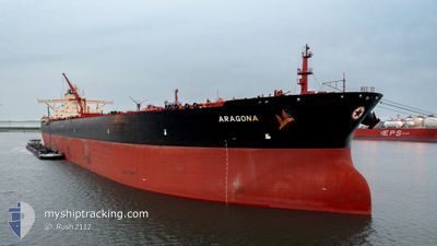
ARAGONA
Tanker
Current Trip
| Time Travelled | 20 days |
|---|---|
| Remaining Time | 2 days |
| Distance Travelled | 4895.46 nm |
| Remaining Distance | 695.79 nm |
| AVG Speed | 8.3 Knots |
| MAX Speed | 19.5 Knots |
| AVG Wind | 11.6 knots |
| MAX Wind | 34.9 knots |
| MIN Temp | 10.1°C / 50.18°F |
| MAX Temp | 23°C / 73.4°F |
| Dybgang | 21.9 m |
| Position Modtaget | 5 h, 26 m siden |
Current Position
| Longitude | -9.40120° |
|---|---|
| Latitude | 43.94185° |
| Status | Under way using engine |
| Fart | 13.1 Knots |
| Kurs | 34.9° |
| Område | North Atlantic Ocean |
| Station | T-AIS |
| Position Modtaget | 5 h, 26 m siden |
Info
Information
The current position of ARAGONA is in North Atlantic Ocean with coordinates 43.94185° / -9.40120° as reported on 2024-04-24 16:40 by AIS to our vessel tracker app. The vessel's current speed is 13.1 Knots and is heading at the port of ROTTERDAM. The estimated time of arrival as calculated by MyShipTracking vessel tracking app is 2024-04-27 03:56 LT
The vessel ARAGONA (IMO: 9513115, MMSI: 241162000) is a Tanker It's sailing under the flag of [GR] Greece.
In this page you can find informations about the vessels current position, last detected port calls, and current voyage information. If the vessels is not in coverage by AIS you will find the latest position.
The current position of ARAGONA is detected by our AIS receivers and we are not responsible for the reliability of the data. The last position was recorded while the vessel was in Coverage by the Ais receivers of our vessel tracking app.
The current draught of ARAGONA as reported by AIS is 21.9 meters
Weather
| Temperature | 12.1°C / 53.78°F |
|---|---|
| Wind Speed | 9 knots |
| Direction | 330° NNW |
| Pressure | 1019.8 hPa |
| Humidity | 79.8 % |
| Cloud Coverage | 100 % |
Featured Company
Events
| Tid | Hændelsen | Detaljer | Position / Dest | Info |
|---|---|---|---|---|
| 2024-04-24 16:52 | Status er ændret | Default Under way using engine |
43.97833 / -9.37333
ROTTERDAM
|
Fart: 13.1 kn Kurs: 34.9° |
| 2024-04-24 16:40 | Status er ændret | Under way using engine Default |
43.94185 / -9.40120
ROTTERDAM
|
Fart: 13 kn Kurs: 44° |
| 2024-04-24 16:40 | Udenfor Dækning |
43.94185 / -9.40120
North Atlantic Ocean
ROTTERDAM
|
Fart: 13.1 kn Kurs: 34.9° |
|
| 2024-04-24 16:22 | Indenfor Dækning |
43.94185 / -9.40120
North Atlantic Ocean
ROTTERDAM
|
Fart: 13.1 kn Kurs: 34.9° |
|
| 2024-04-24 14:16 | Status er ændret | Default Under way using engine |
43.47833 / -9.79667
ROTTERDAM
|
Fart: 13.6 kn Kurs: 24.9° |
| 2024-04-24 14:07 | Udenfor Dækning |
43.44965 / -9.81861
North Atlantic Ocean
ROTTERDAM
|
Fart: 13.6 kn Kurs: 24.9° |
|
| 2024-04-24 13:28 | Status er ændret | Under way using engine Default |
43.31393 / -9.90585
ROTTERDAM
|
Fart: 13 kn Kurs: 21° |
| 2024-04-24 13:16 | Indenfor Dækning |
43.31393 / -9.90585
North Atlantic Ocean
ROTTERDAM
|
Fart: 13.6 kn Kurs: 23.2° |
|
| 2024-04-24 07:29 | Status er ændret | Default Under way using engine |
42.01429 / -9.94854
ROTTERDAM
|
Fart: 12.6 kn Kurs: 0.9° |
| 2024-04-24 07:14 | Udenfor Dækning |
41.96124 / -9.94891
North Atlantic Ocean
ROTTERDAM
|
Fart: 12.6 kn Kurs: 0.9° |