
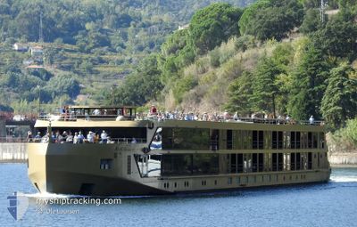
AMADOURO
Passenger
Current Trip
PTDOU
| Time Travelled | 6 h, 33 mins |
|---|---|
| Remaining Time | --- |
| Distance Travelled | 0.31 nm |
| Remaining Distance | --- |
| AVG Speed | --- |
| MAX Speed | --- |
| AVG Wind | 8.7 knots |
| MAX Wind | 8.9 knots |
| MIN Temp | 14.7°C / 58.46°F |
| MAX Temp | 23.8°C / 74.84°F |
| Dybgang | 1.6 m |
| Position Modtaget | 3 m siden |
Current Position
| Longitude | -8.61835° |
|---|---|
| Latitude | 41.13801° |
| Status | At anchor |
| Fart | |
| Kurs | --- |
| Område | North Atlantic Ocean |
| Station | T-AIS |
| Position Modtaget | 3 m siden |
Info
Information
The current position of AMADOURO is in North Atlantic Ocean with coordinates 41.13801° / -8.61835° as reported on 2024-04-18 14:26 by AIS to our vessel tracker app. The vessel's current speed is 0 Knots
The vessel AMADOURO (MMSI: 263752970) is a Passenger It's sailing under the flag of [PT] Portugal.
In this page you can find informations about the vessels current position, last detected port calls, and current voyage information. If the vessels is not in coverage by AIS you will find the latest position.
The current position of AMADOURO is detected by our AIS receivers and we are not responsible for the reliability of the data. The last position was recorded while the vessel was in Coverage by the Ais receivers of our vessel tracking app.
The current draught of AMADOURO as reported by AIS is 1.6 meters
Weather
| Temperature | 24.3°C / 75.74°F |
|---|---|
| Wind Speed | 8 knots |
| Direction | 92° E |
| Pressure | 1014.3 hPa |
| Humidity | 27.4 % |
| Cloud Coverage | 61 % |
Featured Company
Most Visited Ports (Last year)
| Port | Arrivals | |
|---|---|---|
| 13 |
Last Trips
| Origin | Departure | Destination | Arrival | Distance |
|---|
Events
| Tid | Hændelsen | Detaljer | Position / Dest | Info |
|---|---|---|---|---|
| 2024-04-18 13:10 | Status er ændret | At anchor Default |
41.13805 / -8.61827
PTDOU
|
Fart: Kurs: -1° |
| 2024-04-18 13:05 | Status er ændret | Default At anchor |
41.13833 / -8.61833
PTDOU
|
Fart: Kurs: 511° |
| 2024-04-18 08:03 | STOP Sejllads | 1.77 nm, East of PORTO |
41.13802 / -8.61828
PTDOU
|
Fart: Kurs: 511° |
| 2024-04-18 07:56 | Afsejlet fra sidste havn |
|
41.14138 / -8.62233
PTDOU
|
Fart: 6.8 kn Kurs: 130.9° |
| 2024-04-18 07:54 | START Sejllads |
41.14349 / -8.62635
[PT] PORTO
|
Fart: 6.7 kn Kurs: 107.4° |
|
| 2024-04-18 07:52 | STOP Sejllads |
41.14397 / -8.62935
[PT] PORTO
|
Fart: 0.1 kn Kurs: 511° |
|
| 2024-04-18 07:51 | Skibe i havn |
|
41.14399 / -8.62934
[PT] PORTO
|
Fart: 0.7 kn Kurs: 511° |
| 2024-04-18 06:53 | Indenfor Dækning |
41.07020 / -8.50526
North Atlantic Ocean
|
Fart: 9.6 kn Kurs: 274.3° |
|
| 2024-04-18 06:51 | Status er ændret | At anchor Default |
41.07043 / -8.49861
PTDOU
|
Fart: Kurs: -1° |
| 2024-04-18 06:51 | START Sejllads | 8.42 nm, South East of PORTO |
41.07043 / -8.49861
PTDOU
|
Fart: 10.4 kn Kurs: 265.4° |