
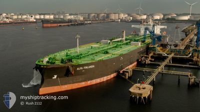
ALFA FINLANDIA
Tanker
Current Trip
| Time Travelled | 7 days |
|---|---|
| Remaining Time | 1 day |
| Distance Travelled | 1420.44 nm |
| Remaining Distance | 277.56 nm |
| AVG Speed | 7.6 Knots |
| MAX Speed | 13.2 Knots |
| AVG Wind | 14.7 knots |
| MAX Wind | 29 knots |
| MIN Temp | 10.4°C / 50.72°F |
| MAX Temp | 18.8°C / 65.84°F |
| Dybgang | 8.3 m |
| Position Modtaget | 3 m siden |
Current Position
| Longitude | -5.70594° |
|---|---|
| Latitude | 35.92226° |
| Status | Under way using engine |
| Fart | 7.3 Knots |
| Kurs | 89.5° |
| Område | Strait of Gibraltar |
| Station | T-AIS |
| Position Modtaget | 3 m siden |
Info
Information
The current position of ALFA FINLANDIA is in Strait of Gibraltar with coordinates 35.92226° / -5.70594° as reported on 2024-04-18 08:57 by AIS to our vessel tracker app. The vessel's current speed is 7.3 Knots and is heading at the port of ARZEW. The estimated time of arrival as calculated by MyShipTracking vessel tracking app is 2024-04-19 18:13 LT
The vessel ALFA FINLANDIA (IMO: 9823041, MMSI: 311000820) is a Tanker It's sailing under the flag of [BS] Bahamas.
In this page you can find informations about the vessels current position, last detected port calls, and current voyage information. If the vessels is not in coverage by AIS you will find the latest position.
The current position of ALFA FINLANDIA is detected by our AIS receivers and we are not responsible for the reliability of the data. The last position was recorded while the vessel was in Coverage by the Ais receivers of our vessel tracking app.
The current draught of ALFA FINLANDIA as reported by AIS is 8.3 meters
Weather
| Temperature | 17.5°C / 63.5°F |
|---|---|
| Wind Speed | 6 knots |
| Direction | 108° ESE |
| Pressure | 1014.8 hPa |
| Humidity | 81.2 % |
| Cloud Coverage | 98 % |
Featured Company
Last Port Calls
| Port | Arrival | Departure | Time In Port |
|---|---|---|---|
| 2024-04-09 23:05 | 2024-04-11 01:54 | 1 d | |
| 2024-04-06 18:07 | 2024-04-07 16:02 | 21 h | |
| 2024-04-01 12:29 | 2024-04-02 15:27 | 1 d | |
| 2024-03-27 16:04 | 2024-03-28 16:11 | 1 d | |
| 2024-03-19 10:11 | 2024-03-20 18:29 | 1 d | |
| 2024-02-12 10:41 | 2024-02-24 09:06 | 11 d |
Last Trips
| Origin | Departure | Destination | Arrival | Distance | |
|---|---|---|---|---|---|
| 2024-04-07 18:02 | 2024-04-10 01:05 | 583.35 nm | |||
| 2024-04-02 17:27 | 2024-04-06 20:07 | 927.82 nm | |||
| 2024-03-28 17:11 | 2024-04-01 14:29 | 936.75 nm | |||
| 2024-03-20 18:29 | 2024-03-27 17:04 | 1011.37 nm | |||
| 2024-02-24 10:06 | 2024-03-19 10:11 | 568.35 nm | |||
| 2024-01-21 18:47 | 2024-02-12 11:41 | 1117.44 nm |
Events
| Tid | Hændelsen | Detaljer | Position / Dest | Info |
|---|---|---|---|---|
| 2024-04-18 08:47 | Status er ændret | Under way using engine Default |
35.92175 / -5.73144
NLRTM>DZAZW
|
Fart: 7.5 kn Kurs: 90° |
| 2024-04-18 08:37 | Status er ændret | Default Under way using engine |
35.92148 / -5.75683
NLRTM>DZAZW
|
Fart: 7.6 kn Kurs: 89.4° |
| 2024-04-18 08:22 | Status er ændret | Under way using engine Default |
35.92124 / -5.79524
NLRTM>DZAZW
|
Fart: 7.8 kn Kurs: 88° |
| 2024-04-18 08:15 | Status er ændret | Default Under way using engine |
35.92084 / -5.81390
NLRTM>DZAZW
|
Fart: 8.3 kn Kurs: 88.6° |
| 2024-04-18 07:32 | Fundet i havområde | Moroccan part of the Strait of Gibraltar |
35.91741 / -5.93667
Strait of Gibraltar
NLRTM>DZAZW
|
Fart: 8.5 kn Kurs: 86.9° |
| 2024-04-18 07:10 | Status er ændret | Under way using engine Default |
35.91390 / -6.01278
NLRTM>DZAZW
|
Fart: 11.9 kn Kurs: 86° |
| 2024-04-18 06:40 | Status er ændret | Default Under way using engine |
35.90971 / -6.11644
NLRTM>DZAZW
|
Fart: 8.4 kn Kurs: 94.2° |
| 2024-04-18 05:44 | Ændre havområde | Moroccan part of the North Atlantic Ocean Spanish part of the North Atlantic Ocean |
35.92139 / -6.28282
North Atlantic Ocean
NLRTM>DZAZW
|
Fart: 8.4 kn Kurs: 101.5° |
| 2024-04-18 05:25 | Status er ændret | Under way using engine Default |
35.93645 / -6.34424
NLRTM>DZAZW
|
Fart: 8.3 kn Kurs: 106° |
| 2024-04-18 05:06 | Indenfor Dækning |
35.93645 / -6.34424
North Atlantic Ocean
NLRTM>DZAZW
|
Fart: 8.5 kn Kurs: 107.2° |