
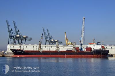
ALEXANDROS I
Bulk Carrier
Current Trip
MA CAS
| Time Travelled | 28 days |
|---|---|
| Remaining Time | --- |
| Distance Travelled | 3942.96 nm |
| Remaining Distance | --- |
| AVG Speed | 9.5 Knots |
| MAX Speed | 9.5 Knots |
| AVG Wind | 10.6 knots |
| MAX Wind | 32 knots |
| MIN Temp | 14.2°C / 57.56°F |
| MAX Temp | 29.5°C / 85.1°F |
| Dybgang | 9.1 m |
| Position Modtaget | 6 m siden |
Current Position
| Longitude | -7.65333° |
|---|---|
| Latitude | 33.70124° |
| Status | At anchor |
| Fart | 0.1 Knots |
| Kurs | 334° |
| Område | North Atlantic Ocean |
| Station | T-AIS |
| Position Modtaget | 6 m siden |
Info
Information
The current position of ALEXANDROS I is in North Atlantic Ocean with coordinates 33.70124° / -7.65333° as reported on 2024-04-16 21:36 by AIS to our vessel tracker app. The vessel's current speed is 0.1 Knots
The vessel ALEXANDROS I (IMO: 9587685, MMSI: 636016477) is a Bulk Carrier that was built in 2010 ( 14 år gamle ). It's sailing under the flag of [LR] Liberia.
In this page you can find informations about the vessels current position, last detected port calls, and current voyage information. If the vessels is not in coverage by AIS you will find the latest position.
The current position of ALEXANDROS I is detected by our AIS receivers and we are not responsible for the reliability of the data. The last position was recorded while the vessel was in Coverage by the Ais receivers of our vessel tracking app.
The current draught of ALEXANDROS I as reported by AIS is 9.1 meters
Weather
| Temperature | 18.5°C / 65.3°F |
|---|---|
| Wind Speed | 8 knots |
| Direction | 16° NNE |
| Pressure | 1015.7 hPa |
| Humidity | 86.2 % |
| Cloud Coverage | 40 % |
Featured Company
Last Port Calls
| Port | Arrival | Departure | Time In Port |
|---|---|---|---|
| 2024-03-12 09:46 | 2024-03-19 14:11 | 7 d | |
| 2024-03-11 17:52 | 2024-03-11 18:28 | 35 m | |
| 2024-03-08 22:54 | |||
| 2024-02-26 18:22 | 2024-02-28 16:16 | 1 d | |
| 2024-02-15 16:10 | 2024-02-22 18:30 | 7 d | |
| 2024-02-02 19:01 |
Most Visited Ports (Last year)
| Port | Arrivals | |
|---|---|---|
| 5 | ||
| 2 | ||
| 2 | ||
| 2 | ||
| 2 | ||
| 1 |
Last Trips
| Origin | Departure | Destination | Arrival | Distance | |
|---|---|---|---|---|---|
| 2024-03-11 19:28 | 2024-03-12 10:46 | 8.45 nm | |||
| 2024-03-09 00:54 | 2024-03-11 18:52 | 762.30 nm | |||
| 2024-02-22 20:30 | 2024-02-26 20:22 | 15.16 nm | |||
| 2024-02-02 19:01 | 2024-02-15 18:10 | 3227.76 nm |
Events
| Tid | Hændelsen | Detaljer | Position / Dest | Info |
|---|---|---|---|---|
| 2024-04-16 21:36 | Status er ændret | At anchor Default |
33.70124 / -7.65333
MA CAS
|
Fart: 0.1 kn Kurs: 342° |
| 2024-04-16 21:27 | Status er ændret | Default At anchor |
33.70114 / -7.65337
MA CAS
|
Fart: 0.3 kn Kurs: 347° |
| 2024-04-16 21:09 | Status er ændret | At anchor Default |
33.70104 / -7.65362
MA CAS
|
Fart: 0.4 kn Kurs: 353° |
| 2024-04-16 21:03 | Status er ændret | Default At anchor |
33.70103 / -7.65364
MA CAS
|
Fart: 0.2 kn Kurs: 350° |
| 2024-04-16 20:27 | Status er ændret | At anchor Default |
33.70105 / -7.65367
MA CAS
|
Fart: 0.2 kn Kurs: 353° |
| 2024-04-16 20:23 | Status er ændret | Default At anchor |
33.70101 / -7.65366
MA CAS
|
Fart: 0.1 kn Kurs: 355° |
| 2024-04-16 18:51 | Status er ændret | At anchor Default |
33.70095 / -7.65383
MA CAS
|
Fart: 0.4 kn Kurs: 352° |
| 2024-04-16 18:48 | Status er ændret | Default At anchor |
33.70100 / -7.65380
MA CAS
|
Fart: 0.3 kn Kurs: 356° |
| 2024-04-16 18:32 | Status er ændret | At anchor Default |
33.70088 / -7.65411
MA CAS
|
Fart: 0.3 kn Kurs: 359° |
| 2024-04-16 18:26 | Status er ændret | Default At anchor |
33.70092 / -7.65403
MA CAS
|
Fart: 0.2 kn Kurs: 356° |