
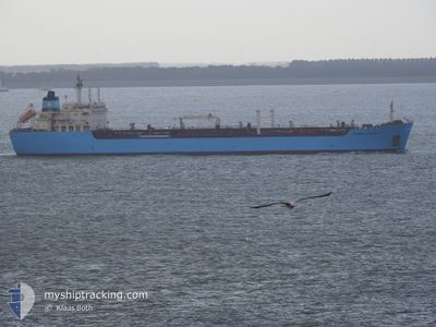
AL NABILA 6
Oil/Chemical Tanker
Current Trip
RAS SADAT
| Time Travelled | 39 days |
|---|---|
| Remaining Time | --- |
| Distance Travelled | 1236.41 nm |
| Remaining Distance | --- |
| AVG Speed | 9.6 Knots |
| MAX Speed | 13.2 Knots |
| AVG Wind | 9.1 knots |
| MAX Wind | 24 knots |
| MIN Temp | 13.2°C / 55.76°F |
| MAX Temp | 32°C / 89.6°F |
| Dybgang | 6.5 m |
| Position Modtaget | 2024-03-16 17:40 |
Current Position
| Longitude | 32.55130° |
|---|---|
| Latitude | 29.87010° |
| Status | Under way using engine |
| Fart | 11.1 Knots |
| Kurs | 171.8° |
| Område | Gulf of Suez |
| Station | T-AIS |
| Position Modtaget | 2024-03-16 17:40 |
Info
Information
The current position of AL NABILA 6 is in Gulf of Suez with coordinates 29.87010° / 32.55130° as reported on 2024-03-16 17:40 by AIS to our vessel tracker app. The vessel's current speed is 11.1 Knots
The vessel AL NABILA 6 (IMO: 9236987, MMSI: 622120927) is a Oil/Chemical Tanker that was built in 2003 ( 21 år gamle ). It's sailing under the flag of [EG] Egypt.
In this page you can find informations about the vessels current position, last detected port calls, and current voyage information. If the vessels is not in coverage by AIS you will find the latest position.
The current position of AL NABILA 6 is detected by our AIS receivers and we are not responsible for the reliability of the data. The last position was recorded while the vessel was in Coverage by the Ais receivers of our vessel tracking app.
The current draught of AL NABILA 6 as reported by AIS is 6.5 meters
Weather
| Temperature | 27.3°C / 81.14°F |
|---|---|
| Wind Speed | 15 knots |
| Direction | 311° NW |
| Pressure | 1007.9 hPa |
| Humidity | 31.8 % |
| Cloud Coverage | --- |
Featured Company
Last Port Calls
| Port | Arrival | Departure | Time In Port |
|---|---|---|---|
| 2024-03-13 03:20 | 2024-03-13 12:44 | 9 h | |
| 2024-03-09 11:59 | 2024-03-12 07:40 | 2 d | |
| 2024-03-08 05:46 | 2024-03-08 15:15 | 9 h | |
| 2024-02-25 11:37 | 2024-02-25 13:41 | 2 h | |
| 2024-02-20 16:35 | |||
| 2024-02-17 05:22 | 2024-02-17 14:30 | 9 h | |
| 2024-02-01 05:00 | 2024-02-01 14:12 | 9 h |
Most Visited Ports (Last year)
| Port | Arrivals | |
|---|---|---|
| 22 | ||
| 9 | ||
| 3 | ||
| 2 |
Last Trips
| Origin | Departure | Destination | Arrival | Distance | |
|---|---|---|---|---|---|
| 2024-03-12 09:40 | 2024-03-13 05:20 | 162.64 nm | |||
| 2024-01-31 09:54 | 2024-02-20 18:35 | 624.74 nm | |||
| 2024-01-31 09:54 | 2024-02-17 07:22 | 365.46 nm | |||
| 2024-01-31 09:54 | 2024-02-01 07:00 | 150.39 nm |
Events
| Tid | Hændelsen | Detaljer | Position / Dest | Info |
|---|---|---|---|---|
| 2024-04-20 03:43 | STOP Sejllads |
28.74667 / 33.19333
RAS SADAT
|
Fart: Kurs: -1° |
|
| 2024-04-19 20:16 | START Sejllads | 7.2 nm, South of AL ADABIYAH |
29.76485 / 32.46257
RAS SADAT
|
Fart: 5.5 kn Kurs: 165° |
| 2024-04-16 14:05 | STOP Sejllads |
28.74667 / 33.19333
RAS SADAT
|
Fart: Kurs: -1° |
|
| 2024-04-16 07:18 | START Sejllads | 4.22 nm, South East of SOKHNA |
29.58242 / 32.39538
RAS SADAT
|
Fart: 3.8 kn Kurs: 111° |
| 2024-04-15 13:26 | STOP Sejllads | 3.98 nm, South East of SOKHNA |
29.58662 / 32.39478
RAS SADAT
|
Fart: 0.2 kn Kurs: 352° |
| 2024-04-13 05:27 | STOP Sejllads |
28.72655 / 33.19143
RAS SADAT
|
Fart: 0.3 kn Kurs: 311° |
|
| 2024-04-13 03:40 | STOP Sejllads |
28.72667 / 33.19167
RAS SADAT
|
Fart: Kurs: -1° |
|
| 2024-04-13 03:01 | START Sejllads |
28.73122 / 33.17627
RAS SADAT
|
Fart: 6.4 kn Kurs: 188° |
|
| 2024-04-12 11:19 | STOP Sejllads |
28.74167 / 33.18667
RAS SADAT
|
Fart: Kurs: -1° |
|
| 2024-04-12 04:42 | START Sejllads | 4.23 nm, South East of SOKHNA |
29.58695 / 32.40502
RAS SADAT
|
Fart: 3.8 kn Kurs: 105° |