
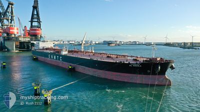
AL AGAILA
Tanker
Current Trip
| Time Travelled | 1 day |
|---|---|
| Remaining Time | 2 days |
| Distance Travelled | 21.00 nm |
| Remaining Distance | 403.80 nm |
| AVG Speed | 6.8 Knots |
| MAX Speed | 10.9 Knots |
| AVG Wind | 7 knots |
| MAX Wind | 13 knots |
| MIN Temp | 24°C / 75.2°F |
| MAX Temp | 25.8°C / 78.44°F |
| Dybgang | 9 m |
| Position Modtaget | 56 m siden |
Current Position
| Longitude | 50.79774° |
|---|---|
| Latitude | 26.28496° |
| Status | Under way using engine |
| Fart | 10.6 Knots |
| Kurs | 17.7° |
| Område | Persian Gulf |
| Station | T-AIS |
| Position Modtaget | 56 m siden |
Info
Information
The current position of AL AGAILA is in Persian Gulf with coordinates 26.28496° / 50.79774° as reported on 2024-04-18 11:34 by AIS to our vessel tracker app. The vessel's current speed is 10.6 Knots and is heading at the port of KHORFAKKAN. The estimated time of arrival as calculated by MyShipTracking vessel tracking app is 2024-04-20 12:39 LT
The vessel AL AGAILA (IMO: 9415404, MMSI: 642122016) is a Tanker It's sailing under the flag of [LY] Libya.
In this page you can find informations about the vessels current position, last detected port calls, and current voyage information. If the vessels is not in coverage by AIS you will find the latest position.
The current position of AL AGAILA is detected by our AIS receivers and we are not responsible for the reliability of the data. The last position was recorded while the vessel was in Coverage by the Ais receivers of our vessel tracking app.
The current draught of AL AGAILA as reported by AIS is 9 meters
Weather
| Temperature | 25.8°C / 78.44°F |
|---|---|
| Wind Speed | 8 knots |
| Direction | 48° NE |
| Pressure | 1009.1 hPa |
| Humidity | 65 % |
| Cloud Coverage | --- |
Featured Company
Most Visited Ports (Last year)
| Port | Arrivals | |
|---|---|---|
| 3 | ||
| 2 | ||
| 2 | ||
| 1 | ||
| 1 | ||
| 1 |
Events
| Tid | Hændelsen | Detaljer | Position / Dest | Info |
|---|---|---|---|---|
| 2024-04-18 12:07 | Status er ændret | Default Under way using engine |
26.37587 / 50.83843
KHOR FAKKAN
|
Fart: 10.6 kn Kurs: 17.7° |
| 2024-04-18 11:04 | Dybgangen er ændret | 9 7 |
26.20722 / 50.79198
KHOR FAKKAN
|
Fart: 6.9 kn Kurs: 332.8° |
| 2024-04-18 11:04 | Destination er ændret | KHOR FAKKAN BAHRAIN ASRY |
26.20722 / 50.79198
KHOR FAKKAN
|
Fart: 6.9 kn Kurs: 332.8° |
| 2024-04-18 11:04 | ETA er ændret | 2024/04/20 06:00 2025/03/04 07:00 |
26.20722 / 50.79198
KHOR FAKKAN
|
Fart: 6.9 kn Kurs: 332.8° |
| 2024-04-18 09:35 | Indenfor Dækning |
26.25404 / 50.78265
Persian Gulf
|
Fart: 8.5 kn Kurs: 185.7° |
|
| 2024-04-18 08:00 | Status er ændret | Default Under way using engine |
26.24240 / 50.78665
BAHRAIN ASRY
|
Fart: 10.1 kn Kurs: 5.9° |
| 2024-04-18 07:50 | Udenfor Dækning |
26.21197 / 50.78183
Persian Gulf
|
Fart: 10.1 kn Kurs: 5.9° |
|
| 2024-04-18 06:55 | START Sejllads | 1.37 nm, North East of SITRAH |
26.17736 / 50.68431
BAHRAIN ASRY
|
Fart: 3.1 kn Kurs: 123° |
| 2024-04-18 06:43 | Status er ændret | Under way using engine At anchor |
26.17889 / 50.68398
BAHRAIN ASRY
|
Fart: 0.3 kn Kurs: 237° |
| 2024-04-18 04:20 | Status er ændret | At anchor Default |
26.17965 / 50.68267
BAHRAIN ASRY
|
Fart: Kurs: 215° |