
AKSON SERIN
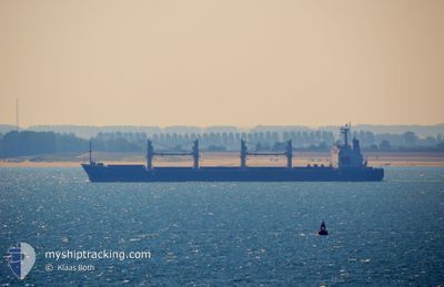
Bulk Carrier
Current Trip
| Trip Time | 7 days |
|---|---|
| Trip Distance | 1705.15 nm |
| AVG Speed | 10.6 Knots |
| MAX Speed | 10.6 Knots |
| Dybgang | 5.6 m |
| AVG Wind | 9.4 knots |
| MAX Wind | 17.8 knots |
| MIN Temp | 11.2°C / 52.16°F |
| MAX Temp | 21.7°C / 71.06°F |
| Position Modtaget | 6 d siden |
Current Position
| Longitude | 29.50308° |
|---|---|
| Latitude | 41.41081° |
| Status | Under way using engine |
| Fart | 12.4 Knots |
| Kurs | 57.3° |
| Område | Black Sea |
| Station | T-AIS |
| Position Modtaget | 6 d siden |
Info
Information
The current position of AKSON SERIN is in Black Sea with coordinates 41.41081° / 29.50308° as reported on 2024-04-09 20:14 by AIS to our vessel tracker app. The vessel's current speed is 12.4 Knots and is currently inside the port of TAMAN.
The vessel AKSON SERIN (IMO: 9275311, MMSI: 354912000) is a Bulk Carrier that was built in 2004 ( 20 år gamle ). It's sailing under the flag of [PA] Panama.
In this page you can find informations about the vessels current position, last detected port calls, and current voyage information. If the vessels is not in coverage by AIS you will find the latest position.
The current position of AKSON SERIN is detected by our AIS receivers and we are not responsible for the reliability of the data. The last position was recorded while the vessel was in Coverage by the Ais receivers of our vessel tracking app.
The current draught of AKSON SERIN as reported by AIS is 5.6 meters
Weather
| Temperature | 12.9°C / 55.22°F |
|---|---|
| Wind Speed | 10 knots |
| Direction | 183° S |
| Pressure | 1019 hPa |
| Humidity | 87.4 % |
| Cloud Coverage | 20 % |
Featured Company
Last Port Calls
| Port | Arrival | Departure | Time In Port |
|---|---|---|---|
| 2024-04-11 13:11 | |||
| 2024-04-02 07:42 | 2024-04-03 23:44 | 1 d | |
| 2024-03-19 01:31 | 2024-03-27 15:59 | 8 d | |
| 2024-03-16 16:11 | 2024-03-17 22:06 | 1 d | |
| 2024-03-13 05:40 | |||
| 2024-02-11 05:22 | 2024-02-14 23:59 | 3 d |
Most Visited Ports (Last year)
| Port | Arrivals | |
|---|---|---|
| 4 | ||
| 2 | ||
| 2 | ||
| 1 | ||
| 1 | ||
| 1 |
Last Trips
| Origin | Departure | Destination | Arrival | Distance | |
|---|---|---|---|---|---|
| 2024-04-04 01:44 | 2024-04-11 16:11 | 1705.15 nm | |||
| 2024-03-27 18:59 | 2024-04-02 09:42 | 1172.17 nm | |||
| 2024-03-18 01:06 | 2024-03-19 04:31 | 46.81 nm | |||
| 2024-02-15 07:59 | 2024-03-16 19:11 | 7936.78 nm | |||
| 2024-02-15 07:59 | 2024-03-13 07:40 | 7049.53 nm | |||
| 2023-12-10 07:29 | 2024-02-11 13:22 | 7537.46 nm |
Events
| Tid | Hændelsen | Detaljer | Position / Dest | Info |
|---|---|---|---|---|
| 2024-04-11 13:11 | Skibe i havn |
|
45.11924 / 36.65184
[RU] TAMAN
|
Fart: 51.8 kn Kurs: 189° |
| 2024-04-09 20:20 | Status er ændret | Default Under way using engine |
41.42291 / 29.52768
RU TAM
|
Fart: 12.4 kn Kurs: 57.3° |
| 2024-04-09 20:14 | Udenfor Dækning |
41.41081 / 29.50308
Black Sea
|
Fart: 12.4 kn Kurs: 57.3° |
|
| 2024-04-09 18:43 | Ændre havområde | Turkish part of the Black Sea Turkish part of the Sea of Marmara |
41.23304 / 29.15105
Black Sea
|
Fart: 12.4 kn Kurs: 50.8° |
| 2024-04-09 14:52 | START Sejllads | 10.89 nm, South of YESILKOY |
40.77592 / 28.78965
RU TAM
|
Fart: 3.1 kn Kurs: 101° |
| 2024-04-08 18:04 | STOP Sejllads | 9.47 nm, South of YESILKOY |
40.80009 / 28.78797
RU TAM
|
Fart: 0.3 kn Kurs: 65° |
| 2024-04-08 17:34 | START Sejllads | 10.42 nm, South of YESILKOY |
40.78812 / 28.76371
RU TAM
|
Fart: 3.2 kn Kurs: 19° |
| 2024-04-08 17:18 | STOP Sejllads | 10.33 nm, South of YESILKOY |
40.79037 / 28.76100
RU TAM
|
Fart: 0.3 kn Kurs: 305° |
| 2024-04-08 09:58 | START Sejllads | 12.42 nm, South of AMBARLI |
40.75290 / 28.68839
RU TAM
|
Fart: 3.2 kn Kurs: 299° |
| 2024-04-08 06:41 | STOP Sejllads | 10.35 nm, South of AMBARLI |
40.78883 / 28.70663
RU TAM
|
Fart: 0.3 kn Kurs: 9° |