
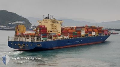
CMA CGM AMAZON
Cargo A
Current Trip
| Time Travelled | 18 h, 55 mins |
|---|---|
| Remaining Time | 8 days |
| Distance Travelled | 374.95 nm |
| Remaining Distance | 4009.69 nm |
| AVG Speed | 18.7 Knots |
| MAX Speed | 21.1 Knots |
| AVG Wind | 14.6 knots |
| MAX Wind | 19 knots |
| MIN Temp | 17.1°C / 62.78°F |
| MAX Temp | 20.2°C / 68.36°F |
| Dybgang | 11.1 m |
| Position Modtaget | 14 m siden |
Current Position
| Longitude | -10.68890° |
|---|---|
| Latitude | 31.62476° |
| Status | Under way using engine |
| Fart | 19.8 Knots |
| Kurs | 220.7° |
| Område | North Atlantic Ocean |
| Station | T-AIS |
| Position Modtaget | 14 m siden |
Info
Information
The current position of CMA CGM AMAZON is in North Atlantic Ocean with coordinates 31.62476° / -10.68890° as reported on 2024-04-25 04:39 by AIS to our vessel tracker app. The vessel's current speed is 19.8 Knots and is heading at the port of SANTOS. The estimated time of arrival as calculated by MyShipTracking vessel tracking app is 2024-05-03 12:13 LT
The vessel CMA CGM AMAZON (IMO: 9706308, MMSI: 215499000) is a Cargo A It's sailing under the flag of [MT] Malta.
In this page you can find informations about the vessels current position, last detected port calls, and current voyage information. If the vessels is not in coverage by AIS you will find the latest position.
The current position of CMA CGM AMAZON is detected by our AIS receivers and we are not responsible for the reliability of the data. The last position was recorded while the vessel was in Coverage by the Ais receivers of our vessel tracking app.
The current draught of CMA CGM AMAZON as reported by AIS is 11.1 meters
Weather
| Temperature | 18.3°C / 64.94°F |
|---|---|
| Wind Speed | 19 knots |
| Direction | 16° NNE |
| Pressure | 1013.8 hPa |
| Humidity | 77.2 % |
| Cloud Coverage | --- |
Featured Company
Last Port Calls
| Port | Arrival | Departure | Time In Port |
|---|---|---|---|
| 2024-04-23 05:15 | 2024-04-24 09:58 | 1 d | |
| 2024-04-19 18:04 | 2024-04-20 19:19 | 1 d | |
| 2024-04-17 22:11 | 2024-04-18 19:55 | 21 h | |
| 2024-04-15 16:58 | 2024-04-16 03:28 | 10 h | |
| 2024-04-04 05:38 | 2024-04-06 13:53 | 2 d | |
| 2024-04-03 16:27 | 2024-04-03 17:24 | 57 m | |
| 2024-04-02 05:26 | 2024-04-02 06:14 | 47 m | |
| 2024-03-19 14:17 | 2024-03-21 16:38 | 2 d | |
| 2024-03-16 00:29 | 2024-03-16 19:38 | 19 h | |
| 2024-03-07 07:58 | 2024-03-15 08:57 | 8 d |
Most Visited Ports (Last year)
| Port | Arrivals | |
|---|---|---|
| 5 | ||
| 5 | ||
| 4 | ||
| 3 | ||
| 3 | ||
| 3 |
Last Trips
| Origin | Departure | Destination | Arrival | Distance | |
|---|---|---|---|---|---|
| 2024-04-20 21:19 | 2024-04-23 06:15 | 38.43 nm | |||
| 2024-04-18 21:55 | 2024-04-19 20:04 | 7.59 nm | |||
| 2024-04-16 04:28 | 2024-04-18 00:11 | 140.92 nm | |||
| 2024-04-06 10:53 | 2024-04-15 17:58 | 4278.75 nm | |||
| 2024-04-03 14:24 | 2024-04-04 02:38 | 187.34 nm | |||
| 2024-04-02 03:14 | 2024-04-03 13:27 | 2.84 nm | |||
| 2024-03-21 16:38 | 2024-04-02 02:26 | 4413.68 nm | |||
| 2024-03-16 20:38 | 2024-03-19 14:17 | 80.29 nm | |||
| 2024-03-15 09:57 | 2024-03-16 01:29 | 8.19 nm | |||
| 2024-03-05 04:35 | 2024-03-07 08:58 | 64.27 nm |
Events
| Tid | Hændelsen | Detaljer | Position / Dest | Info |
|---|---|---|---|---|
| 2024-04-25 04:43 | Status er ændret | Default Under way using engine |
31.60672 / -10.70720
BRSSZ
|
Fart: 19.8 kn Kurs: 220.7° |
| 2024-04-25 04:19 | Status er ændret | Under way using engine Default |
31.70775 / -10.60873
BRSSZ
|
Fart: 19.4 kn Kurs: 218° |
| 2024-04-25 04:08 | Indenfor Dækning |
31.70775 / -10.60873
North Atlantic Ocean
BRSSZ
|
Fart: 19.7 kn Kurs: 218.5° |
|
| 2024-04-25 03:03 | Status er ændret | Default Under way using engine |
32.03659 / -10.30038
BRSSZ
|
Fart: 20.1 kn Kurs: 217.6° |
| 2024-04-25 02:58 | Udenfor Dækning |
32.05748 / -10.28154
North Atlantic Ocean
BRSSZ
|
Fart: 20.1 kn Kurs: 217.6° |
|
| 2024-04-25 02:47 | Status er ændret | Under way using engine Default |
32.10526 / -10.23780
BRSSZ
|
Fart: 20.5 kn Kurs: 218° |
| 2024-04-25 02:37 | Status er ændret | Default Under way using engine |
32.15059 / -10.19633
BRSSZ
|
Fart: 20.4 kn Kurs: 217.5° |
| 2024-04-25 02:27 | Status er ændret | Under way using engine Default |
32.19432 / -10.15525
BRSSZ
|
Fart: 20.5 kn Kurs: 220° |
| 2024-04-25 02:16 | Indenfor Dækning |
32.19432 / -10.15525
North Atlantic Ocean
BRSSZ
|
Fart: 20.5 kn Kurs: 220.9° |
|
| 2024-04-24 21:02 | Udenfor Dækning |
33.62446 / -8.76028
North Atlantic Ocean
BRSSZ
|
Fart: 20.8 kn Kurs: 221.1° |