
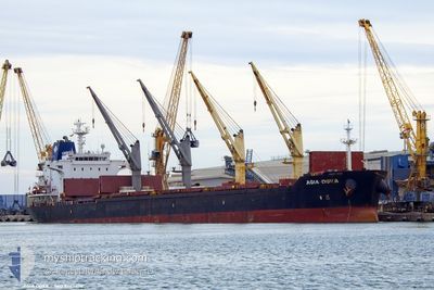
AGIA DOXA
Bulk Carrier
Current Trip
HRSPL
| Time Travelled | --- |
|---|---|
| Remaining Time | --- |
| Distance Travelled | --- |
| Remaining Distance | --- |
| AVG Speed | --- |
| MAX Speed | --- |
| AVG Wind | --- |
| MAX Wind | --- |
| MIN Temp | --- |
| MAX Temp | --- |
| Dybgang | 10.4 m |
| Position Modtaget | 1 m siden |
Current Position
| Longitude | 18.54555° |
|---|---|
| Latitude | 40.67568° |
| Status | Under way using engine |
| Fart | 11 Knots |
| Kurs | 135.5° |
| Område | Adriatic Sea |
| Station | T-AIS |
| Position Modtaget | 1 m siden |
Info
Information
The current position of AGIA DOXA is in Adriatic Sea with coordinates 40.67568° / 18.54555° as reported on 2024-04-19 07:18 by AIS to our vessel tracker app. The vessel's current speed is 11 Knots
The vessel AGIA DOXA (IMO: 9467976, MMSI: 636018086) is a Bulk Carrier that was built in 2010 ( 14 år gamle ). It's sailing under the flag of [LR] Liberia.
In this page you can find informations about the vessels current position, last detected port calls, and current voyage information. If the vessels is not in coverage by AIS you will find the latest position.
The current position of AGIA DOXA is detected by our AIS receivers and we are not responsible for the reliability of the data. The last position was recorded while the vessel was in Coverage by the Ais receivers of our vessel tracking app.
The current draught of AGIA DOXA as reported by AIS is 10.4 meters
Weather
| Temperature | 14°C / 57.2°F |
|---|---|
| Wind Speed | 5 knots |
| Direction | 129° SE |
| Pressure | 1008.8 hPa |
| Humidity | 62.4 % |
| Cloud Coverage | 100 % |
Featured Company
Last Port Calls
| Port | Arrival | Departure | Time In Port |
|---|---|---|---|
| 2024-04-11 09:27 | |||
| 2024-03-09 22:13 | 2024-03-09 22:49 | 36 m | |
| 2024-02-24 01:40 | 2024-02-24 07:57 | 6 h |
Most Visited Ports (Last year)
| Port | Arrivals | |
|---|---|---|
| 3 | ||
| 1 | ||
| 1 | ||
| 1 | ||
| 1 | ||
| 1 |
Last Trips
| Origin | Departure | Destination | Arrival | Distance | |
|---|---|---|---|---|---|
| 2024-03-09 16:49 | 2024-04-11 11:27 | 6611.08 nm | |||
| 2024-02-24 01:57 | 2024-03-09 16:13 | 592.61 nm | |||
| 2024-01-23 09:28 | 2024-02-23 19:40 | 7137.52 nm |
Events
| Tid | Hændelsen | Detaljer | Position / Dest | Info |
|---|---|---|---|---|
| 2024-04-19 07:07 | Indenfor Dækning |
40.69803 / 18.51530
Adriatic Sea
|
Fart: 10.9 kn Kurs: 138.9° |
|
| 2024-04-19 01:11 | Udenfor Dækning |
41.62245 / 17.65991
Adriatic Sea
|
Fart: 11.8 kn Kurs: 146.1° |
|
| 2024-04-19 00:54 | Ændre havområde | Italian part of the Adriatic Sea Croatian part of the Adriatic Sea |
41.67174 / 17.61697
Adriatic Sea
|
Fart: 12 kn Kurs: 147.7° |
| 2024-04-19 00:54 | Indenfor Dækning |
41.67174 / 17.61697
Adriatic Sea
|
Fart: 12 kn Kurs: 147.7° |
|
| 2024-04-11 11:24 | STOP Sejllads |
43.52814 / 16.46857
[HR] SPLIT INNER
|
Fart: Kurs: 281° |
|
| 2024-04-11 09:27 | Skibe i havn |
|
43.53736 / 16.41204
[HR] SPLIT INNER
|
Fart: 6.3 kn Kurs: 293° |
| 2024-04-11 08:48 | START Sejllads | 1.18 nm, South of SPLIT |
43.48454 / 16.43797
HRSPL
|
Fart: 5 kn Kurs: 310° |
| 2024-04-10 09:03 | STOP Sejllads | 1.08 nm, South of SPLIT |
43.48700 / 16.44290
HRSPL
|
Fart: Kurs: 102° |
| 2024-04-10 00:17 | Status er ændret | Default Under way using engine |
42.25437 / 17.10142
HRSPL
|
Fart: 10.9 kn Kurs: 322.5° |
| 2024-04-10 00:14 | Udenfor Dækning |
42.24623 / 17.10983
Adriatic Sea
HRSPL
|
Fart: 10.9 kn Kurs: 322.5° |