
AEOLOS
Cargo
Current Trip
| Time Travelled | 15 days |
|---|---|
| Remaining Time | 5 days |
| Distance Travelled | 2966.78 nm |
| Remaining Distance | 1039.54 nm |
| AVG Speed | 8.6 Knots |
| MAX Speed | 10.4 Knots |
| AVG Wind | 9.8 knots |
| MAX Wind | 18 knots |
| MIN Temp | 19.5°C / 67.1°F |
| MAX Temp | 31.7°C / 89.06°F |
| Dybgang | 11.8 m |
| Position Modtaget | 3 h, 50 m siden |
Current Position
| Longitude | -13.77753° |
|---|---|
| Latitude | 27.84311° |
| Status | Under way using engine |
| Fart | 8.5 Knots |
| Kurs | 30° |
| Område | North Atlantic Ocean |
| Station | T-AIS |
| Position Modtaget | 3 h, 50 m siden |
Info
Information
The current position of AEOLOS is in North Atlantic Ocean with coordinates 27.84311° / -13.77753° as reported on 2024-04-16 18:56 by AIS to our vessel tracker app. The vessel's current speed is 8.5 Knots and is heading at the port of VALENCIA. The estimated time of arrival as calculated by MyShipTracking vessel tracking app is 2024-04-22 18:44 LT
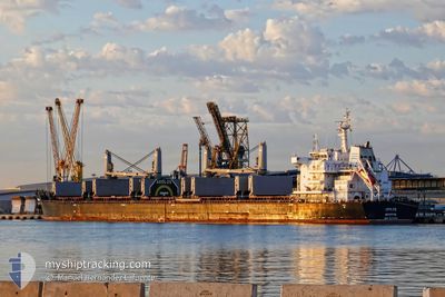
The vessel AEOLOS (IMO: 9670901, MMSI: 636016600) is a Cargo It's sailing under the flag of [LR] Liberia.
In this page you can find informations about the vessels current position, last detected port calls, and current voyage information. If the vessels is not in coverage by AIS you will find the latest position.
The current position of AEOLOS is detected by our AIS receivers and we are not responsible for the reliability of the data. The last position was recorded while the vessel was in Coverage by the Ais receivers of our vessel tracking app.
The current draught of AEOLOS as reported by AIS is 11.8 meters
Weather
| Temperature | 19.6°C / 67.28°F |
|---|---|
| Wind Speed | 13 knots |
| Direction | 21° NNE |
| Pressure | 1017 hPa |
| Humidity | 87.4 % |
| Cloud Coverage | 2 % |
Featured Company
Last Port Calls
Last Trips
| Origin | Departure | Destination | Arrival | Distance | |
|---|---|---|---|---|---|
| 2024-03-26 13:17 | 2024-03-30 19:44 | 15.93 nm | |||
| 2024-03-22 16:17 | 2024-03-25 13:05 | 14.08 nm | |||
| 2024-03-13 09:35 | 2024-03-22 03:00 | 827.71 nm | |||
| 2024-02-17 17:52 | 2024-03-08 12:31 | 4836.08 nm | |||
| 2024-02-06 18:00 | 2024-02-13 14:46 | 33.76 nm |
Events
| Tid | Hændelsen | Detaljer | Position / Dest | Info |
|---|---|---|---|---|
| 2024-04-16 19:01 | Status er ændret | Default Under way using engine |
27.85309 / -13.77059
ESVLC
|
Fart: 8.5 kn Kurs: 30° |
| 2024-04-16 18:56 | Udenfor Dækning |
27.84311 / -13.77753
North Atlantic Ocean
ESVLC
|
Fart: 8.5 kn Kurs: 30° |
|
| 2024-04-16 18:54 | Fundet i havområde | Spanish (Canary Islands) part of the North Atlantic Ocean |
27.83768 / -13.78110
North Atlantic Ocean
ESVLC
|
Fart: 8.5 kn Kurs: 31.2° |
| 2024-04-16 18:54 | Status er ændret | Under way using engine Default |
27.83768 / -13.78110
ESVLC
|
Fart: 8.4 kn Kurs: 31° |
| 2024-04-16 18:37 | Indenfor Dækning |
27.83768 / -13.78110
North Atlantic Ocean
ESVLC
|
Fart: 8.5 kn Kurs: 31.2° |
|
| 2024-04-16 09:33 | Status er ændret | Default Under way using engine |
26.93629 / -14.44342
ESVLC
|
Fart: 6 kn Kurs: 37.3° |
| 2024-04-16 09:28 | Udenfor Dækning |
26.92892 / -14.44949
North Atlantic Ocean
ESVLC
|
Fart: 6 kn Kurs: 37.3° |
|
| 2024-04-16 09:19 | Status er ændret | Under way using engine Default |
26.91778 / -14.45875
ESVLC
|
Fart: 6 kn Kurs: 35° |
| 2024-04-16 09:11 | Indenfor Dækning |
26.91778 / -14.45875
North Atlantic Ocean
ESVLC
|
Fart: 6 kn Kurs: 37.5° |
|
| 2024-04-16 08:11 | Udenfor Dækning |
26.82345 / -14.53214
North Atlantic Ocean
ESVLC
|
Fart: 6 kn Kurs: 34.9° |