
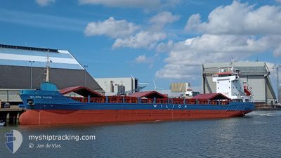
WILSON CLYDE
General Cargo
Current Trip
| Time Travelled | 2 days |
|---|---|
| Remaining Time | --- |
| Distance Travelled | 510.70 nm |
| Remaining Distance | --- |
| AVG Speed | 10.1 Knots |
| MAX Speed | 12.4 Knots |
| AVG Wind | 9.6 knots |
| MAX Wind | 29 knots |
| MIN Temp | 4.4°C / 39.92°F |
| MAX Temp | 9.2°C / 48.56°F |
| Draught | 5.8 m |
| Position Received | 1 d ago |
Current Position
| Longitude | 4.48017° |
|---|---|
| Latitude | 57.78217° |
| Status | Under way using engine |
| Speed | 9.6 Knots |
| Course | 261.9° |
| Area | North Sea |
| Station | T-AIS |
| Position Received | 1 d ago |
Info
Information
The current position of WILSON CLYDE is in North Sea with coordinates 57.78217° / 4.48017° as reported on 2024-04-18 21:41 by AIS to our vessel tracker app. The vessel's current speed is 9.6 Knots and is heading at the port of BELFAST. The estimated time of arrival as calculated by MyShipTracking vessel tracking app is 2024-04-21 11:00 LT
The vessel WILSON CLYDE (IMO: 9178458, MMSI: 314187000) is a General Cargo that was built in 1998 ( 26 years old ). It's sailing under the flag of [BB] Barbados.
In this page you can find informations about the vessels current position, last detected port calls, and current voyage information. If the vessels is not in coverage by AIS you will find the latest position.
The current position of WILSON CLYDE is detected by our AIS receivers and we are not responsible for the reliability of the data. The last position was recorded while the vessel was in Coverage by the Ais receivers of our vessel tracking app.
The current draught of WILSON CLYDE as reported by AIS is 5.8 meters
Weather
| Temperature | 5.3°C / 41.54°F |
|---|---|
| Wind Speed | 22 knots |
| Direction | 353° N |
| Pressure | 1025.2 hPa |
| Humidity | 58.5 % |
| Cloud Coverage | 77 % |
Featured Company
Last Port Calls
| Port | Arrival | Departure | Time In Port |
|---|---|---|---|
| 2024-04-16 02:21 | 2024-04-17 09:47 | 1 d | |
| 2024-04-15 08:02 | 2024-04-16 02:11 | 18 h | |
| 2024-03-17 07:21 | 2024-03-18 17:39 | 1 d | |
| 2024-03-13 22:01 | 2024-03-16 01:33 | 2 d | |
| 2024-03-06 14:34 | 2024-03-12 23:46 | 6 d | |
| 2024-02-28 12:39 | 2024-03-02 15:49 | 3 d | |
| 2024-02-14 14:54 | 2024-02-16 13:54 | 1 d | |
| 2024-02-04 23:20 | 2024-02-07 17:57 | 2 d |
Most Visited Ports (Last year)
| Port | Arrivals | |
|---|---|---|
| 3 | ||
| 3 | ||
| 2 | ||
| 2 | ||
| 2 | ||
| 2 |
Last Trips
| Origin | Departure | Destination | Arrival | Distance | |
|---|---|---|---|---|---|
| 2024-04-16 04:11 | 2024-04-16 04:21 | 0.65 nm | |||
| 2024-03-18 18:39 | 2024-04-15 10:02 | 2929.85 nm | |||
| 2024-03-16 02:33 | 2024-03-17 08:21 | 82.36 nm | |||
| 2024-03-12 23:46 | 2024-03-13 23:01 | 228.23 nm | |||
| 2024-03-02 16:49 | 2024-03-06 14:34 | 753.87 nm | |||
| 2024-02-16 14:54 | 2024-02-28 13:39 | 2128.55 nm | |||
| 2024-02-07 17:57 | 2024-02-14 15:54 | 1357.97 nm | |||
| 2024-01-25 22:18 | 2024-02-04 23:20 | 1823.95 nm |
Events
| Time | Event | Details | Position / Dest | Info |
|---|---|---|---|---|
| 2024-04-18 21:41 | OUT of Coverage |
57.78217 / 4.48017
North Sea
GBBEL
|
Speed: 9.6 kn Course: 261.9° |
|
| 2024-04-18 21:41 | IN Coverage |
57.78217 / 4.48017
North Sea
GBBEL
|
Speed: 9.6 kn Course: 261.9° |
|
| 2024-04-18 20:17 | OUT of Coverage |
57.80902 / 4.90570
North Sea
GBBEL
|
Speed: 10 kn Course: 263.6° |
|
| 2024-04-18 13:15 | Detected in Sea | Norwegian part of the North Sea |
57.88571 / 7.19180
North Sea
GBBEL
|
Speed: 10.8 kn Course: 267.7° |
| 2024-04-18 09:38 | ETA Changed | 2024/04/21 11:00 2024/04/21 21:00 |
57.90156 / 8.49214
GBBEL
|
Speed: 10.7 kn Course: 267.2° |
| 2024-04-18 07:26 | Change Sea Area | Norwegian part of the Skaggerak Danish part of the Skaggerak |
57.90733 / 9.22383
Skaggerak
GBBEL
|
Speed: 10.7 kn Course: 273.7° |
| 2024-04-18 01:56 | Change Sea Area | Danish part of the Skaggerak Swedish part of the Skaggerak |
57.87792 / 10.94204
Skaggerak
GBBEL
|
Speed: 10.4 kn Course: 284.4° |
| 2024-04-18 01:17 | Change Sea Area | Swedish part of the Skaggerak Swedish part of the Kattegat |
57.84946 / 11.15350
Skaggerak
GBBEL
|
Speed: 10.8 kn Course: 290.7° |
| 2024-04-17 22:58 | START Moving | 2.99 nm, South West of SANDVIK |
57.59700 / 11.68900
GBBEL
|
Speed: 4.9 kn Course: 240° |
| 2024-04-17 22:51 | Status Changed | Under way using engine At anchor |
57.59956 / 11.69102
GBBEL
|
Speed: 0.1 kn Course: 117° |