
VERA
Cargo
Current Trip
| Trip Time | 1 day |
|---|---|
| Trip Distance | 306.62 nm |
| AVG Speed | 9.6 Knots |
| MAX Speed | 9.6 Knots |
| Draught | 1.8 m |
| AVG Wind | 6.9 knots |
| MAX Wind | 20.3 knots |
| MIN Temp | 2.2°C / 35.96°F |
| MAX Temp | 11.7°C / 53.06°F |
| Position Received | 2 m ago |
Current Position
| Longitude | 4.13070° |
|---|---|
| Latitude | 51.94712° |
| Status | Moored |
| Speed | |
| Course | 175° |
| Area | North Sea |
| Station | T-AIS |
| Position Received | 2 m ago |
Info
Information
The current position of VERA is in North Sea with coordinates 51.94712° / 4.13070° as reported on 2024-04-18 06:40 by AIS to our vessel tracker app. The vessel's current speed is 0 Knots and is currently inside the port of ROTTERDAM.
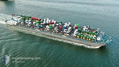
The vessel VERA (MMSI: 244660542) is a Cargo It's sailing under the flag of [NL] Netherlands.
In this page you can find informations about the vessels current position, last detected port calls, and current voyage information. If the vessels is not in coverage by AIS you will find the latest position.
The current position of VERA is detected by our AIS receivers and we are not responsible for the reliability of the data. The last position was recorded while the vessel was in Coverage by the Ais receivers of our vessel tracking app.
The current draught of VERA as reported by AIS is 1.8 meters
Weather
| Temperature | 6.3°C / 43.34°F |
|---|---|
| Wind Speed | 5 knots |
| Direction | 17° NNE |
| Pressure | 1019.2 hPa |
| Humidity | 78.4 % |
| Cloud Coverage | 19 % |
Featured Company
Last Port Calls
| Port | Arrival | Departure | Time In Port |
|---|---|---|---|
| 2024-04-17 21:24 | |||
| 2024-04-16 09:20 | 2024-04-16 11:05 | 1 h | |
| 2024-04-15 11:50 | 2024-04-16 06:55 | 19 h | |
| 2024-04-14 22:58 | 2024-04-15 06:58 | 8 h | |
| 2024-04-11 17:42 | 2024-04-12 11:34 | 17 h | |
| 2024-04-11 05:45 | 2024-04-11 10:10 | 4 h | |
| 2024-04-10 19:45 | 2024-04-11 05:04 | 9 h | |
| 2024-04-10 16:50 | 2024-04-10 17:06 | 16 m | |
| 2024-04-08 16:31 | 2024-04-09 10:05 | 17 h | |
| 2024-04-08 10:56 | 2024-04-08 14:02 | 3 h |
Last Trips
| Origin | Departure | Destination | Arrival | Distance | |
|---|---|---|---|---|---|
| 2024-04-16 13:05 | 2024-04-17 23:24 | 306.62 nm | |||
| 2024-04-16 08:55 | 2024-04-16 11:20 | 25.31 nm | |||
| 2024-04-15 08:58 | 2024-04-15 13:50 | 25.15 nm | |||
| 2024-04-12 13:34 | 2024-04-15 00:58 | 325.45 nm | |||
| 2024-04-11 12:10 | 2024-04-11 19:42 | 55.17 nm | |||
| 2024-04-11 07:04 | 2024-04-11 07:45 | 5.67 nm | |||
| 2024-04-10 19:06 | 2024-04-10 21:45 | 18.11 nm | |||
| 2024-04-09 12:05 | 2024-04-10 18:50 | 288.43 nm | |||
| 2024-04-08 16:02 | 2024-04-08 18:31 | 25.32 nm | |||
| 2024-04-08 08:08 | 2024-04-08 12:56 | 25.01 nm |
Events
| Time | Event | Details | Position / Dest | Info |
|---|---|---|---|---|
| 2024-04-17 22:16 | Status Changed | Moored Under way using engine |
51.94706 / 4.13068
[NL] ROTTERDAM
|
Speed: 0.3 kn Course: 176° |
| 2024-04-17 22:13 | STOP Moving |
51.94682 / 4.13053
[NL] ROTTERDAM
|
Speed: 0.3 kn Course: 167° |
|
| 2024-04-17 21:24 | PORT ARRIVAL |
|
51.90498 / 4.22564
[NL] ROTTERDAM
|
Speed: 7.8 kn Course: 354.7° |
| 2024-04-17 21:18 | START Moving | 0.68 nm, North of ZWARTEWAAL |
51.89481 / 4.22825
BENELUXHAVEN
|
Speed: 3.4 kn Course: 348° |
| 2024-04-17 21:10 | STOP Moving | 0.56 nm, North of ZWARTEWAAL |
51.89276 / 4.22886
BENELUXHAVEN
|
Speed: 0.3 kn Course: 349° |
| 2024-04-17 18:52 | START Moving | 1.22 nm, North East of ZWIJNDRECHT |
51.81214 / 4.65051
BENELUXHAVEN
|
Speed: 5.2 kn Course: 216.9° |
| 2024-04-17 18:50 | Status Changed | Under way using engine Moored |
51.81378 / 4.65226
BENELUXHAVEN
|
Speed: 1 kn Course: 219° |
| 2024-04-17 18:50 | Status Changed | Moored Under way using engine |
51.81384 / 4.65229
BENELUXHAVEN
|
Speed: 0.6 kn Course: 221° |
| 2024-04-17 18:45 | STOP Moving | 1.33 nm, North East of ZWIJNDRECHT |
51.81389 / 4.65220
BENELUXHAVEN
|
Speed: 0.3 kn Course: 226° |
| 2024-04-17 11:27 | IN Coverage |
51.82295 / 6.26410
North Sea
BENELUXHAVEN
|
Speed: 9.5 kn Course: 307.3° |