
TRES HOMBRES
Sailing
Current Trip
Unknown
| Time Travelled | --- |
|---|---|
| Remaining Time | --- |
| Distance Travelled | 2519.60 nm |
| Remaining Distance | --- |
| AVG Speed | 5.3 Knots |
| MAX Speed | 13.1 Knots |
| AVG Wind | 15.7 knots |
| MAX Wind | 31.3 knots |
| MIN Temp | 12.8°C / 55.04°F |
| MAX Temp | 26.9°C / 80.42°F |
| Draught | 0 m |
| Position Received | 6 d ago |
Current Position
| Longitude | -27.91457° |
|---|---|
| Latitude | 39.27554° |
| Status | Default |
| Speed | 4.3 Knots |
| Course | 57.8° |
| Area | North Atlantic Ocean |
| Station | T-AIS |
| Position Received | 6 d ago |
Info
Information
The current position of TRES HOMBRES is in North Atlantic Ocean with coordinates 39.27554° / -27.91457° as reported on 2024-04-18 18:37 by AIS to our vessel tracker app. The vessel's current speed is 4.3 Knots
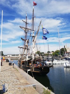
The vessel TRES HOMBRES (MMSI: 577333000) is a Sailing It's sailing under the flag of [VU] Vanuatu.
In this page you can find informations about the vessels current position, last detected port calls, and current voyage information. If the vessels is not in coverage by AIS you will find the latest position.
The current position of TRES HOMBRES is detected by our AIS receivers and we are not responsible for the reliability of the data. The last position was recorded while the vessel was in Coverage by the Ais receivers of our vessel tracking app.
Weather
| Temperature | 16.6°C / 61.88°F |
|---|---|
| Wind Speed | 13 knots |
| Direction | 205° SSW |
| Pressure | 1009.4 hPa |
| Humidity | 88.5 % |
| Cloud Coverage | 8 % |
Featured Company
Last Port Calls
Most Visited Ports (Last year)
| Port | Arrivals | |
|---|---|---|
| 3 | ||
| 2 | ||
| 2 | ||
| 1 | ||
| 1 | ||
| 1 |
Last Trips
| Origin | Departure | Destination | Arrival | Distance |
|---|
Events
| Time | Event | Details | Position / Dest | Info |
|---|---|---|---|---|
| 2024-04-18 18:37 | OUT of Coverage |
39.27554 / -27.91457
North Atlantic Ocean
|
Speed: 4.3 kn Course: 57.8° |
|
| 2024-04-18 16:01 | IN Coverage |
39.20247 / -28.17323
North Atlantic Ocean
|
Speed: 5 kn Course: 68.2° |
|
| 2024-04-18 14:23 | OUT of Coverage |
39.17204 / -28.28386
North Atlantic Ocean
|
Speed: 3.3 kn Course: 73.9° |
|
| 2024-04-18 12:30 | START Moving |
39.12682 / -28.36415
|
Speed: 3.3 kn Course: 41.8° |
|
| 2024-04-18 11:28 | STOP Moving |
39.10471 / -28.37981
|
Speed: Course: 511° |
|
| 2024-04-18 08:40 | START Moving |
39.01994 / -28.41683
|
Speed: 3.2 kn Course: 13.3° |
|
| 2024-04-18 03:57 | STOP Moving |
38.93520 / -28.40279
|
Speed: 0.2 kn Course: 511° |
|
| 2024-04-18 02:16 | START Moving |
38.88660 / -28.40633
|
Speed: 3.4 kn Course: 8.2° |
|
| 2024-04-17 23:13 | STOP Moving |
38.84643 / -28.38638
|
Speed: 0.2 kn Course: 511° |
|
| 2024-04-17 22:10 | START Moving |
38.81668 / -28.41519
|
Speed: 3.2 kn Course: 42.6° |