
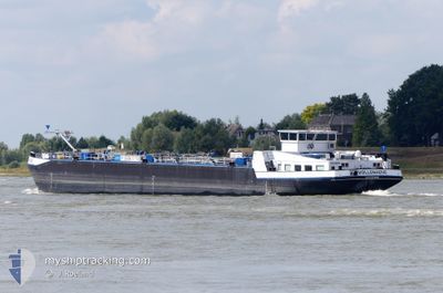
VOLLENHOVE
Tanker
Current Trip
| Time Travelled | 1 day |
|---|---|
| Remaining Time | 6 h, 56 mins |
| Distance Travelled | 197.65 nm |
| Remaining Distance | 57.91 nm |
| AVG Speed | 7.6 Knots |
| MAX Speed | 11 Knots |
| AVG Wind | 13.4 knots |
| MAX Wind | 19.3 knots |
| MIN Temp | 5.8°C / 42.44°F |
| MAX Temp | 9.6°C / 49.28°F |
| Draught | 3.1 m |
| Position Received | 51 m ago |
Current Position
| Longitude | 6.71814° |
|---|---|
| Latitude | 51.42969° |
| Status | Under way using engine |
| Speed | 7 Knots |
| Course | 140.7° |
| Area | North Sea |
| Station | T-AIS |
| Position Received | 51 m ago |
Info
Information
The current position of VOLLENHOVE is in North Sea with coordinates 51.42969° / 6.71814° as reported on 2024-04-20 01:32 by AIS to our vessel tracker app. The vessel's current speed is 7 Knots and is heading at the port of LULSDORF. The estimated time of arrival as calculated by MyShipTracking vessel tracking app is 2024-04-20 09:19 LT
The vessel VOLLENHOVE (MMSI: 244660841) is a Tanker It's sailing under the flag of [NL] Netherlands.
In this page you can find informations about the vessels current position, last detected port calls, and current voyage information. If the vessels is not in coverage by AIS you will find the latest position.
The current position of VOLLENHOVE is detected by our AIS receivers and we are not responsible for the reliability of the data. The last position was recorded while the vessel was in Coverage by the Ais receivers of our vessel tracking app.
The current draught of VOLLENHOVE as reported by AIS is 3.1 meters
Weather
| Temperature | 5.8°C / 42.44°F |
|---|---|
| Wind Speed | 7 knots |
| Direction | 325° NW |
| Pressure | 1014.8 hPa |
| Humidity | 78.4 % |
| Cloud Coverage | 100 % |
Featured Company
Last Port Calls
| Port | Arrival | Departure | Time In Port |
|---|---|---|---|
| 2024-04-18 17:13 | 2024-04-18 17:36 | 23 m | |
| 2024-04-17 13:45 | 2024-04-17 14:07 | 21 m | |
| 2024-04-17 11:19 | 2024-04-17 11:39 | 20 m | |
| 2024-04-13 15:11 | 2024-04-15 07:52 | 1 d | |
| 2024-04-12 07:32 | 2024-04-12 07:54 | 22 m | |
| 2024-04-12 05:21 | 2024-04-12 05:50 | 28 m | |
| 2024-04-07 13:50 | 2024-04-07 14:12 | 22 m | |
| 2024-04-05 08:33 | 2024-04-05 10:35 | 2 h | |
| 2024-03-30 06:21 | 2024-03-30 08:10 | 1 h | |
| 2024-03-29 05:29 | 2024-03-29 08:03 | 2 h |
Most Visited Ports (Last year)
| Port | Arrivals | |
|---|---|---|
| 48 | ||
| 36 | ||
| 30 | ||
| 10 | ||
| 7 | ||
| 5 |
Last Trips
| Origin | Departure | Destination | Arrival | Distance | |
|---|---|---|---|---|---|
| 2024-04-17 16:07 | 2024-04-18 19:13 | 1.02 nm | |||
| 2024-04-17 13:39 | 2024-04-17 15:45 | 3.74 nm | |||
| 2024-04-15 09:52 | 2024-04-17 13:19 | 142.50 nm | |||
| 2024-04-12 09:54 | 2024-04-13 17:11 | 160.20 nm | |||
| 2024-04-12 07:50 | 2024-04-12 09:32 | 9.94 nm | |||
| 2024-04-07 16:12 | 2024-04-12 07:21 | 482.92 nm | |||
| 2024-04-05 12:35 | 2024-04-07 15:50 | 1.52 nm | |||
| 2024-03-30 09:10 | 2024-04-05 10:33 | 494.85 nm | |||
| 2024-03-29 09:03 | 2024-03-30 07:21 | 126.09 nm | |||
| 2024-03-29 01:39 | 2024-03-29 06:29 | 34.08 nm |
Events
| Time | Event | Details | Position / Dest | Info |
|---|---|---|---|---|
| 2024-04-20 01:12 | IN Coverage |
51.45611 / 6.72313
North Sea
LULSDORF
|
Speed: 6.5 kn Course: 190.5° |
|
| 2024-04-19 18:25 | OUT of Coverage |
51.84696 / 6.10978
North Sea
LULSDORF
|
Speed: 7.5 kn Course: 96.7° |
|
| 2024-04-19 15:05 | IN Coverage |
51.89842 / 5.60598
North Sea
LULSDORF
|
Speed: 7.3 kn Course: 89.1° |
|
| 2024-04-19 11:15 | OUT of Coverage |
52.08081 / 5.08015
North Sea
LULSDORF
|
Speed: 8.9 kn Course: 168.8° |
|
| 2024-04-19 09:01 | Draught Changed | 3.1 3 |
52.37487 / 4.95477
LULSDORF
|
Speed: 9.2 kn Course: 166° |
| 2024-04-19 09:01 | ETA Changed | 2024/04/20 17:05 |
52.37487 / 4.95477
LULSDORF
|
Speed: 9.2 kn Course: 166° |
| 2024-04-19 08:55 | START Moving | 0.18 nm, West of SCHELLINGWOUDE |
52.38195 / 4.96006
LULSDORF
|
Speed: 3.4 kn Course: 308.3° |
| 2024-04-19 08:40 | Draught Changed | 3 3.1 |
52.38054 / 4.96335
LULSDORF
|
Speed: 3.2 kn Course: 302.2° |
| 2024-04-19 08:38 | STOP Moving | 0.07 nm, South of SCHELLINGWOUDE |
52.37998 / 4.96512
LULSDORF
|
Speed: 0.2 kn Course: 349° |
| 2024-04-19 08:07 | IN Coverage |
52.38256 / 5.05399
North Sea
LULSDORF
|
Speed: 9.3 kn Course: 239° |