
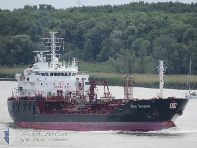
STOLT SEAGULL
Oil/Chemical Tanker
Current Trip
| Time Travelled | 12 h, 40 mins |
|---|---|
| Remaining Time | 32 mins |
| Distance Travelled | 157.40 nm |
| Remaining Distance | 6.48 nm |
| AVG Speed | 12.3 Knots |
| MAX Speed | 14 Knots |
| AVG Wind | 13.9 knots |
| MAX Wind | 20 knots |
| MIN Temp | 4.8°C / 40.64°F |
| MAX Temp | 8.2°C / 46.76°F |
| Draught | 6.6 m |
| Position Received | Now |
Current Position
| Longitude | 12.85308° |
|---|---|
| Latitude | 55.59271° |
| Status | Under way using engine |
| Speed | 11.2 Knots |
| Course | 40.7° |
| Area | Kattegat |
| Station | T-AIS |
| Position Received | Now |
Info
Information
The current position of STOLT SEAGULL is in Kattegat with coordinates 55.59271° / 12.85308° as reported on 2024-04-19 04:44 by AIS to our vessel tracker app. The vessel's current speed is 11.2 Knots and is heading at the port of MALMO. The estimated time of arrival as calculated by MyShipTracking vessel tracking app is 2024-04-19 05:17 LT
The vessel STOLT SEAGULL (IMO: 9125645, MMSI: 235112571) is a Oil/Chemical Tanker that was built in 1997 ( 27 years old ). It's sailing under the flag of [GB] United Kingdom.
In this page you can find informations about the vessels current position, last detected port calls, and current voyage information. If the vessels is not in coverage by AIS you will find the latest position.
The current position of STOLT SEAGULL is detected by our AIS receivers and we are not responsible for the reliability of the data. The last position was recorded while the vessel was in Coverage by the Ais receivers of our vessel tracking app.
The current draught of STOLT SEAGULL as reported by AIS is 6.6 meters
Weather
| Temperature | 4.9°C / 40.82°F |
|---|---|
| Wind Speed | 5 knots |
| Direction | 112° ESE |
| Pressure | 1005.5 hPa |
| Humidity | 81.9 % |
| Cloud Coverage | 100 % |
Featured Company
Last Port Calls
| Port | Arrival | Departure | Time In Port |
|---|---|---|---|
| 2024-04-18 16:01 | 2024-04-18 16:05 | 3 m | |
| 2024-04-14 12:05 | 2024-04-17 03:34 | 2 d | |
| 2024-04-13 19:30 | 2024-04-14 10:02 | 14 h | |
| 2024-04-11 18:49 | 2024-04-11 19:29 | 40 m | |
| 2024-04-10 07:11 | 2024-04-10 08:33 | 1 h | |
| 2024-04-08 05:27 | 2024-04-10 01:17 | 1 d | |
| 2024-04-07 23:00 | 2024-04-07 23:32 | 31 m | |
| 2024-04-06 05:58 | 2024-04-06 15:29 | 9 h | |
| 2024-04-03 22:29 | 2024-04-05 06:17 | 1 d | |
| 2024-04-02 02:15 | 2024-04-02 21:48 | 19 h |
Most Visited Ports (Last year)
| Port | Arrivals | |
|---|---|---|
| 17 | ||
| 14 | ||
| 11 | ||
| 9 | ||
| 9 | ||
| 7 |
Last Trips
| Origin | Departure | Destination | Arrival | Distance | |
|---|---|---|---|---|---|
| 2024-04-17 05:34 | 2024-04-18 18:01 | 391.38 nm | |||
| 2024-04-14 12:02 | 2024-04-14 14:05 | 25.44 nm | |||
| 2024-04-11 21:29 | 2024-04-13 21:30 | 378.55 nm | |||
| 2024-04-10 10:33 | 2024-04-11 20:49 | 459.65 nm | |||
| 2024-04-10 03:17 | 2024-04-10 09:11 | 65.61 nm | |||
| 2024-04-08 01:32 | 2024-04-08 07:27 | 65.59 nm | |||
| 2024-04-06 17:29 | 2024-04-08 01:00 | 399.42 nm | |||
| 2024-04-05 08:17 | 2024-04-06 07:58 | 234.24 nm | |||
| 2024-04-02 23:48 | 2024-04-04 00:29 | 317.40 nm | |||
| 2024-04-02 01:52 | 2024-04-02 04:15 | 29.56 nm |
Events
| Time | Event | Details | Position / Dest | Info |
|---|---|---|---|---|
| 2024-04-19 03:04 | Change Sea Area | Swedish part of the Kattegat Swedish part of the Baltic Sea |
55.33500 / 12.66617
Kattegat
BEANR>SEMMA
|
Speed: 13.5 kn Course: 357.4° |
| 2024-04-19 02:46 | Change Sea Area | Swedish part of the Baltic Sea Danish part of the Baltic Sea |
55.26743 / 12.66641
Baltic Sea
BEANR>SEMMA
|
Speed: 13.6 kn Course: 359.2° |
| 2024-04-19 00:31 | Change Sea Area | Danish part of the Baltic Sea German part of the Baltic Sea |
54.76733 / 12.74533
Baltic Sea
BEANR>SEMMA
|
Speed: 12.8 kn Course: 23.9° |
| 2024-04-18 23:14 | Change Sea Area | German part of the Baltic Sea Danish part of the Baltic Sea |
54.60726 / 12.35025
Baltic Sea
BEANR>SEMMA
|
Speed: 13.1 kn Course: 56.5° |
| 2024-04-18 22:56 | Change Sea Area | Danish part of the Baltic Sea German part of the Baltic Sea |
54.55769 / 12.28645
Baltic Sea
BEANR>SEMMA
|
Speed: 12.7 kn Course: 18.4° |
| 2024-04-18 21:59 | Change Sea Area | German part of the Baltic Sea Danish part of the Baltic Sea |
54.40886 / 12.10424
Baltic Sea
BEANR>SEMMA
|
Speed: 12.9 kn Course: 89.3° |
| 2024-04-18 20:08 | Change Sea Area | Danish part of the Baltic Sea German part of the Baltic Sea |
54.48956 / 11.46154
Baltic Sea
BEANR>SEMMA
|
Speed: 12.8 kn Course: 113° |
| 2024-04-18 18:13 | Change Sea Area | German part of the Baltic Sea Danish part of the Baltic Sea |
54.56156 / 10.76786
Baltic Sea
BEANR>SEMMA
|
Speed: 13.8 kn Course: 85.1° |
| 2024-04-18 17:53 | Change Sea Area | Danish part of the Baltic Sea German part of the Baltic Sea |
54.55450 / 10.63450
Baltic Sea
BEANR>SEMMA
|
Speed: 13.9 kn Course: 72.4° |
| 2024-04-18 17:11 | ETA Changed | 2024/04/19 04:00 2024/04/19 03:00 |
54.50677 / 10.38239
BEANR>SEMMA
|
Speed: 12.1 kn Course: 65.4° |