
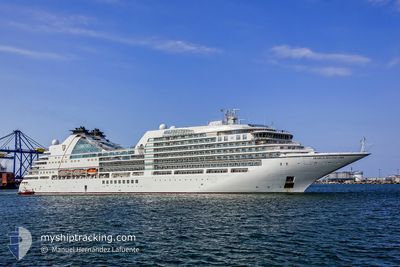
SEABOURN ENCORE
Passenger
Current Trip
| Time Travelled | 2 days |
|---|---|
| Remaining Time | 14 h, 4 mins |
| Distance Travelled | 328.12 nm |
| Remaining Distance | 110.25 nm |
| AVG Speed | 7.9 Knots |
| MAX Speed | 15 Knots |
| AVG Wind | 13.4 knots |
| MAX Wind | 38.9 knots |
| MIN Temp | 13.7°C / 56.66°F |
| MAX Temp | 20.4°C / 68.72°F |
| Draught | 6.8 m |
| Position Received | 1 m ago |
Current Position
| Longitude | 20.14471° |
|---|---|
| Latitude | 38.09273° |
| Status | Under way using engine |
| Speed | 6.2 Knots |
| Course | 359.1° |
| Area | Ionian Sea |
| Station | T-AIS |
| Position Received | 1 m ago |
Info
Information
The current position of SEABOURN ENCORE is in Ionian Sea with coordinates 38.09273° / 20.14471° as reported on 2024-04-23 16:52 by AIS to our vessel tracker app. The vessel's current speed is 6.2 Knots and is heading at the port of KERKYRA. The estimated time of arrival as calculated by MyShipTracking vessel tracking app is 2024-04-24 06:57 LT
The vessel SEABOURN ENCORE (IMO: 9731171, MMSI: 311000464) is a Passenger It's sailing under the flag of [BS] Bahamas.
In this page you can find informations about the vessels current position, last detected port calls, and current voyage information. If the vessels is not in coverage by AIS you will find the latest position.
The current position of SEABOURN ENCORE is detected by our AIS receivers and we are not responsible for the reliability of the data. The last position was recorded while the vessel was in Coverage by the Ais receivers of our vessel tracking app.
The current draught of SEABOURN ENCORE as reported by AIS is 6.8 meters
Weather
| Temperature | 18.2°C / 64.76°F |
|---|---|
| Wind Speed | 4 knots |
| Direction | 281° W |
| Pressure | 1002.8 hPa |
| Humidity | 87.6 % |
| Cloud Coverage | 23 % |
Featured Company
Last Port Calls
| Port | Arrival | Departure | Time In Port |
|---|---|---|---|
| 2024-04-20 01:46 | 2024-04-21 14:26 | 1 d | |
| 2024-04-13 05:01 | 2024-04-13 17:42 | 12 h | |
| 2024-04-02 05:28 | 2024-04-02 16:44 | 11 h | |
| 2024-03-25 04:22 | 2024-03-25 13:58 | 9 h | |
| 2024-03-15 21:28 | 2024-03-16 10:35 | 13 h | |
| 2024-03-12 22:39 | 2024-03-13 11:46 | 13 h | |
| 2024-03-10 23:20 | 2024-03-11 12:57 | 13 h | |
| 2024-03-01 21:16 | 2024-03-02 13:24 | 16 h | |
| 2024-02-27 00:07 | 2024-02-27 11:36 | 11 h | |
| 2024-02-19 22:47 | 2024-02-20 11:47 | 12 h |
Last Trips
| Origin | Departure | Destination | Arrival | Distance | |
|---|---|---|---|---|---|
| 2024-04-13 18:42 | 2024-04-20 04:46 | 2239.17 nm | |||
| 2024-04-02 18:44 | 2024-04-13 06:01 | 3826.28 nm | |||
| 2024-03-25 17:58 | 2024-04-02 07:28 | 3040.00 nm | |||
| 2024-03-16 18:35 | 2024-03-25 08:22 | 3337.09 nm | |||
| 2024-03-13 18:46 | 2024-03-16 05:28 | 815.46 nm | |||
| 2024-03-11 19:57 | 2024-03-13 05:39 | 282.80 nm | |||
| 2024-03-02 21:24 | 2024-03-11 06:20 | 1716.94 nm | |||
| 2024-02-27 18:36 | 2024-03-02 05:16 | 777.40 nm | |||
| 2024-02-20 18:47 | 2024-02-27 07:07 | 1142.87 nm | |||
| 2024-02-17 23:05 | 2024-02-20 05:47 | 815.79 nm |
Events
| Time | Event | Details | Position / Dest | Info |
|---|---|---|---|---|
| 2024-04-23 14:48 | Status Changed | Under way using engine Default |
37.86081 / 20.18338
GR CFU
|
Speed: 8 kn Course: 329° |
| 2024-04-23 14:42 | Status Changed | Default Under way using engine |
37.84954 / 20.19155
GR CFU
|
Speed: 7.9 kn Course: 329.6° |
| 2024-04-23 12:30 | ETA Changed | 2024/04/22 04:00 2024/04/24 04:00 |
37.59400 / 20.37809
GR CFU
|
Speed: 8.5 kn Course: 330.2° |
| 2024-04-23 11:37 | ETA Changed | 2024/04/24 04:00 2024/04/22 04:00 |
37.48730 / 20.45602
GR CFU
|
Speed: 8.1 kn Course: 329.5° |
| 2024-04-23 08:48 | ETA Changed | 2024/04/22 04:00 2024/04/24 04:00 |
37.14501 / 20.70431
GR CFU
|
Speed: 8.6 kn Course: 330.1° |
| 2024-04-23 08:31 | ETA Changed | 2024/04/24 04:00 2024/04/22 04:00 |
37.10967 / 20.73015
GR CFU
|
Speed: 8.9 kn Course: 330.1° |
| 2024-04-23 07:24 | ETA Changed | 2024/04/22 04:00 2024/04/24 04:00 |
36.96940 / 20.83818
GR CFU
|
Speed: 8.7 kn Course: 314.6° |
| 2024-04-23 07:00 | Status Changed | Under way using engine Default |
36.93002 / 20.88787
GR CFU
|
Speed: 8.7 kn Course: 315° |
| 2024-04-23 06:34 | Status Changed | Default Under way using engine |
36.88512 / 20.94445
GR CFU
|
Speed: 8.6 kn Course: 314.3° |
| 2024-04-23 06:29 | Change Sea Area | Greek part of the Ionian Sea Greek part of the Mediterranean Sea - Eastern Basin |
36.87728 / 20.95448
Ionian Sea
GR CFU
|
Speed: 8.6 kn Course: 314.3° |