
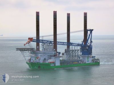
SEA CHALLENGER
Offshore Construction Jack Up
Current Trip
PORT OF SHEET CANADA
| Time Travelled | 17 days |
|---|---|
| Remaining Time | --- |
| Distance Travelled | 1903.98 nm |
| Remaining Distance | --- |
| AVG Speed | 7.9 Knots |
| MAX Speed | 11.9 Knots |
| AVG Wind | 17.7 knots |
| MAX Wind | 35.4 knots |
| MIN Temp | 8.8°C / 47.84°F |
| MAX Temp | 18.6°C / 65.48°F |
| Draught | 6.5 m |
| Position Received | 1 d ago |
Current Position
| Longitude | -30.20494° |
|---|---|
| Latitude | 38.50569° |
| Status | Under way using engine |
| Speed | 9.2 Knots |
| Course | 287.3° |
| Area | North Atlantic Ocean |
| Station | T-AIS |
| Position Received | 1 d ago |
Info
Information
The current position of SEA CHALLENGER is in North Atlantic Ocean with coordinates 38.50569° / -30.20494° as reported on 2024-04-18 08:28 by AIS to our vessel tracker app. The vessel's current speed is 9.2 Knots
The vessel SEA CHALLENGER (IMO: 9658290, MMSI: 219019002) is a Offshore Construction Jack Up that was built in 2014 ( 10 years old ). It's sailing under the flag of [DK] Denmark.
In this page you can find informations about the vessels current position, last detected port calls, and current voyage information. If the vessels is not in coverage by AIS you will find the latest position.
The current position of SEA CHALLENGER is detected by our AIS receivers and we are not responsible for the reliability of the data. The last position was recorded while the vessel was in Coverage by the Ais receivers of our vessel tracking app.
The current draught of SEA CHALLENGER as reported by AIS is 6.5 meters
Weather
| Temperature | 15.8°C / 60.44°F |
|---|---|
| Wind Speed | 10 knots |
| Direction | 264° W |
| Pressure | 1007.1 hPa |
| Humidity | 92.5 % |
| Cloud Coverage | 5 % |
Featured Company
Last Port Calls
| Port | Arrival | Departure | Time In Port |
|---|---|---|---|
| 2024-03-10 08:33 | 2024-04-02 19:35 | 23 d | |
| 2024-03-03 02:50 | 2024-03-09 09:18 | 6 d | |
| 2024-02-19 18:14 | 2024-02-23 20:33 | 4 d | |
| 2024-02-09 07:29 | 2024-02-12 11:51 | 3 d | |
| 2024-02-07 15:38 |
Most Visited Ports (Last year)
| Port | Arrivals | |
|---|---|---|
| 10 | ||
| 3 | ||
| 2 |
Last Trips
| Origin | Departure | Destination | Arrival | Distance | |
|---|---|---|---|---|---|
| 2024-03-09 10:18 | 2024-03-10 09:33 | 208.06 nm | |||
| 2024-02-23 21:33 | 2024-03-03 03:50 | 68.34 nm | |||
| 2024-02-12 12:51 | 2024-02-19 19:14 | 71.31 nm | |||
| 2024-02-07 16:38 | 2024-02-09 08:29 | 262.10 nm |
Events
| Time | Event | Details | Position / Dest | Info |
|---|---|---|---|---|
| 2024-04-18 08:28 | OUT of Coverage |
38.50569 / -30.20494
North Atlantic Ocean
PORT OF SHEET CANADA
|
Speed: 9.2 kn Course: 287.3° |
|
| 2024-04-17 18:57 | Destination Changed | PORT OF SHEET CANADA SALEM US |
37.96089 / -27.30234
PORT OF SHEET CANADA
|
Speed: 10.7 kn Course: 282.7° |
| 2024-04-17 18:57 | ETA Changed | 2024/04/25 06:00 2024/04/26 23:00 |
37.96089 / -27.30234
PORT OF SHEET CANADA
|
Speed: 10.7 kn Course: 282.7° |
| 2024-04-17 17:22 | IN Coverage |
37.89844 / -26.94881
North Atlantic Ocean
SALEM US
|
Speed: 10.9 kn Course: 282.3° |
|
| 2024-04-17 13:35 | OUT of Coverage |
37.75458 / -26.11491
North Atlantic Ocean
SALEM US
|
Speed: 10.5 kn Course: 274.7° |
|
| 2024-04-17 11:24 | START Moving |
37.73768 / -25.65366
SALEM US
|
Speed: 6.8 kn Course: 98.6° |
|
| 2024-04-17 09:27 | Status Changed | Under way using engine Moored |
37.73613 / -25.65934
SALEM US
|
Speed: Course: 248° |
| 2024-04-17 08:11 | Draught Changed | 6.5 6.7 |
37.73617 / -25.65931
SALEM US
|
Speed: Course: 248° |
| 2024-04-16 08:21 | Destination Changed | SALEM US PONTA DELGADA |
37.73616 / -25.65931
SALEM US
|
Speed: Course: 248° |
| 2024-04-16 08:21 | ETA Changed | 2024/04/26 23:00 2024/04/15 16:00 |
37.73616 / -25.65931
SALEM US
|
Speed: Course: 248° |