
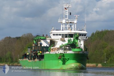
REYNAERT
Trailing Suction Hopper Dredger
Current Trip
| Time Travelled | 11 days |
|---|---|
| Remaining Time | --- |
| Distance Travelled | 957.83 nm |
| Remaining Distance | --- |
| AVG Speed | 8.9 Knots |
| MAX Speed | 13.9 Knots |
| AVG Wind | 12.9 knots |
| MAX Wind | 27.9 knots |
| MIN Temp | -0.7°C / 30.74°F |
| MAX Temp | 19.3°C / 66.74°F |
| Draught | 4.5 m |
| Position Received | 8 d ago |
Current Position
| Longitude | 16.72848° |
|---|---|
| Latitude | 55.78113° |
| Status | Under way using engine |
| Speed | 11 Knots |
| Course | 70.9° |
| Area | Baltic Sea |
| Station | T-AIS |
| Position Received | 8 d ago |
Info
Information
The current position of REYNAERT is in Baltic Sea with coordinates 55.78113° / 16.72848° as reported on 2024-04-16 14:19 by AIS to our vessel tracker app. The vessel's current speed is 11 Knots
The vessel REYNAERT (IMO: 9360726, MMSI: 245043000) is a Trailing Suction Hopper Dredger that was built in 2007 ( 17 years old ). It's sailing under the flag of [NL] Netherlands.
In this page you can find informations about the vessels current position, last detected port calls, and current voyage information. If the vessels is not in coverage by AIS you will find the latest position.
The current position of REYNAERT is detected by our AIS receivers and we are not responsible for the reliability of the data. The last position was recorded while the vessel was in Coverage by the Ais receivers of our vessel tracking app.
The current draught of REYNAERT as reported by AIS is 4.5 meters
Weather
| Temperature | 4.4°C / 39.92°F |
|---|---|
| Wind Speed | 6 knots |
| Direction | 31° NNE |
| Pressure | 999.9 hPa |
| Humidity | 96.1 % |
| Cloud Coverage | 100 % |
Featured Company
Most Visited Ports (Last year)
| Port | Arrivals | |
|---|---|---|
| 451 | ||
| 444 | ||
| 25 | ||
| 2 | ||
| 2 | ||
| 1 |
Events
| Time | Event | Details | Position / Dest | Info |
|---|---|---|---|---|
| 2024-04-18 04:21 | START Moving | 11.19 nm, North West of RIGA |
57.10377 / 23.90924
LV RIX
|
Speed: 6.8 kn Course: 83° |
| 2024-04-17 21:10 | STOP Moving | 11.51 nm, North West of RIGA |
57.10416 / 23.89265
LV RIX
|
Speed: 0.3 kn Course: 136° |
| 2024-04-16 14:23 | Status Changed | Default Under way using engine |
55.78484 / 16.75184
LV RIX
|
Speed: 11 kn Course: 70.9° |
| 2024-04-16 14:19 | Status Changed | Under way using engine Default |
55.78113 / 16.72848
LV RIX
|
Speed: 9.6 kn Course: 76° |
| 2024-04-16 14:19 | OUT of Coverage |
55.78113 / 16.72848
Baltic Sea
LV RIX
|
Speed: 11 kn Course: 70.9° |
|
| 2024-04-16 14:07 | Status Changed | Default Under way using engine |
55.77314 / 16.67306
LV RIX
|
Speed: 9.6 kn Course: 74.5° |
| 2024-04-16 12:00 | Status Changed | Under way using engine Default |
55.66382 / 16.08222
LV RIX
|
Speed: 8.8 kn Course: 75° |
| 2024-04-16 11:55 | Status Changed | Default Under way using engine |
55.66649 / 16.09808
LV RIX
|
Speed: 8.9 kn Course: 75.4° |
| 2024-04-16 09:29 | Detected in Sea | Swedish part of the Baltic Sea |
55.59759 / 15.47033
Baltic Sea
LV RIX
|
Speed: 9.2 kn Course: 68.4° |
| 2024-04-16 03:05 | Change Sea Area | Danish part of the Kattegat Swedish part of the Baltic Sea |
54.99662 / 14.04523
Kattegat
LV RIX
|
Speed: 10.9 kn Course: 66.9° |