
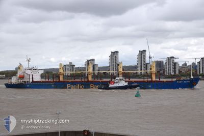
PORT ALICE
Bulk Carrier
Current Trip
| Time Travelled | 2 days |
|---|---|
| Remaining Time | --- |
| Distance Travelled | 303.75 nm |
| Remaining Distance | --- |
| AVG Speed | 10.6 Knots |
| MAX Speed | 16.3 Knots |
| AVG Wind | 7.7 knots |
| MAX Wind | 15 knots |
| MIN Temp | 1.9°C / 35.42°F |
| MAX Temp | 9.4°C / 48.92°F |
| Draught | 5.7 m |
| Position Received | 2 m ago |
Current Position
| Longitude | 1.01267° |
|---|---|
| Latitude | 49.39934° |
| Status | Moored |
| Speed | 0.1 Knots |
| Course | 187° |
| Area | English Channel |
| Station | T-AIS |
| Position Received | 2 m ago |
Info
Information
The current position of PORT ALICE is in English Channel with coordinates 49.39934° / 1.01267° as reported on 2024-04-25 04:34 by AIS to our vessel tracker app. The vessel's current speed is 0.1 Knots
The vessel PORT ALICE (IMO: 9311402, MMSI: 477351600) is a Bulk Carrier that was built in 2005 ( 19 years old ). It's sailing under the flag of [HK] Hong Kong.
In this page you can find informations about the vessels current position, last detected port calls, and current voyage information. If the vessels is not in coverage by AIS you will find the latest position.
The current position of PORT ALICE is detected by our AIS receivers and we are not responsible for the reliability of the data. The last position was recorded while the vessel was in Coverage by the Ais receivers of our vessel tracking app.
The current draught of PORT ALICE as reported by AIS is 5.7 meters
Weather
| Temperature | 0.9°C / 33.62°F |
|---|---|
| Wind Speed | 3 knots |
| Direction | 191° S |
| Pressure | 1010.6 hPa |
| Humidity | 91 % |
| Cloud Coverage | 87 % |
Featured Company
Last Port Calls
| Port | Arrival | Departure | Time In Port |
|---|---|---|---|
| 2024-04-09 13:48 | 2024-04-22 11:33 | 12 d | |
| 2024-03-10 14:38 | |||
| 2024-02-09 18:44 | 2024-03-02 13:59 | 21 d |
Most Visited Ports (Last year)
| Port | Arrivals | |
|---|---|---|
| 2 | ||
| 2 | ||
| 1 | ||
| 1 | ||
| 1 | ||
| 1 |
Last Trips
| Origin | Departure | Destination | Arrival | Distance | |
|---|---|---|---|---|---|
| 2024-03-10 16:38 | 2024-04-09 14:48 | 7649.35 nm | |||
| 2024-01-05 07:46 | 2024-02-09 21:44 | 5998.66 nm |
Events
| Time | Event | Details | Position / Dest | Info |
|---|---|---|---|---|
| 2024-04-24 12:16 | Status Changed | Moored Default |
49.39939 / 1.01265
GB LON>FR URO
|
Speed: Course: 187° |
| 2024-04-24 12:10 | Status Changed | Default Moored |
49.39938 / 1.01263
GB LON>FR URO
|
Speed: Course: 187° |
| 2024-04-24 11:16 | Status Changed | Moored Under way using engine |
49.39943 / 1.01268
GB LON>FR URO
|
Speed: 0.2 kn Course: 188° |
| 2024-04-24 11:06 | STOP Moving | 0.75 nm, North of VAL-DE-LA-HAYE |
49.39917 / 1.01229
GB LON>FR URO
|
Speed: 0.3 kn Course: 184° |
| 2024-04-24 10:29 | START Moving | 0.95 nm, West of ROUEN |
49.44021 / 1.04870
GB LON>FR URO
|
Speed: 3.6 kn Course: 246° |
| 2024-04-24 10:28 | Status Changed | Under way using engine Moored |
49.44073 / 1.05068
GB LON>FR URO
|
Speed: 0.3 kn Course: 253° |
| 2024-04-24 01:02 | Status Changed | Moored Under way using engine |
49.44049 / 1.05179
GB LON>FR URO
|
Speed: 0.1 kn Course: 253° |
| 2024-04-24 00:56 | STOP Moving | 0.85 nm, West of ROUEN |
49.44053 / 1.05144
GB LON>FR URO
|
Speed: 0.3 kn Course: 259° |
| 2024-04-23 17:40 | START Moving | 11.24 nm, West of LE HAVRE |
49.48024 / -.16541
GB LON>FR URO
|
Speed: 3.1 kn Course: 325° |
| 2024-04-23 17:35 | Status Changed | Under way using engine At anchor |
49.47922 / -.16187
GB LON>FR URO
|
Speed: 0.8 kn Course: 320° |