
ACAIA
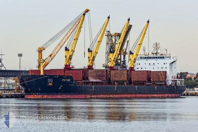
Bulk Carrier
Current Trip
QUANG NINH
| Time Travelled | 8 h, 36 mins |
|---|---|
| Remaining Time | --- |
| Distance Travelled | 9.17 nm |
| Remaining Distance | --- |
| AVG Speed | 9 Knots |
| MAX Speed | 9.7 Knots |
| AVG Wind | 2.3 knots |
| MAX Wind | 2.6 knots |
| MIN Temp | 27.5°C / 81.5°F |
| MAX Temp | 28°C / 82.4°F |
| Draught | 7.1 m |
| Position Received | 7 h, 28 m ago |
Current Position
| Longitude | -61.78749° |
|---|---|
| Latitude | 16.85400° |
| Status | Default |
| Speed | 9.9 Knots |
| Course | 192.8° |
| Area | Caribbean Sea |
| Station | T-AIS |
| Position Received | 7 h, 28 m ago |
Info
Information
The current position of ACAIA is in Caribbean Sea with coordinates 16.85400° / -61.78749° as reported on 2024-04-18 21:35 by AIS to our vessel tracker app. The vessel's current speed is 9.9 Knots
The vessel ACAIA (IMO: 9287962, MMSI: 256147000) is a Bulk Carrier that was built in 2005 ( 19 years old ). It's sailing under the flag of [MT] Malta.
In this page you can find informations about the vessels current position, last detected port calls, and current voyage information. If the vessels is not in coverage by AIS you will find the latest position.
The current position of ACAIA is detected by our AIS receivers and we are not responsible for the reliability of the data. The last position was recorded while the vessel was in Coverage by the Ais receivers of our vessel tracking app.
The current draught of ACAIA as reported by AIS is 7.1 meters
Weather
| Temperature | 27.5°C / 81.5°F |
|---|---|
| Wind Speed | --- |
| Direction | 295° WNW |
| Pressure | 1011.6 hPa |
| Humidity | 70.5 % |
| Cloud Coverage | 39 % |
Featured Company
Last Port Calls
Most Visited Ports (Last year)
| Port | Arrivals | |
|---|---|---|
| 8 | ||
| 7 | ||
| 3 | ||
| 2 | ||
| 1 | ||
| 1 |
Events
| Time | Event | Details | Position / Dest | Info |
|---|---|---|---|---|
| 2024-04-18 21:35 | OUT of Coverage |
16.85400 / -61.78749
Caribbean Sea
|
Speed: 9.9 kn Course: 192.8° |
|
| 2024-04-18 20:40 | Change Sea Area | Antigua and Barbuda part of the Caribbean Sea Sint-Eustasius part of the Caribbean Sea |
16.99293 / -61.78246
Caribbean Sea
|
Speed: 8.5 kn Course: 169.9° |
| 2024-04-18 20:28 | PORT DEPARTURE |
|
17.01220 / -61.77704
QUANG NINH
|
Speed: 4.7 kn Course: 259.2° |
| 2024-04-18 20:26 | START Moving |
17.01276 / -61.77434
[AG] ANTIGUA
|
Speed: 4.9 kn Course: 256.9° |
|
| 2024-04-18 14:23 | IN Coverage |
17.01302 / -61.76989
Caribbean Sea
[AG] ANTIGUA
|
Speed: 0.1 kn Course: 11° |
|
| 2024-04-14 17:19 | OUT of Coverage |
17.01301 / -61.76991
Caribbean Sea
[AG] ANTIGUA
|
Speed: 0.1 kn Course: 511° |
|
| 2024-04-14 16:35 | IN Coverage |
17.01299 / -61.76990
Caribbean Sea
[AG] ANTIGUA
|
Speed: Course: 511° |
|
| 2024-04-14 00:40 | OUT of Coverage |
17.63041 / -63.01771
Caribbean Sea
|
Speed: 7 kn Course: 135.6° |
|
| 2024-04-14 00:22 | Change Sea Area | Sint-Eustasius part of the Caribbean Sea Saba part of the Caribbean Sea |
17.65776 / -63.04783
Caribbean Sea
|
Speed: 7.8 kn Course: 123.4° |
| 2024-04-13 21:51 | Detected in Sea | Saba part of the Caribbean Sea |
17.82247 / -63.37329
Caribbean Sea
|
Speed: 9.4 kn Course: 112.8° |