
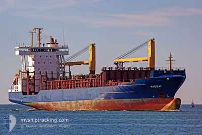
FANTA
Oil Products Tanker
Current Trip
HIGH SEAS
| Time Travelled | 5 days |
|---|---|
| Remaining Time | --- |
| Distance Travelled | 9.25 nm |
| Remaining Distance | --- |
| AVG Speed | 4.6 Knots |
| MAX Speed | 5.6 Knots |
| AVG Wind | 18.1 knots |
| MAX Wind | 24.4 knots |
| MIN Temp | 26.1°C / 78.98°F |
| MAX Temp | 31.7°C / 89.06°F |
| Draught | 7.5 m |
| Position Received | 2024-02-01 19:45 |
Current Position
| Longitude | -62.05887° |
|---|---|
| Latitude | 15.71503° |
| Status | Under way using engine |
| Speed | 1 Knots |
| Course | 340° |
| Area | Caribbean Sea |
| Station | T-AIS |
| Position Received | 2024-02-01 19:45 |
Info
Information
The current position of FANTA is in Caribbean Sea with coordinates 15.71503° / -62.05887° as reported on 2024-02-01 19:45 by AIS to our vessel tracker app. The vessel's current speed is 1 Knots
The vessel FANTA (IMO: 9299147, MMSI: 305965000) is a Oil Products Tanker that was built in 2006 ( 18 years old ). It's sailing under the flag of [AG] Antigua Barbuda.
In this page you can find informations about the vessels current position, last detected port calls, and current voyage information. If the vessels is not in coverage by AIS you will find the latest position.
The current position of FANTA is detected by our AIS receivers and we are not responsible for the reliability of the data. The last position was recorded while the vessel was in Coverage by the Ais receivers of our vessel tracking app.
The current draught of FANTA as reported by AIS is 7.5 meters
Weather
| Temperature | 26.7°C / 80.06°F |
|---|---|
| Wind Speed | 21 knots |
| Direction | 91° E |
| Pressure | 1009.3 hPa |
| Humidity | 83.5 % |
| Cloud Coverage | 100 % |
Featured Company
Last Port Calls
| Port | Arrival | Departure | Time In Port |
|---|---|---|---|
| 2024-04-17 09:59 | 2024-04-20 01:17 | 2 d | |
| 2024-04-10 21:44 | 2024-04-15 14:26 | 4 d | |
| 2024-04-07 01:32 | 2024-04-09 16:02 | 2 d | |
| 2024-04-01 15:04 | 2024-04-04 14:46 | 2 d | |
| 2024-03-25 23:42 | 2024-03-28 15:12 | 2 d | |
| 2024-03-20 16:08 | 2024-03-22 17:28 | 2 d | |
| 2024-03-11 13:33 | 2024-03-14 06:46 | 2 d |
Most Visited Ports (Last year)
| Port | Arrivals | |
|---|---|---|
| 3 | ||
| 2 | ||
| 1 | ||
| 1 |
Last Trips
| Origin | Departure | Destination | Arrival | Distance | |
|---|---|---|---|---|---|
| 2024-04-15 10:26 | 2024-04-17 05:59 | 149.83 nm | |||
| 2024-04-09 12:02 | 2024-04-10 17:44 | 144.96 nm | |||
| 2024-04-04 10:46 | 2024-04-06 21:32 | 127.63 nm | |||
| 2024-03-28 11:12 | 2024-04-01 11:04 | 130.82 nm | |||
| 2024-03-22 13:28 | 2024-03-25 19:42 | 151.21 nm | |||
| 2024-03-14 02:46 | 2024-03-20 12:08 | 166.34 nm |
Events
| Time | Event | Details | Position / Dest | Info |
|---|---|---|---|---|
| 2024-04-20 02:54 | STOP Moving | 2.4 nm, West of AMUAY |
11.75581 / -70.27165
HIGH SEAS
|
Speed: 0.1 kn Course: 74° |
| 2024-04-20 01:17 | PORT DEPARTURE |
|
11.74167 / -70.23500
HIGH SEAS
|
Speed: 7.2 kn Course: 248° |
| 2024-04-20 01:09 | START Moving |
11.74762 / -70.22190
[VE] AMUAY
|
Speed: 5.2 kn Course: 248° |
|
| 2024-04-17 10:21 | STOP Moving |
11.74833 / -70.21667
[VE] AMUAY
|
Speed: Course: -1° |
|
| 2024-04-17 09:59 | PORT ARRIVAL |
|
11.74562 / -70.22697
[VE] AMUAY
|
Speed: 6 kn Course: 74° |
| 2024-04-17 09:42 | START Moving | 1.19 nm, West of AMUAY |
11.74096 / -70.25158
HIGH SEAS
|
Speed: 4 kn Course: 99° |
| 2024-04-17 00:53 | STOP Moving | 1.32 nm, West of AMUAY |
11.74341 / -70.25433
HIGH SEAS
|
Speed: 0.1 kn Course: 64° |
| 2024-04-16 12:12 | START Moving | 1.47 nm, South East of MARACAIBO |
10.61167 / -71.58833
HIGH SEAS
|
Speed: 5 kn Course: 356° |
| 2024-04-15 16:45 | STOP Moving | 1.81 nm, South East of MARACAIBO |
10.60833 / -71.58334
HIGH SEAS
|
Speed: Course: -1° |
| 2024-04-15 14:27 | START Moving | 1.62 nm, West of CABIMAS |
10.35500 / -71.48167
HIGH SEAS
|
Speed: 7 kn Course: -1° |