
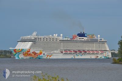
NORWEGIAN GETAWAY
Passengers Ship
Current Trip
| Time Travelled | 12 h, 27 mins |
|---|---|
| Remaining Time | --- |
| Distance Travelled | 100.84 nm |
| Remaining Distance | --- |
| AVG Speed | 8.4 Knots |
| MAX Speed | 11.4 Knots |
| AVG Wind | 12 knots |
| MAX Wind | 13 knots |
| MIN Temp | 26.3°C / 79.34°F |
| MAX Temp | 27.5°C / 81.5°F |
| Draught | 8.5 m |
| Position Received | 33 m ago |
Current Position
| Longitude | -65.93945° |
|---|---|
| Latitude | 18.70816° |
| Status | Under way using engine |
| Speed | 8.1 Knots |
| Course | 265.7° |
| Area | North Atlantic Ocean |
| Station | T-AIS |
| Position Received | 33 m ago |
Info
Information
The current position of NORWEGIAN GETAWAY is in North Atlantic Ocean with coordinates 18.70816° / -65.93945° as reported on 2024-04-25 07:49 by AIS to our vessel tracker app. The vessel's current speed is 8.1 Knots and is heading at the port of SAN JUAN. The estimated time of arrival as calculated by MyShipTracking vessel tracking app is 2024-04-25 10:00 LT
The vessel NORWEGIAN GETAWAY (IMO: 9606924, MMSI: 311050900) is a Passengers Ship that was built in 2014 ( 10 years old ). It's sailing under the flag of [BS] Bahamas.
In this page you can find informations about the vessels current position, last detected port calls, and current voyage information. If the vessels is not in coverage by AIS you will find the latest position.
The current position of NORWEGIAN GETAWAY is detected by our AIS receivers and we are not responsible for the reliability of the data. The last position was recorded while the vessel was in Coverage by the Ais receivers of our vessel tracking app.
The current draught of NORWEGIAN GETAWAY as reported by AIS is 8.5 meters
Weather
| Temperature | 26.5°C / 79.7°F |
|---|---|
| Wind Speed | 12 knots |
| Direction | 109° ESE |
| Pressure | 1013.9 hPa |
| Humidity | 80.1 % |
| Cloud Coverage | 53 % |
Featured Company
Last Port Calls
| Port | Arrival | Departure | Time In Port |
|---|---|---|---|
| 2024-04-24 10:34 | 2024-04-24 19:56 | 9 h | |
| 2024-04-23 16:04 | 2024-04-23 23:47 | 7 h | |
| 2024-04-19 07:09 | 2024-04-19 20:54 | 13 h | |
| 2024-04-15 10:15 | 2024-04-16 01:16 | 15 h | |
| 2024-04-14 10:09 | 2024-04-14 21:02 | 10 h | |
| 2024-04-13 11:08 | 2024-04-13 21:12 | 10 h | |
| 2024-04-12 11:22 | 2024-04-12 20:54 | 9 h | |
| 2024-04-11 17:29 | 2024-04-11 23:47 | 6 h | |
| 2024-04-10 12:58 | 2024-04-10 21:16 | 8 h | |
| 2024-04-07 07:45 | 2024-04-07 20:54 | 13 h |
Most Visited Ports (Last year)
| Port | Arrivals | |
|---|---|---|
| 19 | ||
| 16 | ||
| 14 | ||
| 13 | ||
| 10 | ||
| 8 |
Last Trips
| Origin | Departure | Destination | Arrival | Distance | |
|---|---|---|---|---|---|
| 2024-04-23 19:47 | 2024-04-24 06:34 | 99.82 nm | |||
| 2024-04-19 16:54 | 2024-04-23 12:04 | 1586.48 nm | |||
| 2024-04-15 21:16 | 2024-04-19 03:09 | 1425.36 nm | |||
| 2024-04-14 17:02 | 2024-04-15 06:15 | 108.67 nm | |||
| 2024-04-13 17:12 | 2024-04-14 06:09 | 192.83 nm | |||
| 2024-04-12 16:54 | 2024-04-13 07:08 | 93.46 nm | |||
| 2024-04-11 19:47 | 2024-04-12 07:22 | 100.29 nm | |||
| 2024-04-10 17:16 | 2024-04-11 13:29 | 374.00 nm | |||
| 2024-04-07 16:54 | 2024-04-10 08:58 | 1275.68 nm | |||
| 2024-04-04 20:48 | 2024-04-07 03:45 | 1012.97 nm |
Events
| Time | Event | Details | Position / Dest | Info |
|---|---|---|---|---|
| 2024-04-25 08:07 | Status Changed | Default Under way using engine |
18.70563 / -65.98218
SAN JUAN, PR
|
Speed: 8.1 kn Course: 265.7° |
| 2024-04-25 07:47 | Status Changed | Under way using engine Default |
18.70836 / -65.93549
SAN JUAN, PR
|
Speed: 8.2 kn Course: 267° |
| 2024-04-25 07:34 | Status Changed | Default Under way using engine |
18.71019 / -65.90308
SAN JUAN, PR
|
Speed: 8.3 kn Course: 267.4° |
| 2024-04-25 07:19 | Status Changed | Under way using engine Default |
18.71232 / -65.86740
SAN JUAN, PR
|
Speed: 8.1 kn Course: 268° |
| 2024-04-25 07:15 | Status Changed | Default Under way using engine |
18.71282 / -65.85881
SAN JUAN, PR
|
Speed: 8.1 kn Course: 266.4° |
| 2024-04-25 05:41 | Detected in Sea | Puerto Rican part of the North Atlantic Ocean |
18.72562 / -65.63122
North Atlantic Ocean
SAN JUAN, PR
|
Speed: 8.7 kn Course: 269.3° |
| 2024-04-25 01:23 | Change Sea Area | Puerto Rican part of the Caribbean Sea British Virgin Islands part of the Caribbean Sea |
18.73848 / -65.00452
Caribbean Sea
SAN JUAN, PR
|
Speed: 8.2 kn Course: 269.3° |
| 2024-04-24 19:56 | START Moving | 0.22 nm, East of ROAD TOWN |
18.41951 / -64.60861
SAN JUAN, PR
|
Speed: 4.4 kn Course: 136° |
| 2024-04-24 19:56 | PORT DEPARTURE |
|
18.41951 / -64.60861
SAN JUAN, PR
|
Speed: 3.5 kn Course: 130° |
| 2024-04-24 19:51 | Status Changed | Under way using engine Default |
18.42111 / -64.61082
[VG] ROAD TOWN
|
Speed: Course: 126° |