
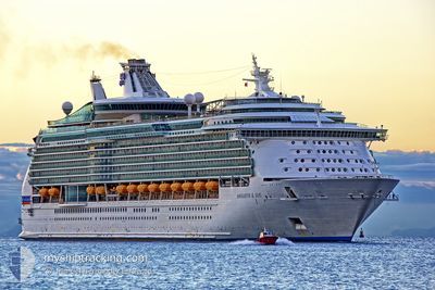
NAVIGATOR OF THE SEA
Passenger
Current Trip
| Time Travelled | 2 days |
|---|---|
| Remaining Time | 9 h, 26 mins |
| Distance Travelled | 918.44 nm |
| Remaining Distance | 201.78 nm |
| AVG Speed | 18 Knots |
| MAX Speed | 20.4 Knots |
| AVG Wind | 9.2 knots |
| MAX Wind | 16 knots |
| MIN Temp | 15.2°C / 59.36°F |
| MAX Temp | 27°C / 80.6°F |
| Draught | 9.1 m |
| Position Received | 9 h, 58 m ago |
Current Position
| Longitude | -115.90618° |
|---|---|
| Latitude | 28.32146° |
| Status | Under way using engine |
| Speed | 17.8 Knots |
| Course | 338.3° |
| Area | North Pacific Ocean |
| Station | T-AIS |
| Position Received | 9 h, 58 m ago |
Info
Information
The current position of NAVIGATOR OF THE SEA is in North Pacific Ocean with coordinates 28.32146° / -115.90618° as reported on 2024-04-18 16:44 by AIS to our vessel tracker app. The vessel's current speed is 17.8 Knots and is heading at the port of LOS ANGELES. The estimated time of arrival as calculated by MyShipTracking vessel tracking app is 2024-04-19 12:09 LT
The vessel NAVIGATOR OF THE SEA (IMO: 9227508, MMSI: 311478000) is a Passenger It's sailing under the flag of [BS] Bahamas.
In this page you can find informations about the vessels current position, last detected port calls, and current voyage information. If the vessels is not in coverage by AIS you will find the latest position.
The current position of NAVIGATOR OF THE SEA is detected by our AIS receivers and we are not responsible for the reliability of the data. The last position was recorded while the vessel was in Coverage by the Ais receivers of our vessel tracking app.
The current draught of NAVIGATOR OF THE SEA as reported by AIS is 9.1 meters
Weather
| Temperature | 15.9°C / 60.62°F |
|---|---|
| Wind Speed | 10 knots |
| Direction | 309° NW |
| Pressure | 1014.9 hPa |
| Humidity | 85.8 % |
| Cloud Coverage | 100 % |
Featured Company
Last Port Calls
| Port | Arrival | Departure | Time In Port |
|---|---|---|---|
| 2024-04-16 13:15 | 2024-04-17 00:11 | 10 h | |
| 2024-04-15 14:03 | 2024-04-16 00:57 | 10 h | |
| 2024-04-11 13:12 | 2024-04-12 23:40 | 1 d | |
| 2024-03-30 02:29 | 2024-03-30 11:20 | 8 h | |
| 2024-03-24 16:27 | 2024-03-24 21:59 | 5 h | |
| 2024-03-09 07:13 | 2024-03-24 13:51 | 15 d | |
| 2024-03-08 22:17 | 2024-03-09 03:35 | 5 h | |
| 2024-03-02 21:39 | 2024-03-03 09:10 | 11 h | |
| 2024-02-16 13:39 | 2024-02-17 05:48 | 16 h | |
| 2024-02-14 15:11 | 2024-02-15 02:21 | 11 h |
Most Visited Ports (Last year)
| Port | Arrivals | |
|---|---|---|
| 71 | ||
| 53 | ||
| 18 | ||
| 17 | ||
| 3 | ||
| 2 |
Last Trips
| Origin | Departure | Destination | Arrival | Distance | |
|---|---|---|---|---|---|
| 2024-04-15 18:57 | 2024-04-16 08:15 | 196.68 nm | |||
| 2024-04-12 16:40 | 2024-04-15 08:03 | 1015.33 nm | |||
| 2024-03-30 20:20 | 2024-04-11 06:12 | 5388.65 nm | |||
| 2024-03-25 05:59 | 2024-03-30 11:29 | 2544.06 nm | |||
| 2024-03-24 21:51 | 2024-03-25 00:27 | 24.17 nm | |||
| 2024-03-09 11:35 | 2024-03-09 15:13 | 22.97 nm | |||
| 2024-03-03 18:10 | 2024-03-09 06:17 | 2512.91 nm | |||
| 2024-02-16 21:48 | 2024-03-03 06:39 | 5874.31 nm | |||
| 2024-02-14 18:21 | 2024-02-16 05:39 | 227.62 nm | |||
| 2024-02-12 16:30 | 2024-02-14 07:11 | 287.34 nm |
Events
| Time | Event | Details | Position / Dest | Info |
|---|---|---|---|---|
| 2024-04-18 16:56 | Status Changed | Default Under way using engine |
28.37427 / -115.92896
US LAX
|
Speed: 17.8 kn Course: 338.3° |
| 2024-04-18 16:44 | OUT of Coverage |
28.32146 / -115.90618
North Pacific Ocean
US LAX
|
Speed: 17.8 kn Course: 338.3° |
|
| 2024-04-18 16:40 | Status Changed | Under way using engine Default |
28.30316 / -115.89812
US LAX
|
Speed: 18 kn Course: 336° |
| 2024-04-18 16:29 | IN Coverage |
28.30677 / -115.89971
North Pacific Ocean
US LAX
|
Speed: 17.7 kn Course: 338.8° |
|
| 2024-04-18 14:11 | Status Changed | Default Under way using engine |
27.65715 / -115.41223
US LAX
|
Speed: 18.9 kn Course: 322.7° |
| 2024-04-18 13:48 | OUT of Coverage |
27.56024 / -115.32798
North Pacific Ocean
US LAX
|
Speed: 18.9 kn Course: 322.7° |
|
| 2024-04-18 13:33 | Status Changed | Under way using engine Default |
27.49807 / -115.27269
US LAX
|
Speed: 19 kn Course: 318° |
| 2024-04-18 13:20 | Status Changed | Default Under way using engine |
27.44167 / -115.22334
US LAX
|
Speed: 19.4 kn Course: 322° |
| 2024-04-18 13:08 | Status Changed | Under way using engine Default |
27.39175 / -115.17655
US LAX
|
Speed: 19.2 kn Course: 321° |
| 2024-04-18 12:57 | IN Coverage |
27.39175 / -115.17655
North Pacific Ocean
US LAX
|
Speed: 19 kn Course: 321° |