
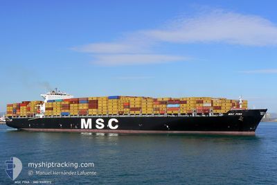
MSC PINA
Container Ship
Current Trip
| Time Travelled | 3 days |
|---|---|
| Remaining Time | 4 days |
| Distance Travelled | 1327.75 nm |
| Remaining Distance | 1684.06 nm |
| AVG Speed | 15.8 Knots |
| MAX Speed | 16.9 Knots |
| AVG Wind | 7.3 knots |
| MAX Wind | 14 knots |
| MIN Temp | 14.4°C / 57.92°F |
| MAX Temp | 19.3°C / 66.74°F |
| Draught | 14.2 m |
| Position Received | 2 d ago |
Current Position
| Longitude | -13.65923° |
|---|---|
| Latitude | 39.12834° |
| Status | Under way using engine |
| Speed | 16.5 Knots |
| Course | 290.4° |
| Area | North Atlantic Ocean |
| Station | T-AIS |
| Position Received | 2 d ago |
Info
Information
The current position of MSC PINA is in North Atlantic Ocean with coordinates 39.12834° / -13.65923° as reported on 2024-04-22 00:17 by AIS to our vessel tracker app. The vessel's current speed is 16.5 Knots and is heading at the port of NEW YORK. The estimated time of arrival as calculated by MyShipTracking vessel tracking app is 2024-04-29 06:31 LT
The vessel MSC PINA (IMO: 9339272, MMSI: 372973000) is a Container Ship that was built in 2007 ( 17 years old ). It's sailing under the flag of [PA] Panama.
In this page you can find informations about the vessels current position, last detected port calls, and current voyage information. If the vessels is not in coverage by AIS you will find the latest position.
The current position of MSC PINA is detected by our AIS receivers and we are not responsible for the reliability of the data. The last position was recorded while the vessel was in Coverage by the Ais receivers of our vessel tracking app.
The current draught of MSC PINA as reported by AIS is 14.2 meters
Weather
| Temperature | 16.5°C / 61.7°F |
|---|---|
| Wind Speed | 2 knots |
| Direction | 224° SW |
| Pressure | 1033.8 hPa |
| Humidity | 74.1 % |
| Cloud Coverage | 40 % |
Featured Company
Last Port Calls
| Port | Arrival | Departure | Time In Port |
|---|---|---|---|
| 2024-04-20 16:20 | 2024-04-21 09:18 | 16 h | |
| 2024-04-17 02:09 | 2024-04-17 23:19 | 21 h | |
| 2024-04-13 17:00 | 2024-04-15 15:36 | 1 d | |
| 2024-04-12 07:35 | 2024-04-13 00:16 | 16 h | |
| 2024-04-08 15:50 | 2024-04-09 22:33 | 1 d | |
| 2024-04-06 15:48 | 2024-04-08 06:27 | 1 d | |
| 2024-03-31 07:54 | 2024-04-02 15:00 | 2 d | |
| 2024-03-28 16:58 | 2024-03-29 20:22 | 1 d | |
| 2024-03-22 23:57 | 2024-03-23 16:50 | 16 h | |
| 2024-03-08 08:26 | 2024-03-10 07:04 | 1 d |
Most Visited Ports (Last year)
| Port | Arrivals | |
|---|---|---|
| 8 | ||
| 6 | ||
| 6 | ||
| 6 | ||
| 4 | ||
| 4 |
Last Trips
| Origin | Departure | Destination | Arrival | Distance | |
|---|---|---|---|---|---|
| 2024-04-18 01:19 | 2024-04-20 17:20 | 317.26 nm | |||
| 2024-04-15 17:36 | 2024-04-17 04:09 | 433.44 nm | |||
| 2024-04-13 02:16 | 2024-04-13 19:00 | 176.44 nm | |||
| 2024-04-10 00:33 | 2024-04-12 09:35 | 373.81 nm | |||
| 2024-04-08 08:27 | 2024-04-08 17:50 | 95.01 nm | |||
| 2024-04-02 17:00 | 2024-04-06 17:48 | 320.10 nm | |||
| 2024-03-29 21:22 | 2024-03-31 09:54 | 235.58 nm | |||
| 2024-03-23 17:50 | 2024-03-28 17:58 | 1117.11 nm | |||
| 2024-03-10 03:04 | 2024-03-23 00:57 | 4203.80 nm | |||
| 2024-03-03 15:57 | 2024-03-08 03:26 | 1060.80 nm |
Events
| Time | Event | Details | Position / Dest | Info |
|---|---|---|---|---|
| 2024-04-22 00:22 | Status Changed | Default Under way using engine |
39.13500 / -13.68167
USNYC
|
Speed: 16.5 kn Course: 290.4° |
| 2024-04-22 00:17 | OUT of Coverage |
39.12834 / -13.65923
North Atlantic Ocean
USNYC
|
Speed: 16.5 kn Course: 290.4° |
|
| 2024-04-21 23:53 | Status Changed | Under way using engine Default |
39.09134 / -13.52005
USNYC
|
Speed: 16 kn Course: 286° |
| 2024-04-21 23:19 | Status Changed | Default Under way using engine |
39.04500 / -13.32833
USNYC
|
Speed: 16.3 kn Course: 289.3° |
| 2024-04-21 22:25 | Status Changed | Under way using engine Default |
38.96077 / -13.03374
USNYC
|
Speed: 16 kn Course: 290° |
| 2024-04-21 22:22 | Status Changed | Default Under way using engine |
38.95334 / -13.01167
USNYC
|
Speed: 16.7 kn Course: 288.2° |
| 2024-04-21 20:07 | Status Changed | Under way using engine Default |
38.75845 / -12.26995
USNYC
|
Speed: 16.3 kn Course: 289° |
| 2024-04-21 20:01 | Status Changed | Default Under way using engine |
38.74934 / -12.23719
USNYC
|
Speed: 16.3 kn Course: 289.4° |
| 2024-04-21 09:18 | PORT DEPARTURE |
|
37.92282 / -8.83637
USNYC
|
Speed: 5.2 kn Course: 145° |
| 2024-04-21 09:13 | START Moving |
37.92773 / -8.84097
[PT] SINES
|
Speed: 3.1 kn Course: 142° |