
HERMANN SCHULTE
Cargo
Current Trip
| Time Travelled | 3 days |
|---|---|
| Remaining Time | --- |
| Distance Travelled | 1426.59 nm |
| Remaining Distance | --- |
| AVG Speed | 17 Knots |
| MAX Speed | 20 Knots |
| AVG Wind | 13.3 knots |
| MAX Wind | 30.2 knots |
| MIN Temp | 3.3°C / 37.94°F |
| MAX Temp | 10.5°C / 50.9°F |
| Draught | 12.1 m |
| Position Received | 2 d ago |
Current Position
| Longitude | -4.66071° |
|---|---|
| Latitude | 58.71406° |
| Status | Under way using engine |
| Speed | 18.7 Knots |
| Course | 269.9° |
| Area | North Atlantic Ocean |
| Station | T-AIS |
| Position Received | 2 d ago |
Info
Information
The current position of HERMANN SCHULTE is in North Atlantic Ocean with coordinates 58.71406° / -4.66071° as reported on 2024-04-22 23:13 by AIS to our vessel tracker app. The vessel's current speed is 18.7 Knots and is heading at the port of NEW YORK. The estimated time of arrival as calculated by MyShipTracking vessel tracking app is 2024-04-30 01:00 LT
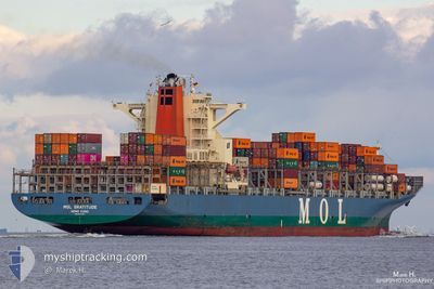
The vessel HERMANN SCHULTE (IMO: 9535187, MMSI: 477462400) is a Cargo It's sailing under the flag of [HK] Hong Kong.
In this page you can find informations about the vessels current position, last detected port calls, and current voyage information. If the vessels is not in coverage by AIS you will find the latest position.
The current position of HERMANN SCHULTE is detected by our AIS receivers and we are not responsible for the reliability of the data. The last position was recorded while the vessel was in Coverage by the Ais receivers of our vessel tracking app.
The current draught of HERMANN SCHULTE as reported by AIS is 12.1 meters
Weather
| Temperature | 7.2°C / 44.96°F |
|---|---|
| Wind Speed | 24 knots |
| Direction | 290° WNW |
| Pressure | 1029 hPa |
| Humidity | 71.5 % |
| Cloud Coverage | 100 % |
Featured Company
Last Port Calls
| Port | Arrival | Departure | Time In Port |
|---|---|---|---|
| 2024-04-20 11:14 | 2024-04-21 16:19 | 1 d | |
| 2024-04-18 22:38 | 2024-04-19 13:39 | 15 h | |
| 2024-04-17 03:48 | 2024-04-17 23:58 | 20 h | |
| 2024-04-05 18:29 | 2024-04-06 16:13 | 21 h | |
| 2024-04-01 12:31 | 2024-04-04 14:06 | 3 d | |
| 2024-03-27 01:55 | 2024-03-28 05:43 | 1 d | |
| 2024-03-23 16:20 | 2024-03-25 13:39 | 1 d | |
| 2024-03-19 19:25 | 2024-03-20 12:56 | 17 h | |
| 2024-03-13 19:47 | 2024-03-14 10:24 | 14 h | |
| 2024-03-10 20:11 | 2024-03-12 06:51 | 1 d |
Last Trips
| Origin | Departure | Destination | Arrival | Distance | |
|---|---|---|---|---|---|
| 2024-04-19 15:39 | 2024-04-20 13:14 | 291.95 nm | |||
| 2024-04-18 01:58 | 2024-04-19 00:38 | 120.13 nm | |||
| 2024-04-06 12:13 | 2024-04-17 05:48 | 3909.72 nm | |||
| 2024-04-04 10:06 | 2024-04-05 14:29 | 403.68 nm | |||
| 2024-03-28 00:43 | 2024-04-01 08:31 | 956.99 nm | |||
| 2024-03-25 08:39 | 2024-03-26 20:55 | 317.39 nm | |||
| 2024-03-20 06:56 | 2024-03-23 11:20 | 689.28 nm | |||
| 2024-03-14 06:24 | 2024-03-19 13:25 | 1691.53 nm | |||
| 2024-03-12 02:51 | 2024-03-13 15:47 | 633.70 nm | |||
| 2024-02-27 17:46 | 2024-03-10 16:11 | 4193.73 nm |
Events
| Time | Event | Details | Position / Dest | Info |
|---|---|---|---|---|
| 2024-04-22 23:17 | Status Changed | Default Under way using engine |
58.71402 / -4.69572
USNYC
|
Speed: 18.7 kn Course: 269.9° |
| 2024-04-22 23:13 | OUT of Coverage |
58.71406 / -4.66071
North Atlantic Ocean
USNYC
|
Speed: 18.7 kn Course: 269.9° |
|
| 2024-04-22 21:02 | Change Sea Area | United Kingdom part of the North Atlantic Ocean United Kingdom part of the North Sea |
58.73040 / -3.43061
North Atlantic Ocean
USNYC
|
Speed: 16.1 kn Course: 268.6° |
| 2024-04-22 18:27 | Status Changed | Under way using engine Default |
58.41984 / -2.46786
USNYC
|
Speed: 17.7 kn Course: 310° |
| 2024-04-22 18:22 | Status Changed | Default Under way using engine |
58.40497 / -2.43456
USNYC
|
Speed: 17.7 kn Course: 310.4° |
| 2024-04-22 18:22 | Status Changed | Under way using engine Default |
58.40364 / -2.43159
USNYC
|
Speed: 17.7 kn Course: 310° |
| 2024-04-22 18:14 | IN Coverage |
58.40364 / -2.43159
North Sea
USNYC
|
Speed: 17.7 kn Course: 310.4° |
|
| 2024-04-22 15:54 | Status Changed | Default Under way using engine |
57.91213 / -1.40595
USNYC
|
Speed: 18 kn Course: 311.5° |
| 2024-04-22 15:44 | OUT of Coverage |
57.87879 / -1.33537
North Sea
USNYC
|
Speed: 18 kn Course: 311.5° |
|
| 2024-04-22 14:29 | Status Changed | Under way using engine Default |
57.62253 / -.83126
USNYC
|
Speed: 17.6 kn Course: 314° |