
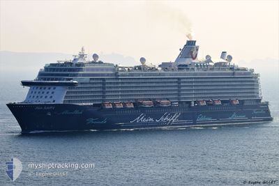
MEIN SCHIFF 6
Passenger
Current Trip
| Time Travelled | 1 day |
|---|---|
| Remaining Time | 59 mins |
| Distance Travelled | 354.52 nm |
| Remaining Distance | 17.31 nm |
| AVG Speed | 11.5 Knots |
| MAX Speed | 15 Knots |
| AVG Wind | 16 knots |
| MAX Wind | 30.5 knots |
| MIN Temp | 8°C / 46.4°F |
| MAX Temp | 13.7°C / 56.66°F |
| Draught | 8.2 m |
| Position Received | Now |
Current Position
| Longitude | 8.49190° |
|---|---|
| Latitude | 41.77130° |
| Status | Under way using engine |
| Speed | 14.8 Knots |
| Course | 59.7° |
| Area | Mediterranean Sea - Western Basin |
| Station | T-AIS |
| Position Received | Now |
Info
Information
The current position of MEIN SCHIFF 6 is in Mediterranean Sea - Western Basin with coordinates 41.77130° / 8.49190° as reported on 2024-04-25 04:08 by AIS to our vessel tracker app. The vessel's current speed is 14.8 Knots and is heading at the port of AJACCIO. The estimated time of arrival as calculated by MyShipTracking vessel tracking app is 2024-04-25 05:08 LT
The vessel MEIN SCHIFF 6 (IMO: 9753208, MMSI: 249660000) is a Passenger It's sailing under the flag of [MT] Malta.
In this page you can find informations about the vessels current position, last detected port calls, and current voyage information. If the vessels is not in coverage by AIS you will find the latest position.
The current position of MEIN SCHIFF 6 is detected by our AIS receivers and we are not responsible for the reliability of the data. The last position was recorded while the vessel was in Coverage by the Ais receivers of our vessel tracking app.
The current draught of MEIN SCHIFF 6 as reported by AIS is 8.2 meters
Weather
| Temperature | 12.5°C / 54.5°F |
|---|---|
| Wind Speed | 26 knots |
| Direction | 296° WNW |
| Pressure | 1007.5 hPa |
| Humidity | 61.1 % |
| Cloud Coverage | 15 % |
Featured Company
Last Port Calls
| Port | Arrival | Departure | Time In Port |
|---|---|---|---|
| 2024-04-23 01:12 | 2024-04-23 19:51 | 18 h | |
| 2024-04-21 06:10 | 2024-04-21 16:24 | 10 h | |
| 2024-04-20 04:20 | 2024-04-20 15:14 | 10 h | |
| 2024-04-18 05:23 | 2024-04-18 17:46 | 12 h | |
| 2024-04-17 03:45 | 2024-04-17 18:30 | 14 h | |
| 2024-04-16 05:25 | 2024-04-16 17:02 | 11 h | |
| 2024-04-14 01:18 | 2024-04-14 20:15 | 18 h | |
| 2024-04-12 05:10 | 2024-04-12 16:08 | 10 h | |
| 2024-04-10 06:31 | 2024-04-10 17:11 | 10 h | |
| 2024-04-03 10:07 | 2024-04-03 22:11 | 12 h |
Last Trips
| Origin | Departure | Destination | Arrival | Distance | |
|---|---|---|---|---|---|
| 2024-04-21 18:24 | 2024-04-23 03:12 | 550.20 nm | |||
| 2024-04-20 17:14 | 2024-04-21 08:10 | 266.59 nm | |||
| 2024-04-18 19:46 | 2024-04-20 06:20 | 318.39 nm | |||
| 2024-04-17 20:30 | 2024-04-18 07:23 | 189.30 nm | |||
| 2024-04-16 19:02 | 2024-04-17 05:45 | 182.84 nm | |||
| 2024-04-14 22:15 | 2024-04-16 07:25 | 359.69 nm | |||
| 2024-04-12 18:08 | 2024-04-14 03:18 | 464.03 nm | |||
| 2024-04-10 18:11 | 2024-04-12 07:10 | 620.46 nm | |||
| 2024-04-03 18:11 | 2024-04-10 07:31 | 2657.37 nm | |||
| 2024-04-02 18:11 | 2024-04-03 06:07 | 107.76 nm |
Events
| Time | Event | Details | Position / Dest | Info |
|---|---|---|---|---|
| 2024-04-25 04:03 | ETA Changed | 2024/04/25 05:10 2024/04/25 05:00 |
41.76167 / 8.46387
ES PMI > FR AJA
|
Speed: 15 kn Course: 68.3° |
| 2024-04-25 03:35 | Change Sea Area | French part of the Mediterranean Sea - Western Basin Spanish part of the Balearic Sea |
41.72275 / 8.34520
Mediterranean Sea - Western Basin
ES PMI > FR AJA
|
Speed: 11.8 kn Course: 68.7° |
| 2024-04-25 03:35 | Status Changed | Under way using engine Default |
41.72275 / 8.34520
ES PMI > FR AJA
|
Speed: 11 kn Course: 56° |
| 2024-04-25 03:35 | IN Coverage |
41.72275 / 8.34520
Mediterranean Sea - Western Basin
ES PMI > FR AJA
|
Speed: 11.8 kn Course: 68.7° |
|
| 2024-04-23 22:24 | Status Changed | Default Under way using engine |
39.05332 / 2.76132
ES PMI > FR AJA
|
Speed: 10.5 kn Course: 163° |
| 2024-04-23 22:18 | OUT of Coverage |
39.06917 / 2.75502
Balearic Sea
ES PMI > FR AJA
|
Speed: 10.5 kn Course: 163° |
|
| 2024-04-23 22:15 | Status Changed | Under way using engine Default |
39.07803 / 2.75150
ES PMI > FR AJA
|
Speed: 10.7 kn Course: 162° |
| 2024-04-23 22:12 | Status Changed | Default Under way using engine |
39.08608 / 2.74817
ES PMI > FR AJA
|
Speed: 10.7 kn Course: 162.3° |
| 2024-04-23 19:51 | PORT DEPARTURE |
|
39.55345 / 2.64307
ES PMI > FR AJA
|
Speed: 3.1 kn Course: 146° |
| 2024-04-23 19:37 | START Moving |
39.55098 / 2.62760
[ES] PALMA DE MALLORCA
|
Speed: 4 kn Course: 253° |