
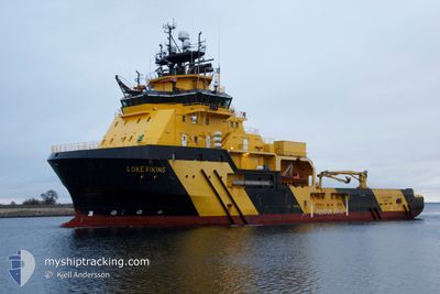
LOKE VIKING
Anchor Handling Vessel
Current Trip
| Time Travelled | 1 day |
|---|---|
| Remaining Time | --- |
| Distance Travelled | 431.08 nm |
| Remaining Distance | --- |
| AVG Speed | 11.3 Knots |
| MAX Speed | 13 Knots |
| AVG Wind | 6.3 knots |
| MAX Wind | 9.9 knots |
| MIN Temp | 15.4°C / 59.72°F |
| MAX Temp | 22.6°C / 72.68°F |
| Draught | 6.6 m |
| Position Received | 2 h, 29 m ago |
Current Position
| Longitude | -9.83252° |
|---|---|
| Latitude | 40.05734° |
| Status | Under way using engine |
| Speed | 11.5 Knots |
| Course | 0.6° |
| Area | North Atlantic Ocean |
| Station | T-AIS |
| Position Received | 2 h, 29 m ago |
Info
Information
The current position of LOKE VIKING is in North Atlantic Ocean with coordinates 40.05734° / -9.83252° as reported on 2024-04-20 00:38 by AIS to our vessel tracker app. The vessel's current speed is 11.5 Knots and is heading at the port of GREAT YARMOUTH. The estimated time of arrival as calculated by MyShipTracking vessel tracking app is 2024-04-24 08:00 LT
The vessel LOKE VIKING (IMO: 9423815, MMSI: 257056000) is a Anchor Handling Vessel that was built in 2010 ( 14 years old ). It's sailing under the flag of [NO] Norway.
In this page you can find informations about the vessels current position, last detected port calls, and current voyage information. If the vessels is not in coverage by AIS you will find the latest position.
The current position of LOKE VIKING is detected by our AIS receivers and we are not responsible for the reliability of the data. The last position was recorded while the vessel was in Coverage by the Ais receivers of our vessel tracking app.
The current draught of LOKE VIKING as reported by AIS is 6.6 meters
Weather
| Temperature | 15.6°C / 60.08°F |
|---|---|
| Wind Speed | 3 knots |
| Direction | 327° NNW |
| Pressure | 1015.1 hPa |
| Humidity | 87.2 % |
| Cloud Coverage | 100 % |
Featured Company
Last Port Calls
| Port | Arrival | Departure | Time In Port |
|---|---|---|---|
| 2024-04-17 18:31 | 2024-04-18 14:13 | 19 h | |
| 2024-04-02 18:24 | 2024-04-03 19:44 | 1 d | |
| 2024-03-26 14:59 | 2024-03-26 21:38 | 6 h | |
| 2024-02-27 17:10 | 2024-02-29 15:41 | 1 d | |
| 2024-02-14 04:13 | 2024-02-15 05:37 | 1 d | |
| 2024-02-09 11:41 | 2024-02-09 13:49 | 2 h | |
| 2024-02-08 01:54 |
Last Trips
| Origin | Departure | Destination | Arrival | Distance | |
|---|---|---|---|---|---|
| 2024-04-03 21:44 | 2024-04-17 20:31 | 967.16 nm | |||
| 2024-03-26 22:38 | 2024-04-02 20:24 | 70.75 nm | |||
| 2024-02-29 16:41 | 2024-03-26 15:59 | 145.09 nm | |||
| 2024-02-15 05:37 | 2024-02-27 18:10 | 2606.76 nm | |||
| 2024-02-09 14:49 | 2024-02-14 04:13 | 567.92 nm | |||
| 2024-02-08 01:54 | 2024-02-09 12:41 | 344.62 nm |
Events
| Time | Event | Details | Position / Dest | Info |
|---|---|---|---|---|
| 2024-04-20 00:46 | Status Changed | Default Under way using engine |
40.08809 / -9.83218
GREAT YARMOUTH
|
Speed: 11.5 kn Course: 0.6° |
| 2024-04-20 00:38 | Status Changed | Under way using engine Default |
40.05734 / -9.83252
GREAT YARMOUTH
|
Speed: 11.4 kn Course: 0° |
| 2024-04-20 00:38 | OUT of Coverage |
40.05734 / -9.83252
North Atlantic Ocean
GREAT YARMOUTH
|
Speed: 11.5 kn Course: 0.6° |
|
| 2024-04-20 00:30 | IN Coverage |
40.05734 / -9.83252
North Atlantic Ocean
GREAT YARMOUTH
|
Speed: 11.5 kn Course: 0.6° |
|
| 2024-04-19 23:30 | Status Changed | Default Under way using engine |
39.84316 / -9.83511
GREAT YARMOUTH
|
Speed: 11.4 kn Course: 0.1° |
| 2024-04-19 23:24 | OUT of Coverage |
39.82522 / -9.83532
North Atlantic Ocean
GREAT YARMOUTH
|
Speed: 11.4 kn Course: 0.1° |
|
| 2024-04-19 23:05 | Status Changed | Under way using engine Default |
39.76476 / -9.83604
GREAT YARMOUTH
|
Speed: 11.5 kn Course: 1° |
| 2024-04-19 22:54 | Status Changed | Default Under way using engine |
39.72886 / -9.83642
GREAT YARMOUTH
|
Speed: 11.3 kn Course: 1° |
| 2024-04-19 09:54 | Status Changed | Under way using engine Default |
37.27530 / -9.42859
GREAT YARMOUTH
|
Speed: 12 kn Course: 350° |
| 2024-04-19 09:39 | IN Coverage |
37.27530 / -9.42859
North Atlantic Ocean
GREAT YARMOUTH
|
Speed: 12.1 kn Course: 347.9° |