
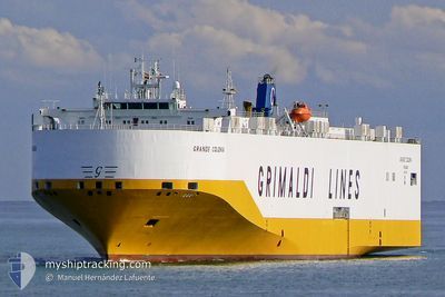
GRANDE COLONIA
Vehicles Carrier
Current Trip
TRGEM>TNLGN
| Time Travelled | 7 h, 38 mins |
|---|---|
| Remaining Time | --- |
| Distance Travelled | 58.98 nm |
| Remaining Distance | --- |
| AVG Speed | 16 Knots |
| MAX Speed | 17.3 Knots |
| AVG Wind | 22.3 knots |
| MAX Wind | 24.3 knots |
| MIN Temp | 14.3°C / 57.74°F |
| MAX Temp | 14.6°C / 58.28°F |
| Draught | 8.4 m |
| Position Received | 2 d ago |
Current Position
| Longitude | 12.06849° |
|---|---|
| Latitude | 37.67926° |
| Status | Under way using engine |
| Speed | 16.3 Knots |
| Course | 279.4° |
| Area | Mediterranean Sea - Western Basin |
| Station | T-AIS |
| Position Received | 2 d ago |
Info
Information
The current position of GRANDE COLONIA is in Mediterranean Sea - Western Basin with coordinates 37.67926° / 12.06849° as reported on 2024-04-22 23:01 by AIS to our vessel tracker app. The vessel's current speed is 16.3 Knots
The vessel GRANDE COLONIA (IMO: 9318527, MMSI: 247217500) is a Vehicles Carrier that was built in 2007 ( 17 years old ). It's sailing under the flag of [IT] Italy.
In this page you can find informations about the vessels current position, last detected port calls, and current voyage information. If the vessels is not in coverage by AIS you will find the latest position.
The current position of GRANDE COLONIA is detected by our AIS receivers and we are not responsible for the reliability of the data. The last position was recorded while the vessel was in Coverage by the Ais receivers of our vessel tracking app.
The current draught of GRANDE COLONIA as reported by AIS is 8.4 meters
Weather
| Temperature | 14.4°C / 57.92°F |
|---|---|
| Wind Speed | 18 knots |
| Direction | 289° WNW |
| Pressure | 1012.8 hPa |
| Humidity | 65.4 % |
| Cloud Coverage | 71 % |
Featured Company
Last Port Calls
| Port | Arrival | Departure | Time In Port |
|---|---|---|---|
| 2024-04-25 00:13 | |||
| 2024-04-19 16:44 | 2024-04-20 05:34 | 12 h | |
| 2024-04-18 11:08 | 2024-04-19 07:03 | 19 h | |
| 2024-04-17 06:52 | 2024-04-18 10:26 | 1 d | |
| 2024-04-13 14:10 | 2024-04-13 21:59 | 7 h | |
| 2024-04-06 12:55 | 2024-04-11 09:15 | 4 d | |
| 2024-04-04 12:09 | 2024-04-05 20:01 | 1 d | |
| 2024-03-22 21:28 | 2024-03-27 23:46 | 5 d | |
| 2024-03-21 02:01 | 2024-03-21 18:35 | 16 h | |
| 2024-03-19 12:45 | 2024-03-20 02:21 | 13 h |
Last Trips
| Origin | Departure | Destination | Arrival | Distance | |
|---|---|---|---|---|---|
| 2024-04-19 10:03 | 2024-04-19 19:44 | 79.57 nm | |||
| 2024-04-18 13:26 | 2024-04-18 14:08 | 1.41 nm | |||
| 2024-04-14 00:59 | 2024-04-17 09:52 | 938.69 nm | |||
| 2024-04-11 11:15 | 2024-04-13 17:10 | 912.69 nm | |||
| 2024-04-05 22:01 | 2024-04-06 14:55 | 247.30 nm | |||
| 2024-03-28 00:46 | 2024-04-04 14:09 | 2639.14 nm | |||
| 2024-03-21 19:35 | 2024-03-22 22:28 | 400.56 nm | |||
| 2024-03-20 03:21 | 2024-03-21 03:01 | 365.65 nm | |||
| 2024-03-18 21:20 | 2024-03-19 13:45 | 227.00 nm | |||
| 2024-03-13 09:26 | 2024-03-17 10:50 | 1601.07 nm |
Events
| Time | Event | Details | Position / Dest | Info |
|---|---|---|---|---|
| 2024-04-25 00:13 | PORT DEPARTURE |
|
36.93746 / 10.45601
TRGEM>TNLGN
|
Speed: Course: 310° |
| 2024-04-22 23:05 | Status Changed | Default Under way using engine |
37.68204 / 12.04762
TRGEM>TNLGN
|
Speed: 16.3 kn Course: 279.4° |
| 2024-04-22 23:01 | Change Sea Area | Italian part of the Mediterranean Sea - Western Basin Italian part of the Mediterranean Sea - Eastern Basin |
37.67926 / 12.06849
Mediterranean Sea - Western Basin
TRGEM>TNLGN
|
Speed: 16.3 kn Course: 279.4° |
| 2024-04-22 23:01 | OUT of Coverage |
37.67926 / 12.06849
Mediterranean Sea - Western Basin
TRGEM>TNLGN
|
Speed: 16.3 kn Course: 279.4° |
|
| 2024-04-22 23:01 | Status Changed | Under way using engine Default |
37.67889 / 12.07131
TRGEM>TNLGN
|
Speed: 16.3 kn Course: 282° |
| 2024-04-22 23:01 | IN Coverage |
37.67926 / 12.06849
Mediterranean Sea - Western Basin
TRGEM>TNLGN
|
Speed: 16.3 kn Course: 279.4° |
|
| 2024-04-22 21:57 | Status Changed | Default Under way using engine |
37.58659 / 12.41329
TRGEM>TNLGN
|
Speed: 15.3 kn Course: 296.2° |
| 2024-04-22 21:53 | OUT of Coverage |
37.57908 / 12.43197
Mediterranean Sea - Eastern Basin
TRGEM>TNLGN
|
Speed: 15.3 kn Course: 296.2° |
|
| 2024-04-22 21:42 | Status Changed | Under way using engine Default |
37.55846 / 12.48830
TRGEM>TNLGN
|
Speed: 16.4 kn Course: 295° |
| 2024-04-22 21:35 | Status Changed | Default Under way using engine |
37.54483 / 12.52443
TRGEM>TNLGN
|
Speed: 16.4 kn Course: 295.2° |