
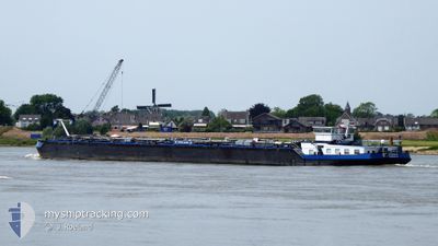
EILTANK 49
Tanker A
Current Trip
SAYER
| Trip Time | 2 days |
|---|---|
| Trip Distance | 283.20 nm |
| AVG Speed | 5.6 Knots |
| MAX Speed | 9 Knots |
| Draught | 2 m |
| AVG Wind | 9.2 knots |
| MAX Wind | 17.8 knots |
| MIN Temp | 3.9°C / 39.02°F |
| MAX Temp | 15°C / 59°F |
| Position Received | Now |
Current Position
| Longitude | 8.34421° |
|---|---|
| Latitude | 49.08258° |
| Status | Under way using engine |
| Speed | 10 Knots |
| Course | 31.6° |
| Area | North Sea |
| Station | T-AIS |
| Position Received | Now |
Info
Information
The current position of EILTANK 49 is in North Sea with coordinates 49.08258° / 8.34421° as reported on 2024-04-18 04:22 by AIS to our vessel tracker app. The vessel's current speed is 10 Knots and is currently inside the port of KARLSRUHE.
The vessel EILTANK 49 (MMSI: 211484440) is a Tanker A It's sailing under the flag of [DE] Germany.
In this page you can find informations about the vessels current position, last detected port calls, and current voyage information. If the vessels is not in coverage by AIS you will find the latest position.
The current position of EILTANK 49 is detected by our AIS receivers and we are not responsible for the reliability of the data. The last position was recorded while the vessel was in Coverage by the Ais receivers of our vessel tracking app.
The current draught of EILTANK 49 as reported by AIS is 2 meters
Weather
| Temperature | 4.1°C / 39.38°F |
|---|---|
| Wind Speed | 5 knots |
| Direction | 231° SW |
| Pressure | 1014.1 hPa |
| Humidity | 93.4 % |
| Cloud Coverage | 100 % |
Featured Company
Last Port Calls
| Port | Arrival | Departure | Time In Port |
|---|---|---|---|
| 2024-04-16 13:43 | |||
| 2024-04-14 08:57 | 2024-04-14 09:07 | 10 m | |
| 2024-04-13 08:10 | 2024-04-14 04:24 | 20 h | |
| 2024-04-13 07:31 | 2024-04-13 08:05 | 33 m | |
| 2024-04-13 03:30 | 2024-04-13 03:55 | 24 m | |
| 2024-04-11 05:21 | 2024-04-12 19:59 | 1 d | |
| 2024-04-10 20:02 | 2024-04-10 20:40 | 37 m | |
| 2024-04-09 14:25 | 2024-04-10 04:08 | 13 h | |
| 2024-04-05 10:56 | 2024-04-05 11:37 | 41 m | |
| 2024-04-03 07:28 | 2024-04-04 19:32 | 1 d |
Last Trips
| Origin | Departure | Destination | Arrival | Distance | |
|---|---|---|---|---|---|
| 2024-04-14 11:07 | 2024-04-16 15:43 | 283.20 nm | |||
| 2024-04-14 06:24 | 2024-04-14 10:57 | 36.62 nm | |||
| 2024-04-13 10:05 | 2024-04-13 10:10 | 0.73 nm | |||
| 2024-04-13 05:55 | 2024-04-13 09:31 | 28.26 nm | |||
| 2024-04-12 21:59 | 2024-04-13 05:30 | 72.90 nm | |||
| 2024-04-10 22:40 | 2024-04-11 07:21 | 42.05 nm | |||
| 2024-04-10 06:08 | 2024-04-10 22:02 | 94.92 nm | |||
| 2024-04-05 13:37 | 2024-04-09 16:25 | 272.54 nm | |||
| 2024-04-04 21:32 | 2024-04-05 12:56 | 70.95 nm | |||
| 2024-04-03 09:22 | 2024-04-03 09:28 | 0.73 nm |
Events
| Time | Event | Details | Position / Dest | Info |
|---|---|---|---|---|
| 2024-04-18 04:17 | START Moving |
49.07391 / 8.34009
[DE] KARLSRUHE
|
Speed: 4.4 kn Course: 346.2° |
|
| 2024-04-18 03:57 | Destination Changed | SAYER KARLSRUHE |
49.07306 / 8.33753
[DE] KARLSRUHE
|
Speed: Course: 511° |
| 2024-04-18 03:57 | ETA Changed | 2024/04/18 09:00 2024/04/16 20:00 |
49.07306 / 8.33753
[DE] KARLSRUHE
|
Speed: Course: 511° |
| 2024-04-17 13:58 | STOP Moving |
49.07278 / 8.33790
[DE] KARLSRUHE
|
Speed: 0.2 kn Course: 511° |
|
| 2024-04-17 13:51 | START Moving |
49.06981 / 8.33956
[DE] KARLSRUHE
|
Speed: 3.5 kn Course: 74.6° |
|
| 2024-04-16 13:53 | STOP Moving |
49.07135 / 8.33805
[DE] KARLSRUHE
|
Speed: 0.3 kn Course: 511° |
|
| 2024-04-16 13:43 | PORT ARRIVAL |
|
49.07829 / 8.34037
[DE] KARLSRUHE
|
Speed: 5.6 kn Course: 188° |
| 2024-04-16 12:10 | START Moving | 2.01 nm, South of GERMERSHEIM |
49.19074 / 8.38228
KARLSRUHE
|
Speed: 4.1 kn Course: 190.2° |
| 2024-04-16 12:00 | STOP Moving | 1.89 nm, South of GERMERSHEIM |
49.19269 / 8.38217
KARLSRUHE
|
Speed: 0.1 kn Course: 511° |
| 2024-04-16 07:41 | Status Changed | Under way using engine Default |
49.46846 / 8.46467
KARLSRUHE
|
Speed: 6 kn Course: 0° |