
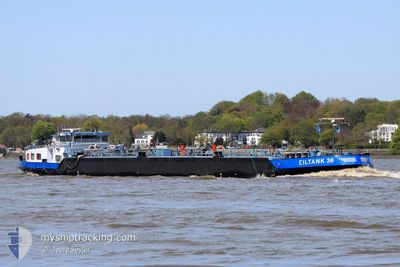
EILTANK 36
Tanker
Current Trip
| Time Travelled | 13 h, 30 mins |
|---|---|
| Remaining Time | --- |
| Distance Travelled | 12.90 nm |
| Remaining Distance | --- |
| AVG Speed | 5.5 Knots |
| MAX Speed | 5.8 Knots |
| AVG Wind | 4.9 knots |
| MAX Wind | 6 knots |
| MIN Temp | 4.3°C / 39.74°F |
| MAX Temp | 5.4°C / 41.72°F |
| Draught | 2.4 m |
| Position Received | 11 h, 4 m ago |
Current Position
| Longitude | 8.45682° |
|---|---|
| Latitude | 49.30968° |
| Status | Under way using engine |
| Speed | 3.4 Knots |
| Course | 161.6° |
| Area | North Sea |
| Station | T-AIS |
| Position Received | 11 h, 4 m ago |
Info
Information
The current position of EILTANK 36 is in North Sea with coordinates 49.30968° / 8.45682° as reported on 2024-04-24 22:40 by AIS to our vessel tracker app. The vessel's current speed is 3.4 Knots and is heading at the port of MILLINGEN AAN DE RIJN. The estimated time of arrival as calculated by MyShipTracking vessel tracking app is 2024-04-24 23:00 LT
The vessel EILTANK 36 (MMSI: 211475070) is a Tanker It's sailing under the flag of [DE] Germany.
In this page you can find informations about the vessels current position, last detected port calls, and current voyage information. If the vessels is not in coverage by AIS you will find the latest position.
The current position of EILTANK 36 is detected by our AIS receivers and we are not responsible for the reliability of the data. The last position was recorded while the vessel was in Coverage by the Ais receivers of our vessel tracking app.
The current draught of EILTANK 36 as reported by AIS is 2.4 meters
Weather
| Temperature | 4.3°C / 39.74°F |
|---|---|
| Wind Speed | 6 knots |
| Direction | 225° SW |
| Pressure | 1010.2 hPa |
| Humidity | 93.6 % |
| Cloud Coverage | 100 % |
Featured Company
Last Port Calls
| Port | Arrival | Departure | Time In Port |
|---|---|---|---|
| 2024-04-24 19:54 | 2024-04-24 20:14 | 19 m | |
| 2024-04-22 13:01 | 2024-04-22 13:45 | 43 m | |
| 2024-04-21 21:23 | 2024-04-21 21:39 | 16 m | |
| 2024-04-21 10:05 | 2024-04-21 19:20 | 9 h | |
| 2024-04-21 07:48 | 2024-04-21 08:11 | 22 m | |
| 2024-04-20 19:43 | 2024-04-20 20:24 | 40 m | |
| 2024-04-17 04:36 | 2024-04-17 12:08 | 7 h | |
| 2024-04-16 05:05 | 2024-04-16 06:04 | 58 m | |
| 2024-04-14 03:49 | 2024-04-14 04:58 | 1 h | |
| 2024-04-12 19:51 | 2024-04-13 23:07 | 1 d |
Last Trips
| Origin | Departure | Destination | Arrival | Distance | |
|---|---|---|---|---|---|
| 2024-04-22 15:45 | 2024-04-24 21:54 | 226.59 nm | |||
| 2024-04-21 23:39 | 2024-04-22 15:01 | 101.37 nm | |||
| 2024-04-21 21:20 | 2024-04-21 23:23 | 18.30 nm | |||
| 2024-04-21 10:11 | 2024-04-21 12:05 | 17.18 nm | |||
| 2024-04-20 22:24 | 2024-04-21 09:48 | 101.88 nm | |||
| 2024-04-17 14:08 | 2024-04-20 21:43 | 420.93 nm | |||
| 2024-04-16 08:04 | 2024-04-17 06:36 | 48.66 nm | |||
| 2024-04-14 06:58 | 2024-04-16 07:05 | 213.35 nm | |||
| 2024-04-14 01:07 | 2024-04-14 05:49 | 43.11 nm | |||
| 2024-04-12 15:58 | 2024-04-12 21:51 | 36.68 nm |
Events
| Time | Event | Details | Position / Dest | Info |
|---|---|---|---|---|
| 2024-04-24 22:40 | OUT of Coverage |
49.30968 / 8.45682
North Sea
SPEYER
|
Speed: 3.4 kn Course: 161.6° |
|
| 2024-04-24 20:14 | PORT DEPARTURE |
|
49.46659 / 8.46335
SPEYER
|
Speed: 5.6 kn Course: 155.8° |
| 2024-04-24 20:05 | START Moving |
49.48010 / 8.45870
[DE] MANNHEIM
|
Speed: 5.9 kn Course: 149.3° |
|
| 2024-04-24 19:55 | STOP Moving |
49.48769 / 8.44991
[DE] MANNHEIM
|
Speed: 0.3 kn Course: 511° |
|
| 2024-04-24 19:54 | PORT ARRIVAL |
|
49.48770 / 8.44989
[DE] MANNHEIM
|
Speed: 1.1 kn Course: 511° |
| 2024-04-24 19:32 | START Moving | 1.8 nm, North of MANNHEIM |
49.51876 / 8.43395
SPEYER
|
Speed: 4.8 kn Course: 177° |
| 2024-04-24 19:30 | Status Changed | Under way using engine Moored |
49.52054 / 8.43378
SPEYER
|
Speed: 0.2 kn Course: 511° |
| 2024-04-24 19:29 | IN Coverage |
49.51996 / 8.43384
North Sea
SPEYER
|
Speed: 3.7 kn Course: 175° |
|
| 2024-04-24 14:38 | OUT of Coverage |
49.52077 / 8.43394
North Sea
SPEYER
|
Speed: Course: 511° |
|
| 2024-04-24 14:14 | Status Changed | Moored Under way using engine |
49.52077 / 8.43394
SPEYER
|
Speed: Course: 511° |