
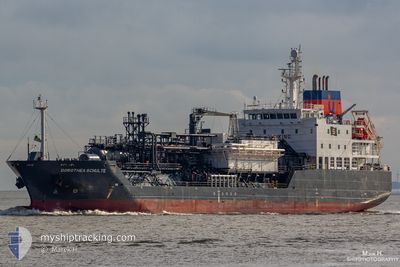
DOROTHEA SCHULTE
Lpg Tanker
Current Trip
WANDELAR
| Time Travelled | 6 days |
|---|---|
| Remaining Time | --- |
| Distance Travelled | 1175.58 nm |
| Remaining Distance | --- |
| AVG Speed | 10.4 Knots |
| MAX Speed | 14.4 Knots |
| AVG Wind | 13.1 knots |
| MAX Wind | 44.9 knots |
| MIN Temp | 12.9°C / 55.22°F |
| MAX Temp | 21.2°C / 70.16°F |
| Draught | 6.5 m |
| Position Received | 19 m ago |
Current Position
| Longitude | -5.68015° |
|---|---|
| Latitude | 35.96016° |
| Status | Under way using engine |
| Speed | 13 Knots |
| Course | 264.1° |
| Area | Strait of Gibraltar |
| Station | T-AIS |
| Position Received | 19 m ago |
Info
Information
The current position of DOROTHEA SCHULTE is in Strait of Gibraltar with coordinates 35.96016° / -5.68015° as reported on 2024-04-19 07:37 by AIS to our vessel tracker app. The vessel's current speed is 13 Knots
The vessel DOROTHEA SCHULTE (IMO: 9618862, MMSI: 235093299) is a Lpg Tanker that was built in 2013 ( 11 years old ). It's sailing under the flag of [GB] United Kingdom.
In this page you can find informations about the vessels current position, last detected port calls, and current voyage information. If the vessels is not in coverage by AIS you will find the latest position.
The current position of DOROTHEA SCHULTE is detected by our AIS receivers and we are not responsible for the reliability of the data. The last position was recorded while the vessel was in Coverage by the Ais receivers of our vessel tracking app.
The current draught of DOROTHEA SCHULTE as reported by AIS is 6.5 meters
Weather
| Temperature | 16.8°C / 62.24°F |
|---|---|
| Wind Speed | 30 knots |
| Direction | 92° E |
| Pressure | 1016.3 hPa |
| Humidity | 85.1 % |
| Cloud Coverage | 100 % |
Featured Company
Last Port Calls
| Port | Arrival | Departure | Time In Port |
|---|---|---|---|
| 2024-04-11 03:20 | 2024-04-12 18:10 | 1 d | |
| 2024-03-31 17:47 | 2024-04-01 19:08 | 1 d | |
| 2024-03-29 00:08 | 2024-03-30 09:54 | 1 d | |
| 2024-03-24 20:18 | 2024-03-26 09:20 | 1 d | |
| 2024-03-22 08:47 | 2024-03-23 10:14 | 1 d | |
| 2024-03-19 14:38 | 2024-03-21 02:31 | 1 d | |
| 2024-03-16 10:04 | 2024-03-17 19:08 | 1 d | |
| 2024-03-12 22:53 | 2024-03-14 10:18 | 1 d | |
| 2024-03-07 09:08 | 2024-03-08 19:51 | 1 d | |
| 2024-03-01 00:04 | 2024-03-03 05:27 | 2 d |
Last Trips
| Origin | Departure | Destination | Arrival | Distance | |
|---|---|---|---|---|---|
| 2024-04-01 20:08 | 2024-04-11 05:20 | 2316.51 nm | |||
| 2024-03-30 10:54 | 2024-03-31 18:47 | 405.62 nm | |||
| 2024-03-26 10:20 | 2024-03-29 01:08 | 379.61 nm | |||
| 2024-03-23 11:14 | 2024-03-24 21:18 | 132.34 nm | |||
| 2024-03-21 02:31 | 2024-03-22 09:47 | 343.61 nm | |||
| 2024-03-17 20:08 | 2024-03-19 14:38 | 400.37 nm | |||
| 2024-03-14 11:18 | 2024-03-16 11:04 | 369.07 nm | |||
| 2024-03-08 20:51 | 2024-03-12 23:53 | 402.27 nm | |||
| 2024-03-03 06:27 | 2024-03-07 10:08 | 365.96 nm | |||
| 2024-02-23 15:41 | 2024-03-01 01:04 | 232.42 nm |
Events
| Time | Event | Details | Position / Dest | Info |
|---|---|---|---|---|
| 2024-04-19 07:47 | Status Changed | Default Under way using engine |
35.95884 / -5.72866
WANDELAR
|
Speed: 13 kn Course: 264.1° |
| 2024-04-19 06:07 | Change Sea Area | Spanish part of the Strait of Gibraltar Gibraltarian part of the Strait of Gibraltar |
36.01855 / -5.34023
Strait of Gibraltar
WANDELAR
|
Speed: 12.2 kn Course: 251.1° |
| 2024-04-19 06:04 | Change Sea Area | Gibraltarian part of the Strait of Gibraltar Gibraltarian part of the Alboran Sea |
36.02162 / -5.32829
Strait of Gibraltar
WANDELAR
|
Speed: 12.2 kn Course: 256.8° |
| 2024-04-19 04:52 | Change Sea Area | Gibraltarian part of the Alboran Sea Spanish part of the Alboran Sea |
36.05391 / -5.07059
Alboran Sea
WANDELAR
|
Speed: 10.4 kn Course: 263.8° |
| 2024-04-19 00:48 | Status Changed | Under way using engine Default |
36.17470 / -4.15120
WANDELAR
|
Speed: 12 kn Course: 263° |
| 2024-04-19 00:38 | Status Changed | Default Under way using engine |
36.17833 / -4.11167
WANDELAR
|
Speed: 12.4 kn Course: 261.6° |
| 2024-04-19 00:25 | IN Coverage |
36.18570 / -4.05015
Alboran Sea
WANDELAR
|
Speed: 12.4 kn Course: 261.6° |
|
| 2024-04-18 23:11 | OUT of Coverage |
36.22848 / -3.74383
Alboran Sea
WANDELAR
|
Speed: 12.8 kn Course: 262.1° |
|
| 2024-04-18 21:30 | Status Changed | Under way using engine Default |
36.28544 / -3.31247
WANDELAR
|
Speed: 12.6 kn Course: 258° |
| 2024-04-18 21:26 | Status Changed | Default Under way using engine |
36.28880 / -3.29309
WANDELAR
|
Speed: 12.5 kn Course: 257.8° |