
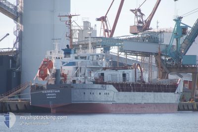
CEMSTAR
Cement Carrier
Current Trip
| Trip Time | 16 h, 52 mins |
|---|---|
| Trip Distance | 166.28 nm |
| AVG Speed | 9.9 Knots |
| MAX Speed | 13.4 Knots |
| Draught | 3.3 m |
| AVG Wind | 16.7 knots |
| MAX Wind | 23.1 knots |
| MIN Temp | 5.3°C / 41.54°F |
| MAX Temp | 10.2°C / 50.36°F |
| Position Received | 4 m ago |
Current Position
| Longitude | 4.59953° |
|---|---|
| Latitude | 51.68819° |
| Status | Under way using engine |
| Speed | |
| Course | 286° |
| Area | North Sea |
| Station | T-AIS |
| Position Received | 4 m ago |
Info
Information
The current position of CEMSTAR is in North Sea with coordinates 51.68819° / 4.59953° as reported on 2024-04-24 10:35 by AIS to our vessel tracker app. The vessel's current speed is 0 Knots and is currently inside the port of MOERDIJK.
The vessel CEMSTAR (IMO: 8903090, MMSI: 209962000) is a Cement Carrier that was built in 1989 ( 35 years old ). It's sailing under the flag of [CY] Cyprus.
In this page you can find informations about the vessels current position, last detected port calls, and current voyage information. If the vessels is not in coverage by AIS you will find the latest position.
The current position of CEMSTAR is detected by our AIS receivers and we are not responsible for the reliability of the data. The last position was recorded while the vessel was in Coverage by the Ais receivers of our vessel tracking app.
The current draught of CEMSTAR as reported by AIS is 3.3 meters
Weather
| Temperature | 8.4°C / 47.12°F |
|---|---|
| Wind Speed | 14 knots |
| Direction | 335° NNW |
| Pressure | 1010.4 hPa |
| Humidity | 62.8 % |
| Cloud Coverage | 100 % |
Featured Company
Last Port Calls
| Port | Arrival | Departure | Time In Port |
|---|---|---|---|
| 2024-04-24 07:14 | |||
| 2024-04-21 23:02 | 2024-04-23 14:22 | 1 d | |
| 2024-04-19 05:36 | 2024-04-20 09:14 | 1 d | |
| 2024-04-17 06:49 | 2024-04-18 12:07 | 1 d | |
| 2024-04-15 02:29 | 2024-04-16 10:38 | 1 d | |
| 2024-04-12 15:44 | 2024-04-13 23:11 | 1 d | |
| 2024-04-10 12:36 | 2024-04-11 21:02 | 1 d | |
| 2024-04-08 11:00 | 2024-04-09 19:56 | 1 d | |
| 2024-04-06 16:02 | 2024-04-07 18:25 | 1 d | |
| 2024-04-06 06:45 | 2024-04-06 12:39 | 5 h |
Last Trips
| Origin | Departure | Destination | Arrival | Distance | |
|---|---|---|---|---|---|
| 2024-04-23 15:22 | 2024-04-24 09:14 | 166.28 nm | |||
| 2024-04-20 11:14 | 2024-04-22 00:02 | 177.26 nm | |||
| 2024-04-18 13:07 | 2024-04-19 07:36 | 166.44 nm | |||
| 2024-04-16 12:38 | 2024-04-17 07:49 | 168.01 nm | |||
| 2024-04-14 00:11 | 2024-04-15 04:29 | 170.60 nm | |||
| 2024-04-11 23:02 | 2024-04-12 16:44 | 168.16 nm | |||
| 2024-04-09 20:56 | 2024-04-10 14:36 | 163.80 nm | |||
| 2024-04-07 20:25 | 2024-04-08 12:00 | 166.02 nm | |||
| 2024-04-06 14:39 | 2024-04-06 18:02 | 32.85 nm | |||
| 2024-04-05 17:58 | 2024-04-06 08:45 | 136.07 nm |
Events
| Time | Event | Details | Position / Dest | Info |
|---|---|---|---|---|
| 2024-04-24 07:36 | STOP Moving |
51.68832 / 4.59977
[NL] MOERDIJK
|
Speed: 0.2 kn Course: 287° |
|
| 2024-04-24 07:14 | PORT ARRIVAL |
|
51.69794 / 4.59519
[NL] MOERDIJK
|
Speed: 4.9 kn Course: 255° |
| 2024-04-24 02:26 | Status Changed | Under way using engine Default |
51.95135 / 3.65327
MOERDIJK
|
Speed: 10.9 kn Course: 79° |
| 2024-04-24 02:04 | Status Changed | Default Under way using engine |
51.94011 / 3.54847
MOERDIJK
|
Speed: 10.9 kn Course: 80.4° |
| 2024-04-24 01:57 | Status Changed | Under way using engine Default |
51.93746 / 3.51813
MOERDIJK
|
Speed: 10.8 kn Course: 74° |
| 2024-04-24 01:35 | Status Changed | Default Under way using engine |
51.91485 / 3.41121
MOERDIJK
|
Speed: 10.9 kn Course: 66.2° |
| 2024-04-23 22:46 | Change Sea Area | Dutch part of the North Sea Belgian part of the North Sea |
51.79930 / 2.66870
North Sea
MOERDIJK
|
Speed: 9.9 kn Course: 96.2° |
| 2024-04-23 22:01 | Change Sea Area | Belgian part of the North Sea United Kingdom part of the North Sea |
51.80526 / 2.48264
North Sea
MOERDIJK
|
Speed: 8.8 kn Course: 87.3° |
| 2024-04-23 19:32 | Status Changed | Under way using engine Default |
51.64889 / 2.09774
MOERDIJK
|
Speed: 6.8 kn Course: 50° |
| 2024-04-23 19:27 | IN Coverage |
51.65256 / 2.10483
North Sea
MOERDIJK
|
Speed: 7.1 kn Course: 49.1° |