
CARDIFF
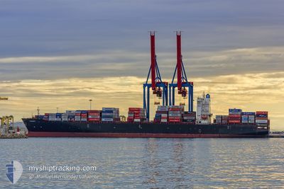
Container Ship
Current Trip
JMKIN
| Time Travelled | 2 days |
|---|---|
| Remaining Time | --- |
| Distance Travelled | 957.06 nm |
| Remaining Distance | --- |
| AVG Speed | 18.6 Knots |
| MAX Speed | 20.2 Knots |
| AVG Wind | 10.8 knots |
| MAX Wind | 22 knots |
| MIN Temp | 21.3°C / 70.34°F |
| MAX Temp | 27.9°C / 82.22°F |
| Draught | 12.8 m |
| Position Received | 1 d ago |
Current Position
| Longitude | -84.35175° |
|---|---|
| Latitude | 20.96876° |
| Status | Under way using engine |
| Speed | 18 Knots |
| Course | 297.3° |
| Area | Caribbean Sea |
| Station | T-AIS |
| Position Received | 1 d ago |
Info
Information
The current position of CARDIFF is in Caribbean Sea with coordinates 20.96876° / -84.35175° as reported on 2024-04-24 08:32 by AIS to our vessel tracker app. The vessel's current speed is 18 Knots
The vessel CARDIFF (IMO: 9629457, MMSI: 636016185) is a Container Ship that was built in 2014 ( 10 years old ). It's sailing under the flag of [LR] Liberia.
In this page you can find informations about the vessels current position, last detected port calls, and current voyage information. If the vessels is not in coverage by AIS you will find the latest position.
The current position of CARDIFF is detected by our AIS receivers and we are not responsible for the reliability of the data. The last position was recorded while the vessel was in Coverage by the Ais receivers of our vessel tracking app.
The current draught of CARDIFF as reported by AIS is 12.8 meters
Weather
| Temperature | 25.2°C / 77.36°F |
|---|---|
| Wind Speed | 19 knots |
| Direction | 86° E |
| Pressure | 1014.7 hPa |
| Humidity | 86.1 % |
| Cloud Coverage | --- |
Featured Company
Last Port Calls
| Port | Arrival | Departure | Time In Port |
|---|---|---|---|
| 2024-04-21 18:42 | 2024-04-23 05:42 | 1 d | |
| 2024-04-19 15:51 | 2024-04-20 15:49 | 23 h | |
| 2024-04-08 17:10 | 2024-04-09 10:42 | 17 h | |
| 2024-04-06 09:28 | 2024-04-06 09:34 | 5 m | |
| 2024-04-04 06:21 | 2024-04-05 15:46 | 1 d | |
| 2024-04-03 00:35 | 2024-04-03 16:26 | 15 h | |
| 2024-04-01 08:25 | 2024-04-01 18:34 | 10 h | |
| 2024-03-28 23:40 | 2024-03-29 17:51 | 18 h | |
| 2024-03-16 02:25 | 2024-03-16 21:44 | 19 h | |
| 2024-03-09 18:21 | 2024-03-10 23:43 | 1 d |
Most Visited Ports (Last year)
| Port | Arrivals | |
|---|---|---|
| 13 | ||
| 12 | ||
| 11 | ||
| 7 | ||
| 6 | ||
| 6 |
Last Trips
| Origin | Departure | Destination | Arrival | Distance | |
|---|---|---|---|---|---|
| 2024-04-20 10:49 | 2024-04-21 13:42 | 478.93 nm | |||
| 2024-04-09 07:42 | 2024-04-19 10:51 | 3372.51 nm | |||
| 2024-04-06 06:34 | 2024-04-08 14:10 | 761.93 nm | |||
| 2024-04-05 12:46 | 2024-04-06 06:28 | 225.77 nm | |||
| 2024-04-03 13:26 | 2024-04-04 03:21 | 171.54 nm | |||
| 2024-04-01 15:34 | 2024-04-02 21:35 | 193.68 nm | |||
| 2024-03-29 14:51 | 2024-04-01 05:25 | 306.09 nm | |||
| 2024-03-16 16:44 | 2024-03-28 20:40 | 4295.09 nm | |||
| 2024-03-10 18:43 | 2024-03-15 21:25 | 667.84 nm | |||
| 2024-03-04 22:51 | 2024-03-09 13:21 | 1116.99 nm |
Events
| Time | Event | Details | Position / Dest | Info |
|---|---|---|---|---|
| 2024-04-24 08:39 | Status Changed | Default Under way using engine |
20.98702 / -84.38862
JMKIN
|
Speed: 18 kn Course: 297.3° |
| 2024-04-24 08:32 | Change Sea Area | Cuban part of the Caribbean Sea Colombian part of the Caribbean Sea |
20.96876 / -84.35175
Caribbean Sea
|
Speed: 18 kn Course: 297.3° |
| 2024-04-24 08:32 | Status Changed | Under way using engine Default |
20.96876 / -84.35175
JMKIN
|
Speed: 18 kn Course: 294° |
| 2024-04-24 08:32 | OUT of Coverage |
20.96876 / -84.35175
Caribbean Sea
|
Speed: 18 kn Course: 297.3° |
|
| 2024-04-24 08:24 | IN Coverage |
20.96876 / -84.35175
Caribbean Sea
|
Speed: 18 kn Course: 297.3° |
|
| 2024-04-23 05:42 | PORT DEPARTURE |
|
17.96050 / -76.84691
JMKIN
|
Speed: 8.1 kn Course: 243° |
| 2024-04-23 05:34 | START Moving |
17.97195 / -76.82709
[JM] KINGSTON (JM)
|
Speed: 4.4 kn Course: 234° |
|
| 2024-04-21 19:14 | STOP Moving |
17.97805 / -76.82962
[JM] KINGSTON (JM)
|
Speed: Course: 133° |
|
| 2024-04-21 18:42 | PORT ARRIVAL |
|
17.96820 / -76.83133
[JM] KINGSTON (JM)
|
Speed: 8.1 kn Course: 67° |
| 2024-04-20 18:20 | OUT of Coverage |
10.81344 / -75.78594
Caribbean Sea
JMKIN
|
Speed: 18.9 kn Course: 353.4° |