
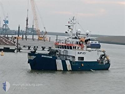
BREAKER
Reserved for future use
Current Trip
| Trip Time | 1 day |
|---|---|
| Trip Distance | 213.31 nm |
| AVG Speed | 5.5 Knots |
| MAX Speed | 8.2 Knots |
| Draught | 2.9 m |
| AVG Wind | 14 knots |
| MAX Wind | 26.1 knots |
| MIN Temp | 6.7°C / 44.06°F |
| MAX Temp | 8.6°C / 47.48°F |
| Position Received | 1 m ago |
Current Position
| Longitude | 4.26412° |
|---|---|
| Latitude | 52.09967° |
| Status | Moored |
| Speed | |
| Course | 220° |
| Area | North Sea |
| Station | T-AIS |
| Position Received | 1 m ago |
Info
Information
The current position of BREAKER is in North Sea with coordinates 52.09967° / 4.26412° as reported on 2024-04-24 04:20 by AIS to our vessel tracker app. The vessel's current speed is 0 Knots and is currently inside the port of SCHEVENINGEN.
The vessel BREAKER (IMO: 4644878, MMSI: 371150000) is a Reserved for future use It's sailing under the flag of [PA] Panama.
In this page you can find informations about the vessels current position, last detected port calls, and current voyage information. If the vessels is not in coverage by AIS you will find the latest position.
The current position of BREAKER is detected by our AIS receivers and we are not responsible for the reliability of the data. The last position was recorded while the vessel was in Coverage by the Ais receivers of our vessel tracking app.
The current draught of BREAKER as reported by AIS is 2.9 meters
Weather
| Temperature | 6°C / 42.8°F |
|---|---|
| Wind Speed | 15 knots |
| Direction | 331° NNW |
| Pressure | 1012.5 hPa |
| Humidity | 67.1 % |
| Cloud Coverage | 100 % |
Featured Company
Last Port Calls
| Port | Arrival | Departure | Time In Port |
|---|---|---|---|
| 2024-04-23 22:31 | |||
| 2024-04-15 04:03 | 2024-04-22 10:30 | 7 d | |
| 2024-04-12 15:13 | 2024-04-13 12:11 | 20 h | |
| 2024-04-12 03:30 | 2024-04-12 14:02 | 10 h | |
| 2024-04-09 01:16 | 2024-04-11 13:53 | 2 d | |
| 2024-03-29 10:41 | 2024-04-06 04:16 | 7 d | |
| 2024-03-22 19:01 | 2024-03-26 10:33 | 3 d | |
| 2024-03-15 09:26 | 2024-03-16 11:10 | 1 d | |
| 2024-03-13 05:55 | 2024-03-13 22:44 | 16 h | |
| 2024-03-08 02:27 | 2024-03-12 05:13 | 4 d |
Most Visited Ports (Last year)
| Port | Arrivals | |
|---|---|---|
| 12 | ||
| 9 | ||
| 8 | ||
| 7 | ||
| 7 | ||
| 3 |
Last Trips
| Origin | Departure | Destination | Arrival | Distance | |
|---|---|---|---|---|---|
| 2024-04-22 12:30 | 2024-04-24 00:31 | 213.31 nm | |||
| 2024-04-13 14:11 | 2024-04-15 06:03 | 216.96 nm | |||
| 2024-04-12 16:02 | 2024-04-12 17:13 | 6.71 nm | |||
| 2024-04-11 15:53 | 2024-04-12 05:30 | 51.91 nm | |||
| 2024-04-06 06:16 | 2024-04-09 03:16 | 363.29 nm | |||
| 2024-03-26 11:33 | 2024-03-29 11:41 | 306.23 nm | |||
| 2024-03-16 12:10 | 2024-03-22 20:01 | 557.17 nm | |||
| 2024-03-13 23:44 | 2024-03-15 10:26 | 168.12 nm | |||
| 2024-03-12 05:13 | 2024-03-13 06:55 | 182.69 nm | |||
| 2024-03-02 13:21 | 2024-03-08 02:27 | 530.64 nm |
Events
| Time | Event | Details | Position / Dest | Info |
|---|---|---|---|---|
| 2024-04-23 22:52 | Status Changed | Moored Under way using engine |
52.09889 / 4.26538
[NL] SCHEVENINGEN
|
Speed: Course: 219° |
| 2024-04-23 22:41 | STOP Moving |
52.09953 / 4.26407
[NL] SCHEVENINGEN
|
Speed: 0.3 kn Course: 231° |
|
| 2024-04-23 22:31 | PORT ARRIVAL |
|
52.10395 / 4.25422
[NL] SCHEVENINGEN
|
Speed: 6.7 kn Course: 141° |
| 2024-04-23 19:50 | Status Changed | Under way using engine Default |
52.01311 / 3.84721
SURVEY AREA
|
Speed: 6.6 kn Course: 82° |
| 2024-04-23 19:38 | IN Coverage |
52.01340 / 3.85227
North Sea
|
Speed: 6.6 kn Course: 84.9° |
|
| 2024-04-23 17:19 | Status Changed | Default Under way using engine |
51.98718 / 3.35879
SURVEY AREA
|
Speed: 7.8 kn Course: 83.5° |
| 2024-04-23 17:11 | OUT of Coverage |
51.98580 / 3.33106
North Sea
|
Speed: 7.8 kn Course: 83.5° |
|
| 2024-04-23 17:11 | Status Changed | Under way using engine Default |
51.98576 / 3.33046
SURVEY AREA
|
Speed: 8 kn Course: 83° |
| 2024-04-23 17:00 | Status Changed | Default Under way using engine |
51.98277 / 3.29100
SURVEY AREA
|
Speed: 8.2 kn Course: 81.4° |
| 2024-04-23 16:40 | Status Changed | Under way using engine Restricted manoeuverability |
51.98045 / 3.25063
SURVEY AREA
|
Speed: 2.2 kn Course: 130° |