
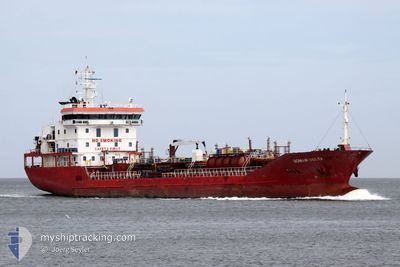
MAR VESTA
Oil/Chemical Tanker
Current Trip
UAIZM
| Time Travelled | 3 days |
|---|---|
| Remaining Time | --- |
| Distance Travelled | 368.67 nm |
| Remaining Distance | --- |
| AVG Speed | 9.5 Knots |
| MAX Speed | 11.1 Knots |
| AVG Wind | 10.8 knots |
| MAX Wind | 26.9 knots |
| MIN Temp | 11.7°C / 53.06°F |
| MAX Temp | 19.8°C / 67.64°F |
| Draught | 6.7 m |
| Position Received | 2 m ago |
Current Position
| Longitude | 28.73613° |
|---|---|
| Latitude | 40.95862° |
| Status | At anchor |
| Speed | |
| Course | 22° |
| Area | Sea of Marmara |
| Station | T-AIS |
| Position Received | 2 m ago |
Info
Information
The current position of MAR VESTA is in Sea of Marmara with coordinates 40.95862° / 28.73613° as reported on 2024-04-20 00:11 by AIS to our vessel tracker app. The vessel's current speed is 0 Knots
The vessel MAR VESTA (IMO: 9489560, MMSI: 229866000) is a Oil/Chemical Tanker that was built in 2008 ( 16 years old ). It's sailing under the flag of [MT] Malta.
In this page you can find informations about the vessels current position, last detected port calls, and current voyage information. If the vessels is not in coverage by AIS you will find the latest position.
The current position of MAR VESTA is detected by our AIS receivers and we are not responsible for the reliability of the data. The last position was recorded while the vessel was in Coverage by the Ais receivers of our vessel tracking app.
The current draught of MAR VESTA as reported by AIS is 6.7 meters
Weather
| Temperature | 12.3°C / 54.14°F |
|---|---|
| Wind Speed | 18 knots |
| Direction | 58° ENE |
| Pressure | 1004.2 hPa |
| Humidity | 81.3 % |
| Cloud Coverage | 100 % |
Featured Company
Last Port Calls
| Port | Arrival | Departure | Time In Port |
|---|---|---|---|
| 2024-04-15 14:41 | 2024-04-16 17:38 | 1 d | |
| 2024-04-01 16:58 | 2024-04-02 18:32 | 1 d | |
| 2024-04-01 07:26 | 2024-04-01 16:27 | 9 h | |
| 2024-03-27 15:46 | 2024-03-29 18:36 | 2 d | |
| 2024-03-20 09:32 | 2024-03-22 13:17 | 2 d | |
| 2024-03-09 10:19 | 2024-03-10 17:26 | 1 d | |
| 2024-03-04 06:35 | 2024-03-07 02:22 | 2 d | |
| 2024-02-07 13:25 | 2024-02-08 18:52 | 1 d |
Last Trips
| Origin | Departure | Destination | Arrival | Distance | |
|---|---|---|---|---|---|
| 2024-04-02 21:32 | 2024-04-15 17:41 | 1445.86 nm | |||
| 2024-04-01 19:27 | 2024-04-01 19:58 | 3.35 nm | |||
| 2024-03-29 21:36 | 2024-04-01 10:26 | 280.75 nm | |||
| 2024-03-22 15:17 | 2024-03-27 18:46 | 639.13 nm | |||
| 2024-03-10 19:26 | 2024-03-20 11:32 | 907.02 nm | |||
| 2024-03-07 05:22 | 2024-03-09 12:19 | 314.16 nm | |||
| 2024-02-08 20:52 | 2024-03-04 09:35 | 1096.23 nm | |||
| 2024-01-18 14:33 | 2024-02-07 15:25 | 1463.09 nm |
Events
| Time | Event | Details | Position / Dest | Info |
|---|---|---|---|---|
| 2024-04-19 23:01 | Status Changed | At anchor Default |
40.95864 / 28.73587
UAIZM
|
Speed: Course: 26° |
| 2024-04-19 22:56 | Status Changed | Default At anchor |
40.95871 / 28.73590
UAIZM
|
Speed: Course: 28° |
| 2024-04-19 20:18 | Status Changed | At anchor Default |
40.95923 / 28.73521
UAIZM
|
Speed: Course: -1° |
| 2024-04-19 20:14 | Status Changed | Default At anchor |
40.95833 / 28.73500
UAIZM
|
Speed: Course: 52° |
| 2024-04-19 12:05 | ETA Changed | 2024/04/22 19:30 2024/04/20 19:30 |
40.95940 / 28.73501
UAIZM
|
Speed: Course: 58° |
| 2024-04-18 10:05 | STOP Moving | 2.84 nm, East of AMBARLI |
40.96002 / 28.73681
UAIZM
|
Speed: 0.3 kn Course: 25° |
| 2024-04-18 10:02 | Status Changed | At anchor Under way using engine |
40.95949 / 28.73655
UAIZM
|
Speed: 1.8 kn Course: 19° |
| 2024-04-18 08:31 | Status Changed | Under way using engine Default |
40.81948 / 28.55031
UAIZM
|
Speed: 10.6 kn Course: 83° |
| 2024-04-18 08:31 | IN Coverage |
40.81961 / 28.55284
Sea of Marmara
UAIZM
|
Speed: 10.3 kn Course: 86.3° |
|
| 2024-04-18 07:19 | OUT of Coverage |
40.79323 / 28.27184
Sea of Marmara
UAIZM
|
Speed: 10.8 kn Course: 81.5° |