
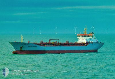
ATLANTIC WIND
Oil/Chemical Tanker
Current Trip
| Time Travelled | 2 days |
|---|---|
| Remaining Time | 1 h, 6 mins |
| Distance Travelled | 130.60 nm |
| Remaining Distance | 9.12 nm |
| AVG Speed | 10.6 Knots |
| MAX Speed | 15.2 Knots |
| AVG Wind | 8.2 knots |
| MAX Wind | 16 knots |
| MIN Temp | 2.2°C / 35.96°F |
| MAX Temp | 8.8°C / 47.84°F |
| Draught | 6.3 m |
| Position Received | 1 m ago |
Current Position
| Longitude | 11.65731° |
|---|---|
| Latitude | 57.59768° |
| Status | Under way using engine |
| Speed | 8.4 Knots |
| Course | 20.1° |
| Area | Kattegat |
| Station | T-AIS |
| Position Received | 1 m ago |
Info
Information
The current position of ATLANTIC WIND is in Kattegat with coordinates 57.59768° / 11.65731° as reported on 2024-04-19 10:46 by AIS to our vessel tracker app. The vessel's current speed is 8.4 Knots and is heading at the port of GOTEBORG. The estimated time of arrival as calculated by MyShipTracking vessel tracking app is 2024-04-19 11:54 LT
The vessel ATLANTIC WIND (IMO: 9341316, MMSI: 236111974) is a Oil/Chemical Tanker that was built in 2007 ( 17 years old ). It's sailing under the flag of [GI] Gibraltar.
In this page you can find informations about the vessels current position, last detected port calls, and current voyage information. If the vessels is not in coverage by AIS you will find the latest position.
The current position of ATLANTIC WIND is detected by our AIS receivers and we are not responsible for the reliability of the data. The last position was recorded while the vessel was in Coverage by the Ais receivers of our vessel tracking app.
The current draught of ATLANTIC WIND as reported by AIS is 6.3 meters
Weather
| Temperature | 5°C / 41°F |
|---|---|
| Wind Speed | 14 knots |
| Direction | 76° ENE |
| Pressure | 1005 hPa |
| Humidity | 55 % |
| Cloud Coverage | 89 % |
Featured Company
Last Port Calls
| Port | Arrival | Departure | Time In Port |
|---|---|---|---|
| 2024-04-16 22:19 | 2024-04-17 09:50 | 11 h | |
| 2024-04-15 21:37 | 2024-04-16 08:53 | 11 h | |
| 2024-04-15 03:30 | 2024-04-15 11:19 | 7 h | |
| 2024-04-14 09:08 | 2024-04-14 19:19 | 10 h | |
| 2024-04-10 10:04 | 2024-04-10 10:43 | 39 m | |
| 2024-04-07 12:28 | 2024-04-10 09:23 | 2 d | |
| 2024-04-07 11:16 | 2024-04-07 12:02 | 46 m | |
| 2024-04-04 20:28 | 2024-04-05 20:12 | 23 h | |
| 2024-03-31 06:41 | 2024-04-01 14:04 | 1 d | |
| 2024-03-30 07:59 | 2024-03-30 08:54 | 54 m |
Last Trips
| Origin | Departure | Destination | Arrival | Distance | |
|---|---|---|---|---|---|
| 2024-04-16 10:53 | 2024-04-17 00:19 | 140.78 nm | |||
| 2024-04-15 13:19 | 2024-04-15 23:37 | 55.27 nm | |||
| 2024-04-14 21:19 | 2024-04-15 05:30 | 93.42 nm | |||
| 2024-04-10 11:43 | 2024-04-14 11:08 | 1133.86 nm | |||
| 2024-04-10 10:23 | 2024-04-10 11:04 | 1.98 nm | |||
| 2024-04-07 13:02 | 2024-04-07 13:28 | 1.56 nm | |||
| 2024-04-05 21:12 | 2024-04-07 12:16 | 284.16 nm | |||
| 2024-04-01 16:04 | 2024-04-04 21:28 | 811.84 nm | |||
| 2024-03-30 09:54 | 2024-03-31 08:41 | 140.55 nm | |||
| 2024-03-30 07:28 | 2024-03-30 08:59 | 6.35 nm |
Events
| Time | Event | Details | Position / Dest | Info |
|---|---|---|---|---|
| 2024-04-19 10:29 | START Moving | 4.78 nm, West of VRANGO |
57.56237 / 11.63153
GOTHENBURG
|
Speed: 3.2 kn Course: 34° |
| 2024-04-19 09:58 | STOP Moving | 4.97 nm, West of VRANGO |
57.56155 / 11.62572
GOTHENBURG
|
Speed: 0.3 kn Course: 135° |
| 2024-04-19 09:15 | START Moving | 4.16 nm, West of VRANGO |
57.54869 / 11.65835
GOTHENBURG
|
Speed: 3.1 kn Course: 39° |
| 2024-04-19 09:12 | Status Changed | Under way using engine At anchor |
57.54962 / 11.65562
GOTHENBURG
|
Speed: 0.3 kn Course: 137° |
| 2024-04-17 20:33 | Status Changed | At anchor Under way using engine |
57.55007 / 11.65550
GOTHENBURG
|
Speed: 0.3 kn Course: 141° |
| 2024-04-17 20:32 | STOP Moving | 4.22 nm, West of VRANGO |
57.55003 / 11.65550
GOTHENBURG
|
Speed: 0.3 kn Course: 141° |
| 2024-04-17 10:47 | Change Sea Area | Swedish part of the Kattegat Danish part of the Kattegat |
55.81480 / 12.73232
Kattegat
GOTHENBURG
|
Speed: 12.9 kn Course: 18.3° |
| 2024-04-17 09:50 | PORT DEPARTURE |
|
55.68715 / 12.64189
GOTHENBURG
|
Speed: 4.1 kn Course: 140° |
| 2024-04-17 09:43 | Status Changed | Under way using engine Moored |
55.68672 / 12.63735
[DK] COPENHAGEN
|
Speed: 3.1 kn Course: 236° |
| 2024-04-17 09:43 | START Moving |
55.68663 / 12.63711
[DK] COPENHAGEN
|
Speed: 3.1 kn Course: 236° |