
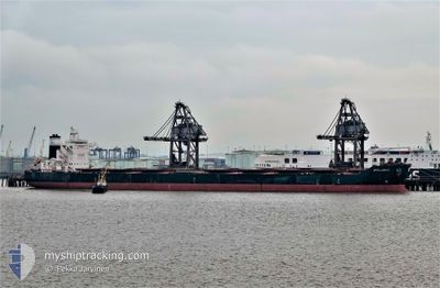
APOLLONIUS
Cargo
Current Trip
ROTTERDAM
| Time Travelled | 41 days |
|---|---|
| Remaining Time | --- |
| Distance Travelled | 10498.97 nm |
| Remaining Distance | --- |
| AVG Speed | 10.5 Knots |
| MAX Speed | 14.2 Knots |
| AVG Wind | 14.8 knots |
| MAX Wind | 34 knots |
| MIN Temp | 13.7°C / 56.66°F |
| MAX Temp | 29.2°C / 84.56°F |
| Draught | 18.3 m |
| Position Received | 4 d ago |
Current Position
| Longitude | -0.45142° |
|---|---|
| Latitude | -12.90489° |
| Status | Under way using engine |
| Speed | 11.8 Knots |
| Course | 321.6° |
| Area | South Atlantic Ocean |
| Station | T-AIS |
| Position Received | 4 d ago |
Info
Information
The current position of APOLLONIUS is in South Atlantic Ocean with coordinates -12.90489° / -0.45142° as reported on 2024-04-19 19:34 by AIS to our vessel tracker app. The vessel's current speed is 11.8 Knots
The vessel APOLLONIUS (IMO: 9718234, MMSI: 538006904) is a Cargo It's sailing under the flag of [MH] Marshall Is.
In this page you can find informations about the vessels current position, last detected port calls, and current voyage information. If the vessels is not in coverage by AIS you will find the latest position.
The current position of APOLLONIUS is detected by our AIS receivers and we are not responsible for the reliability of the data. The last position was recorded while the vessel was in Coverage by the Ais receivers of our vessel tracking app.
The current draught of APOLLONIUS as reported by AIS is 18.3 meters
Weather
| Temperature | 28.7°C / 83.66°F |
|---|---|
| Wind Speed | 9 knots |
| Direction | 221° SW |
| Pressure | 1009.5 hPa |
| Humidity | 77.9 % |
| Cloud Coverage | 52 % |
Featured Company
Most Visited Ports (Last year)
| Port | Arrivals | |
|---|---|---|
| 4 | ||
| 2 | ||
| 2 | ||
| 1 | ||
| 1 | ||
| 1 |
Last Trips
| Origin | Departure | Destination | Arrival | Distance | |
|---|---|---|---|---|---|
| 2024-01-07 04:55 | 2024-03-12 11:48 | 4206.05 nm |
Events
| Time | Event | Details | Position / Dest | Info |
|---|---|---|---|---|
| 2024-04-19 19:40 | Status Changed | Default Under way using engine |
-12.88863 / -.46285
ROTTERDAM
|
Speed: 11.8 kn Course: 321.6° |
| 2024-04-19 19:34 | Status Changed | Under way using engine Default |
-12.90489 / -.45142
ROTTERDAM
|
Speed: 11.8 kn Course: 324° |
| 2024-04-19 19:34 | OUT of Coverage |
-12.90489 / -.45142
South Atlantic Ocean
ROTTERDAM
|
Speed: 11.8 kn Course: 321.6° |
|
| 2024-04-19 19:16 | Status Changed | Default Under way using engine |
-12.95286 / -.41598
ROTTERDAM
|
Speed: 11.8 kn Course: 323.3° |
| 2024-04-19 19:08 | Status Changed | Under way using engine Default |
-12.97318 / -.40076
ROTTERDAM
|
Speed: 11.7 kn Course: 322° |
| 2024-04-19 19:00 | IN Coverage |
-12.96665 / -.40578
South Atlantic Ocean
ROTTERDAM
|
Speed: 11.8 kn Course: 323.3° |
|
| 2024-04-19 15:32 | Status Changed | Default Under way using engine |
-13.56304 / .02636
ROTTERDAM
|
Speed: 12.1 kn Course: 323.5° |
| 2024-04-19 15:21 | Status Changed | Under way using engine Default |
-13.59161 / .04706
ROTTERDAM
|
Speed: 12 kn Course: 326° |
| 2024-04-19 15:21 | OUT of Coverage |
-13.59161 / .04706
South Atlantic Ocean
ROTTERDAM
|
Speed: 12.1 kn Course: 323.5° |
|
| 2024-04-19 14:55 | Status Changed | Default Under way using engine |
-13.66474 / .09755
ROTTERDAM
|
Speed: 12.1 kn Course: 327.1° |