
AMBER LIGHT
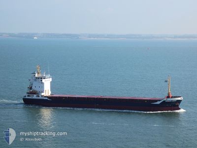
General Cargo
Current Trip
| Trip Time | 3 days |
|---|---|
| Trip Distance | 774.10 nm |
| AVG Speed | 10.1 Knopen |
| MAX Speed | 11.8 Knopen |
| Diepgang | 5 M |
| AVG Wind | 17.6 knots |
| MAX Wind | 27.8 knots |
| MIN Temp | -0.4°C / 31.28°F |
| MAX Temp | 8.9°C / 48.02°F |
| Positie ontvangen | 1 d geleden |
Current Position
| Lengtegraad | 29.39385° |
|---|---|
| Breedtegraat | 60.01400° |
| Status | At anchor |
| Snelheid | 0.6 Knopen |
| Koers | 74° |
| Gebied | Gulf of Finland |
| Station | T-AIS |
| Positie ontvangen | 1 d geleden |
Info
Information
The current position of AMBER LIGHT is in Gulf of Finland with coordinates 60.01400° / 29.39385° as reported on 2024-04-22 13:20 by AIS to our vessel tracker app. The vessel's current speed is 0.6 Knopen and is currently inside the port of KRONSHTADT.
The vessel AMBER LIGHT (IMO: 9158109, MMSI: 304778000) is a General Cargo that was built in 2005 ( 19 Jaar oud ). It's sailing under the flag of [AG] Antigua Barbuda.
In this page you can find informations about the vessels current position, last detected port calls, and current voyage information. If the vessels is not in coverage by AIS you will find the latest position.
The current position of AMBER LIGHT is detected by our AIS receivers and we are not responsible for the reliability of the data. The last position was recorded while the vessel was in Coverage by the Ais receivers of our vessel tracking app.
The current draught of AMBER LIGHT as reported by AIS is 5 meters
Weather
| Temperature | 3.2°C / 37.76°F |
|---|---|
| Wind Speed | 14 knots |
| Direction | 200° SSW |
| Pressure | 1004.9 hPa |
| Humidity | 90.6 % |
| Cloud Coverage | 100 % |
Featured Company
Last Port Calls
| Port | Arrival | Departure | Time In Port |
|---|---|---|---|
| 2024-04-23 04:55 | |||
| 2024-04-19 11:35 | 2024-04-19 11:39 | 4 m | |
| 2024-04-16 07:15 | 2024-04-18 00:12 | 1 d | |
| 2024-04-10 16:01 | 2024-04-12 17:36 | 2 d | |
| 2024-03-22 13:53 | 2024-03-29 11:48 | 6 d | |
| 2024-03-20 16:46 | 2024-03-21 21:25 | 1 d | |
| 2024-03-13 16:25 | 2024-03-16 13:06 | 2 d | |
| 2024-03-10 06:57 | 2024-03-12 14:56 | 2 d | |
| 2024-03-02 22:21 | 2024-03-05 14:35 | 2 d | |
| 2024-02-26 22:56 | 2024-02-27 05:03 | 6 h |
Most Visited Ports (Last year)
| Port | Arrivals | |
|---|---|---|
| 8 | ||
| 7 | ||
| 4 | ||
| 4 | ||
| 2 | ||
| 2 |
Last Trips
| Origin | Departure | Destination | Arrival | Distance | |
|---|---|---|---|---|---|
| 2024-04-19 13:39 | 2024-04-23 07:55 | 774.10 nm | |||
| 2024-04-18 02:12 | 2024-04-19 13:35 | 331.80 nm | |||
| 2024-04-12 19:36 | 2024-04-16 09:15 | 716.85 nm | |||
| 2024-03-29 11:48 | 2024-04-10 18:01 | 1749.28 nm | |||
| 2024-03-21 21:25 | 2024-03-22 13:53 | 36.86 nm | |||
| 2024-03-16 14:06 | 2024-03-20 16:46 | 823.05 nm | |||
| 2024-03-12 14:56 | 2024-03-13 17:25 | 271.41 nm | |||
| 2024-03-05 14:35 | 2024-03-10 06:57 | 789.70 nm | |||
| 2024-02-27 05:03 | 2024-03-02 22:21 | 755.07 nm | |||
| 2024-02-26 22:39 | 2024-02-26 22:56 | 1.49 nm |
Events
| Tijd | Evenement | Details | Positie / Bestemming | Info |
|---|---|---|---|---|
| 2024-04-23 04:55 | Aankomsthaven |
|
60.00451 / 29.71190
[RU] KRONSHTADT
|
Snelheid: 3.6 kn Koers: 110° |
| 2024-04-23 03:30 | Start beweging | 9.27 nm, North West of BRONKA |
60.02413 / 29.43535
RULED
|
Snelheid: 4.4 kn Koers: 98° |
| 2024-04-22 13:22 | Status Changed | Default At anchor |
60.01393 / 29.39290
RULED
|
Snelheid: 0.6 kn Koers: 74° |
| 2024-04-22 13:20 | Status Changed | At anchor Under way using engine |
60.01400 / 29.39385
RULED
|
Snelheid: 0.2 kn Koers: 73° |
| 2024-04-22 13:20 | Buitenbereik |
60.01400 / 29.39385
Gulf of Finland
RULED
|
Snelheid: 0.6 kn Koers: 259.9° |
|
| 2024-04-22 13:18 | Stop beweging | 10.03 nm, North West of BRONKA |
60.01402 / 29.39422
RULED
|
Snelheid: 0.2 kn Koers: 73° |
| 2024-04-22 12:55 | Status Changed | Under way using engine Default |
60.01592 / 29.38113
RULED
|
Snelheid: 5.8 kn Koers: 107° |
| 2024-04-22 12:36 | Binnenbereik |
60.01592 / 29.38113
Gulf of Finland
RULED
|
Snelheid: 1.9 kn Koers: 125.5° |
|
| 2024-04-22 11:45 | Status Changed | Default Under way using engine |
60.02998 / 29.06932
RULED
|
Snelheid: 10.7 kn Koers: 91.8° |
| 2024-04-22 11:44 | Buitenbereik |
60.03015 / 29.05940
Gulf of Finland
RULED
|
Snelheid: 10.7 kn Koers: 91.8° |